Home » State Maps » Massachusetts Population Density Map

Massachusetts Population Density Map

Massachusetts Population Density Map

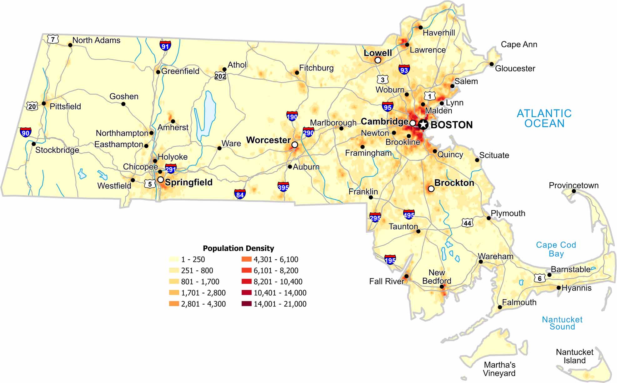
Eastern Massachusetts appears tightly packed on our population density map. Roads and cities overlap heavily on the map. Check out our map to see density drop westward as hills create natural breaks.

Map Information

  • Population Density Map of Massachusetts
  • Data provided by NASA SEDAC Gridded Population of the World
  • Free for personal and commercial purpose. Attribution is required. How to attribute?

Leave a Reply

Your email address will not be published. Required fields are marked *