Map of Brockton, Massachusetts
Brockton is south of Boston, long known as the City of Champions. Our map shows dense neighborhoods mixed with parks.
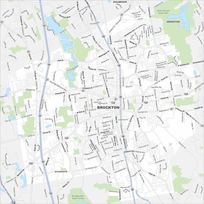
Brockton is south of Boston, long known as the City of Champions. Our map shows dense neighborhoods mixed with parks.
Check out Broken Arrow on our map just outside Tulsa. This city has grown into one of the state’s largest suburbs. It’s family-focused.
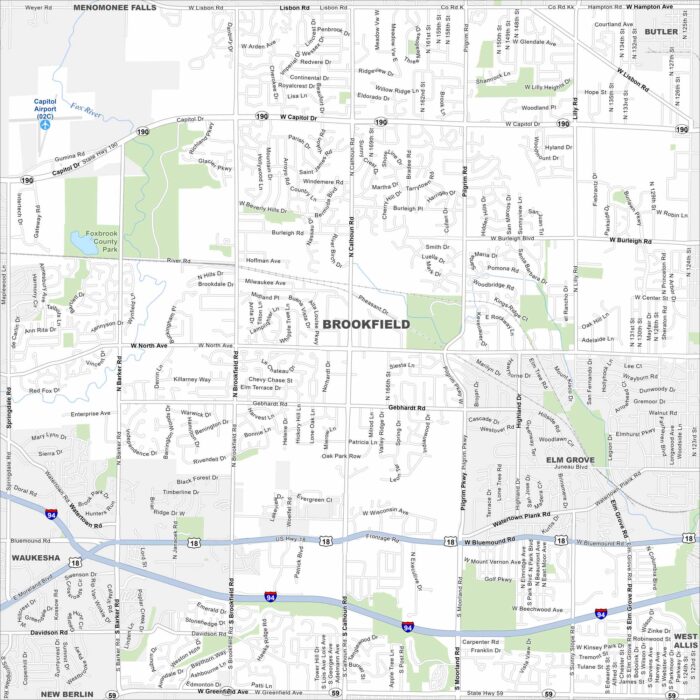
Our map of Brookfield highlights its highways, roads and parks. Green space spreads along its edges. It’s a western suburb of Milwaukee.
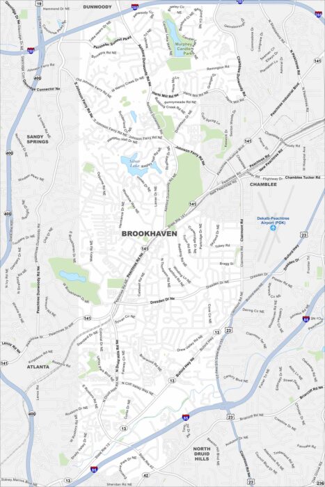
Explore our map of Brookhaven, which includes parks, waterways and highways. Major roads cut through making their way to Atlanta.
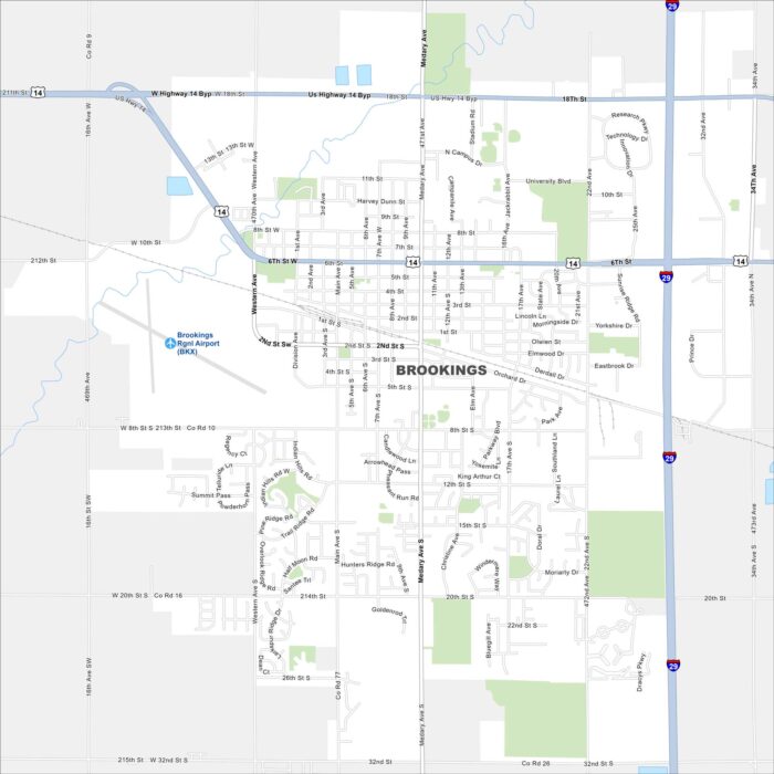
Brookings is in eastern South Dakota, surrounded by farmland. Our map highlights its grid of streets and open fields.
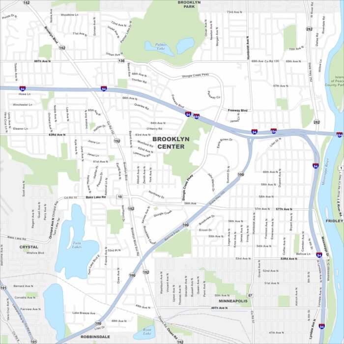
Check out Brooklyn Center on our map, sitting just northwest of Minneapolis. The Mississippi River forms its eastern edge.
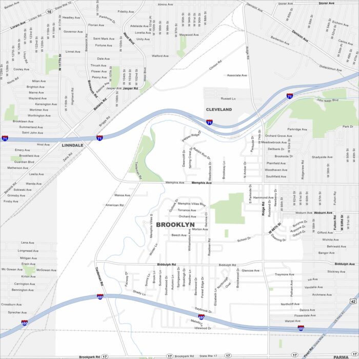
Our map of Brooklyn shows its compact layout west of Cleveland. Streets connect quickly into the larger metro.
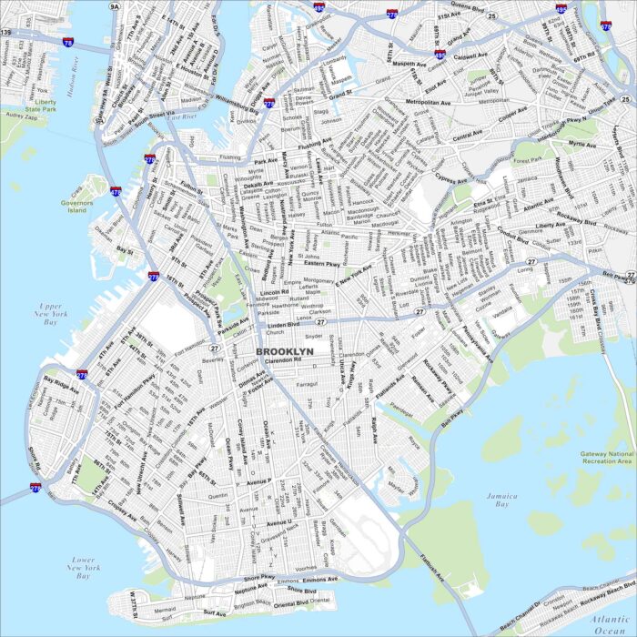
Our Brooklyn map highlights a borough that never sits still. You’ll see its streets stretching from the East River to Coney Island’s shore.
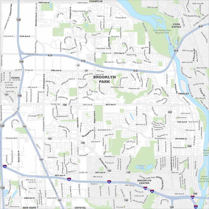
Brooklyn Park is along the Mississippi River, north of Minneapolis. Our map highlights curving roads, parks, and riverfront trails.
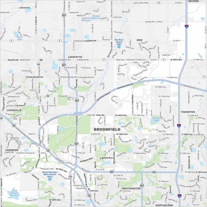
See Broomfield on our map, spread between Denver and Boulder. Highways pass through, but open space and trails are easy to spot.
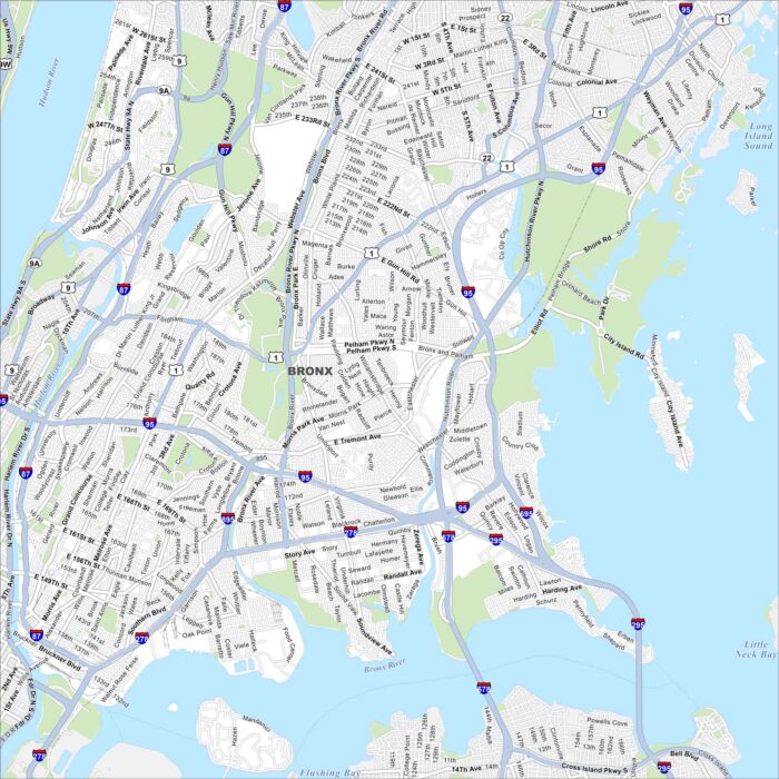
The Bronx is full of energy with deep roots in New York’s history. Our map shows its busy avenues, parks, and bays.
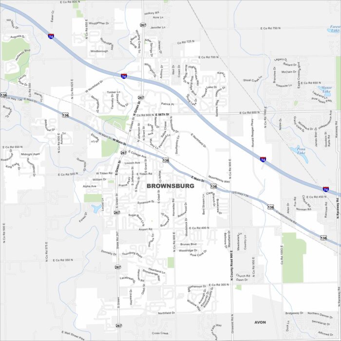
Explore our map of Brownsburg, just west of Indianapolis. Suburban streets meet farmland at the edges. It also has easy access to the metro.
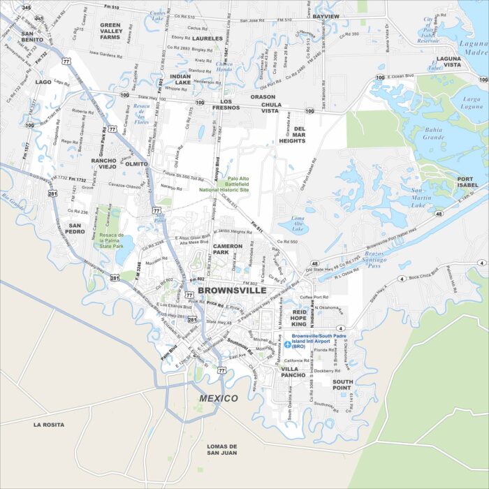
Brownsville sits at the southern tip of Texas, right on the Rio Grande. Our map shows the border crossing and roads leading into Mexico.
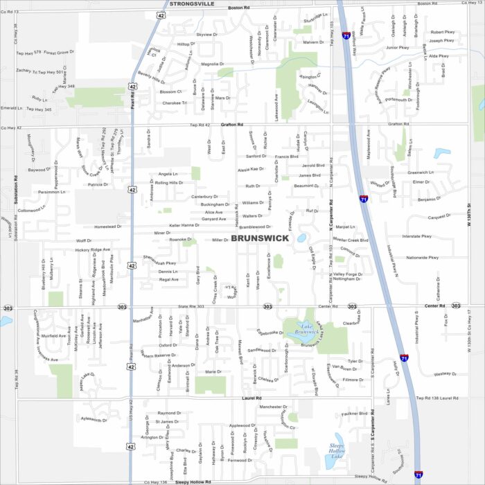
Our map of Brunswick highlights its roads, parks and lakes. It’s south of Cleveland. Parks and quiet neighborhoods fill much of the city.
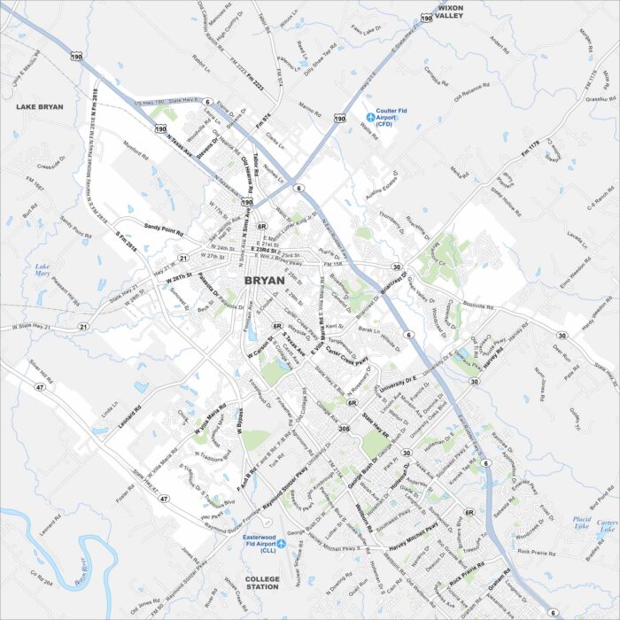
Check out Bryan on our map, paired with nearby College Station. Roads stretch across the Brazos Valley. The city is often tied to Texas A&M.