Map of Justice, Illinois
Justice is a compact suburb southwest of Chicago. Our map shows it pressed between two major interstates on both sides.
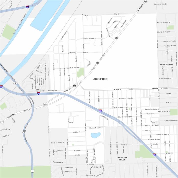
Justice is a compact suburb southwest of Chicago. Our map shows it pressed between two major interstates on both sides.
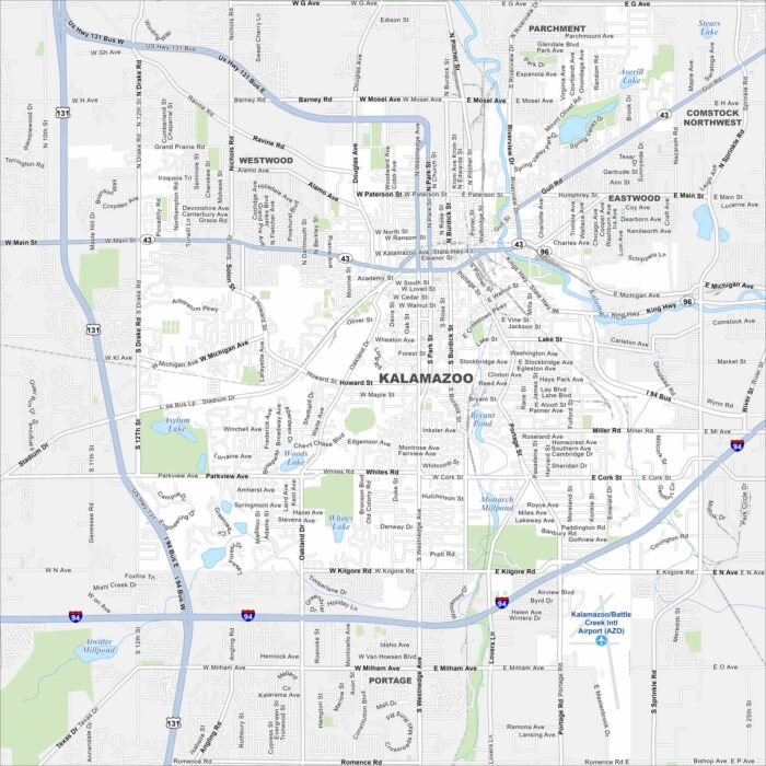
Our map of Kalamazoo shows a downtown split by the Kalamazoo River. Highways link the city to Lake Michigan and Detroit.
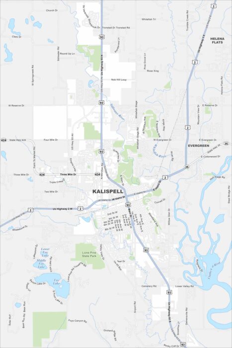
Kalispell is set in the Flathead Valley. This map shows it as a gateway to Glacier National Park. Surrounding mountains rise on every side.
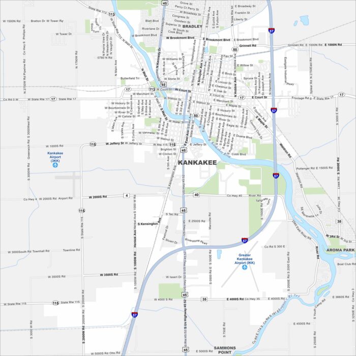
Kankakee is built on the Kankakee River. Our map shows the river winding straight through the city. Parks and bridges line its banks.
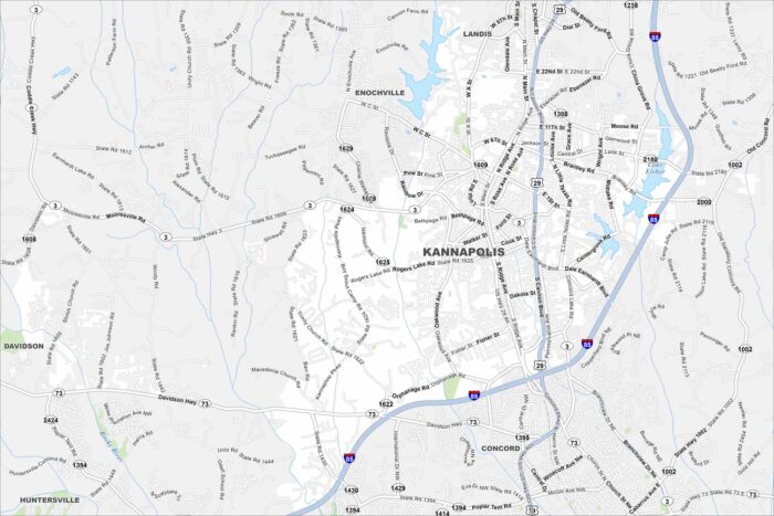
Kannapolis lies north of Charlotte. The map shows a redeveloped downtown with its lakes in northeast. Residential areas spread outward.
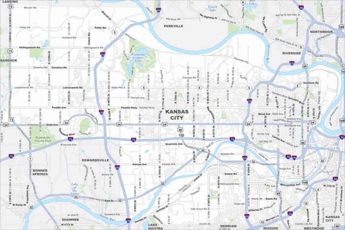
Our map shows Kansas City sitting at the junction of the Kansas and Missouri Rivers. Highways cross in every direction.
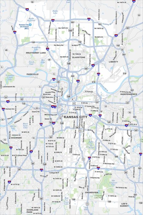
Kansas City spreads wide across the Missouri side. Our map highlights the Missouri River bending around downtown.
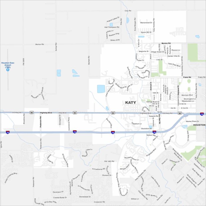
Katy is just west of Houston. Our map shows new subdivisions spreading quickly across former farmland. Interstate 10 runs straight through.
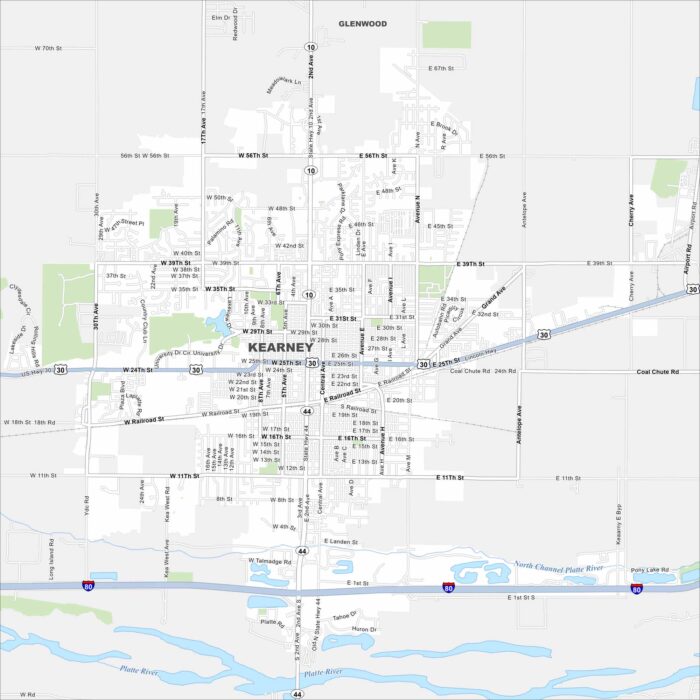
Kearney is set along the Platte River and sits in the middle of Nebraska’s plains. This map shows Interstate 80 running in the south.
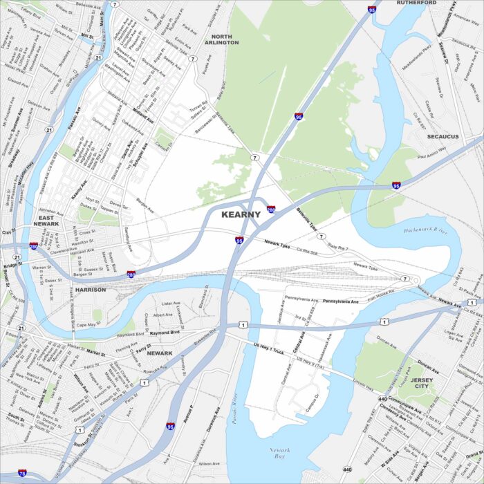
Kearny lies between the Passaic and Hackensack Rivers. Our map shows industry and neighborhoods side by side.
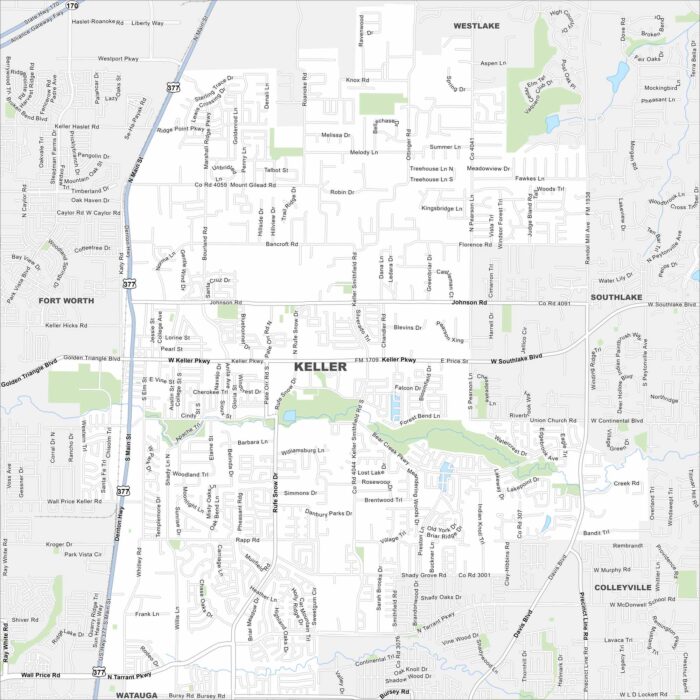
Keller sits in the Dallas-Fort Worth area. Our map shows its streets spreading across rolling land. Roads tie it closely to Fort Worth.
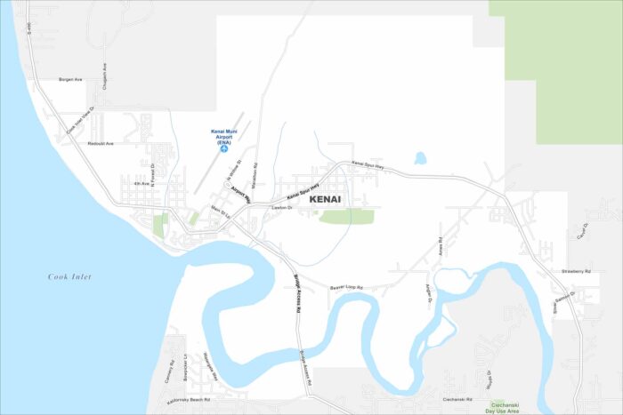
Kenai is right on the Cook Inlet. The map highlights roads, lakes, streams, and the mouth of the Kenai River.
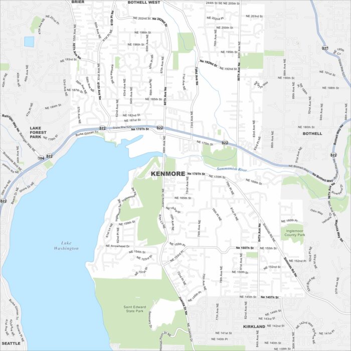
Kenmore sits at the north end of Lake Washington. Our map shows major routes, parks, and neighborhoods climbing into the hills.
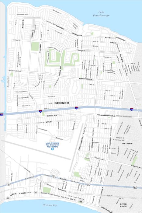
Kenner borders the Mississippi River and Lake Pontchartrain. This map shows Louis Armstrong Airport dominating its center.
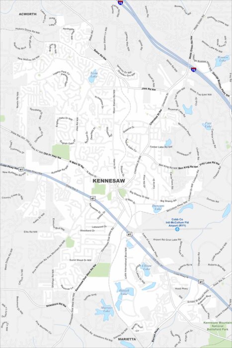
Kennesaw sits northwest of Atlanta. Our map shows Kennesaw Mountain National Battlefield Park on with highways connecting it.