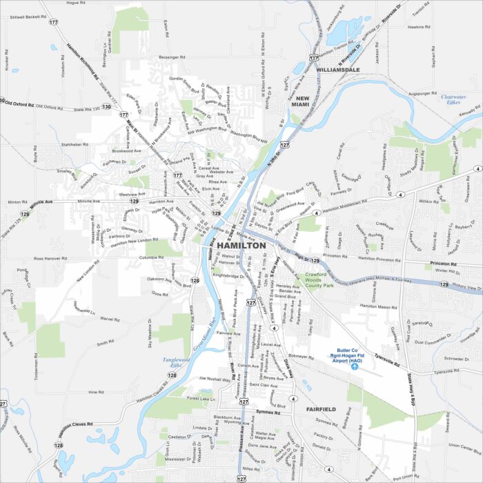
Map of Hamilton, Ohio
Hamilton sits along the Great Miami River in southwestern Ohio. Our map shows the river bending right through downtown.
Hamilton sits along the Great Miami River in southwestern Ohio. Our map shows the river bending right through downtown.
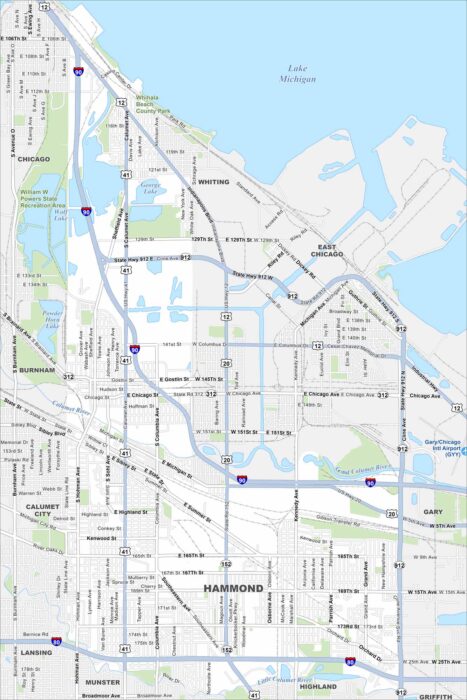
Hammond lies in northwest Indiana along Lake Michigan’s southern edge. You’ll see the lakefront, rail lines, and industry on our map.
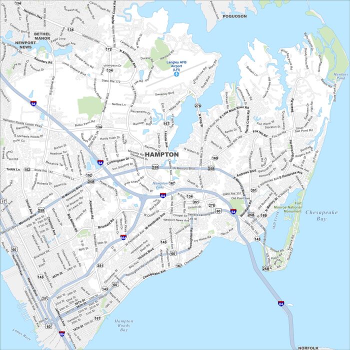
Our map shows Hampton, which is on the Virginia Peninsula. It’s surrounded by the Chesapeake Bay and Hampton Roads.
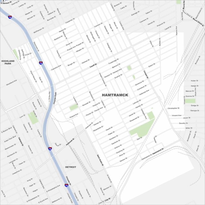
Hamtramck is a small city enclosed entirely by Detroit. On our map, it’s easy to see how tightly packed its streets are.
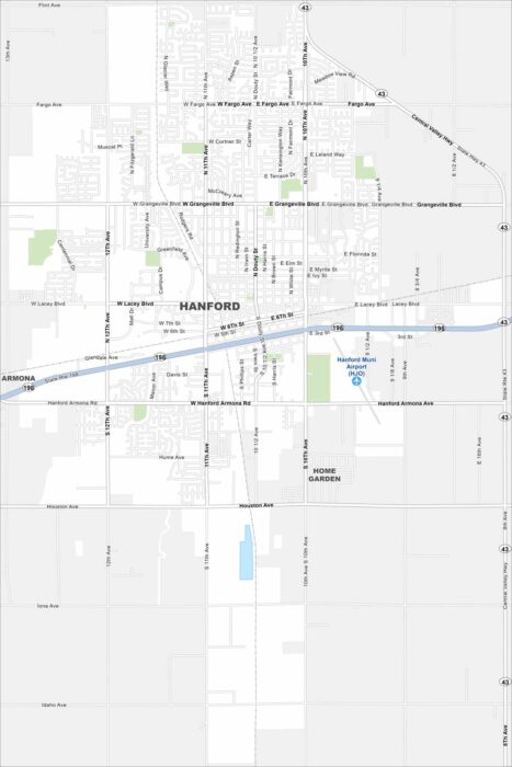
Hanford sits in California’s Central Valley between Fresno and Visalia. Our map shows the roads, railways and green spaces in the city.
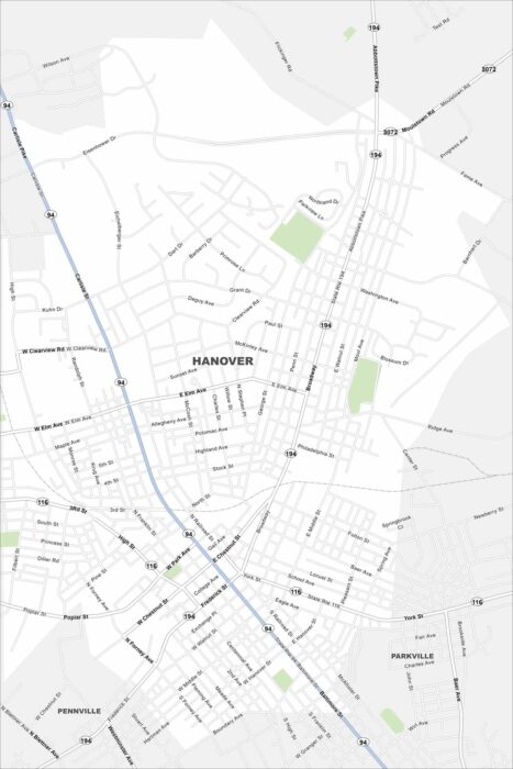
Hanover is located in southern Pennsylvania near the Maryland border. You’ll notice the compact street grid on our map.
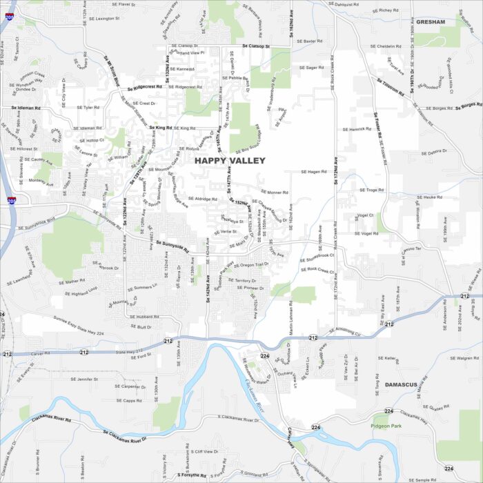
Happy Valley sits southeast of Portland in northwestern Oregon. Our map of the city highlights neighborhoods, parks and road connections.
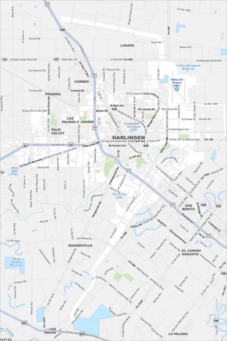
Harlingen sits in the Rio Grande Valley of far south Texas. Our map highlights highways spreading outward toward Brownsville and McAllen.
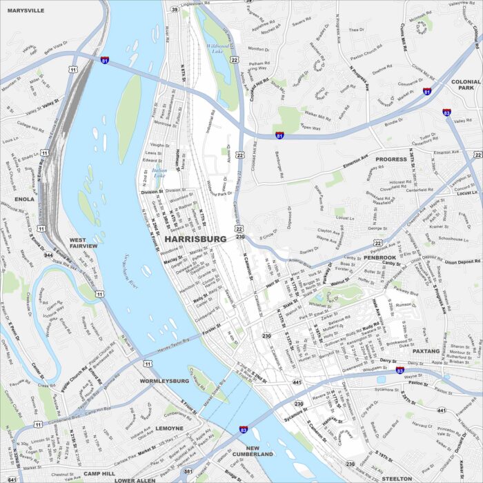
Harrisburg is along the Susquehanna River in south-central Pennsylvania. The city is the state capital so it’s a key place in Pennsylvania.
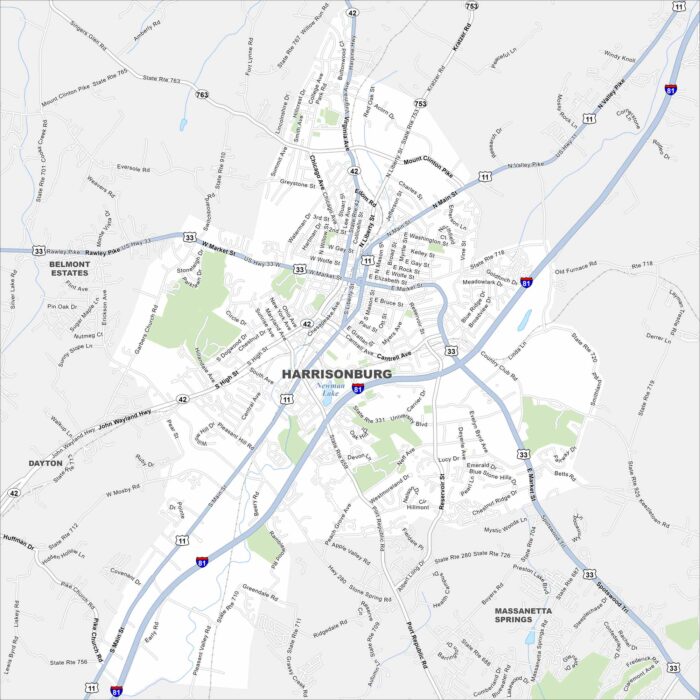
Harrisonburg rests in the Shenandoah Valley of Virginia. Mountains rise on both sides of the valley here. Interstate 81 and US-33 cross here.
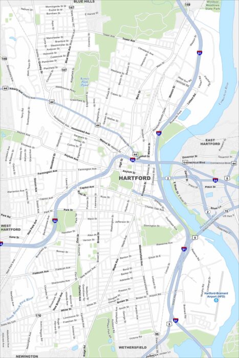
Hartford sits along the Connecticut River in the north-central part of the state. Our map shows the city’s grid cut by the highway loops.
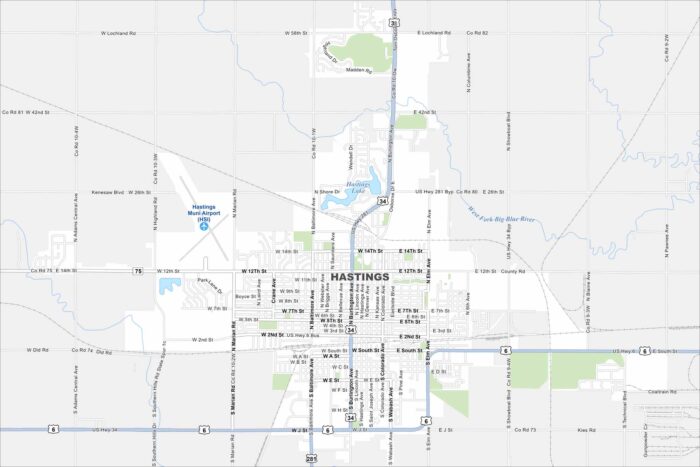
Our map of Hastings shows a city on the flat plains of southcentral Nebraska. Railroad lines are easy to spot cutting across town.
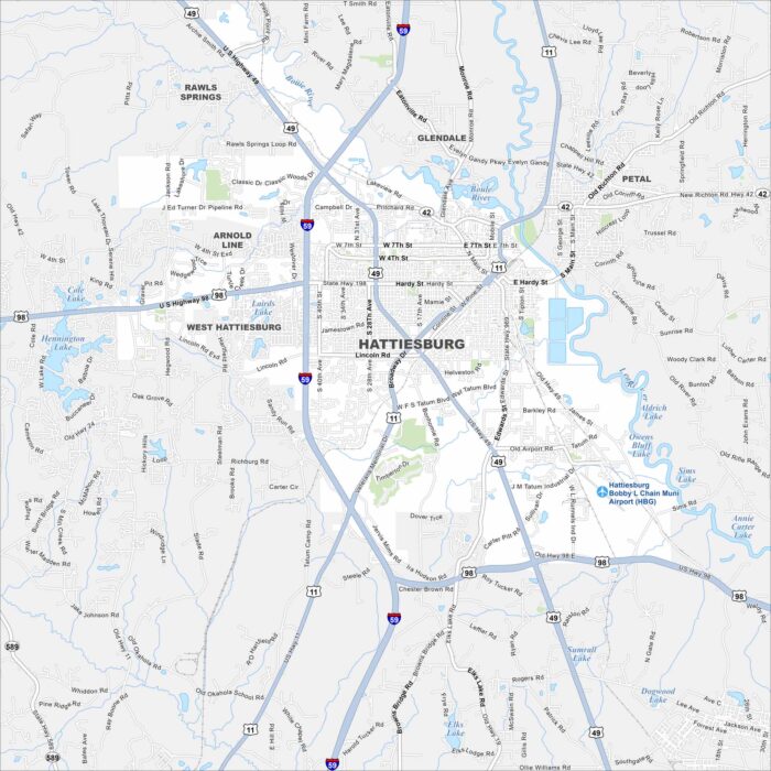
Hattiesburg is in southern Mississippi, not far from the Pine Belt forests. Highways converge here, making it a regional hub.
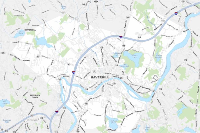
Explore our map of Haverhill along the Merrimack River in northeastern Massachusetts. The city runs right up to the New Hampshire border.
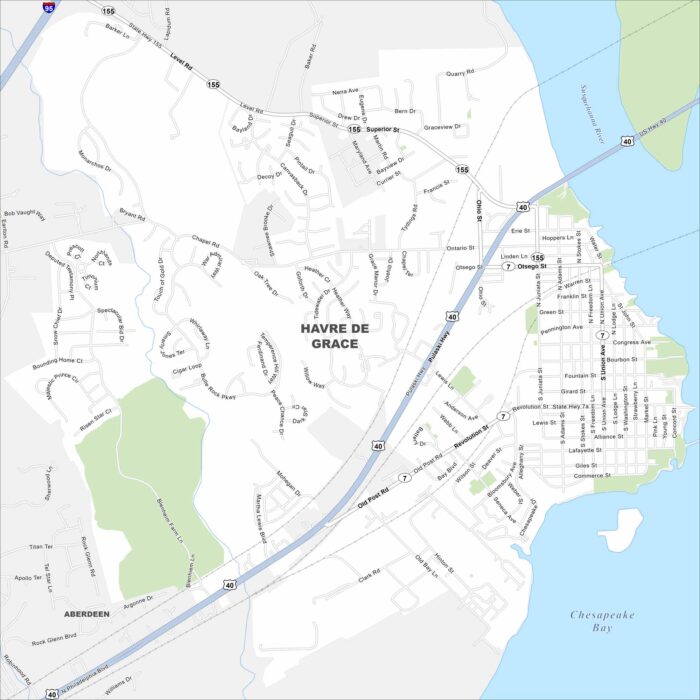
Havre de Grace sits at the head of the Chesapeake Bay where the Susquehanna River meets the bay. Our map shows plenty of water nearby.