Map of Manassas, Virginia
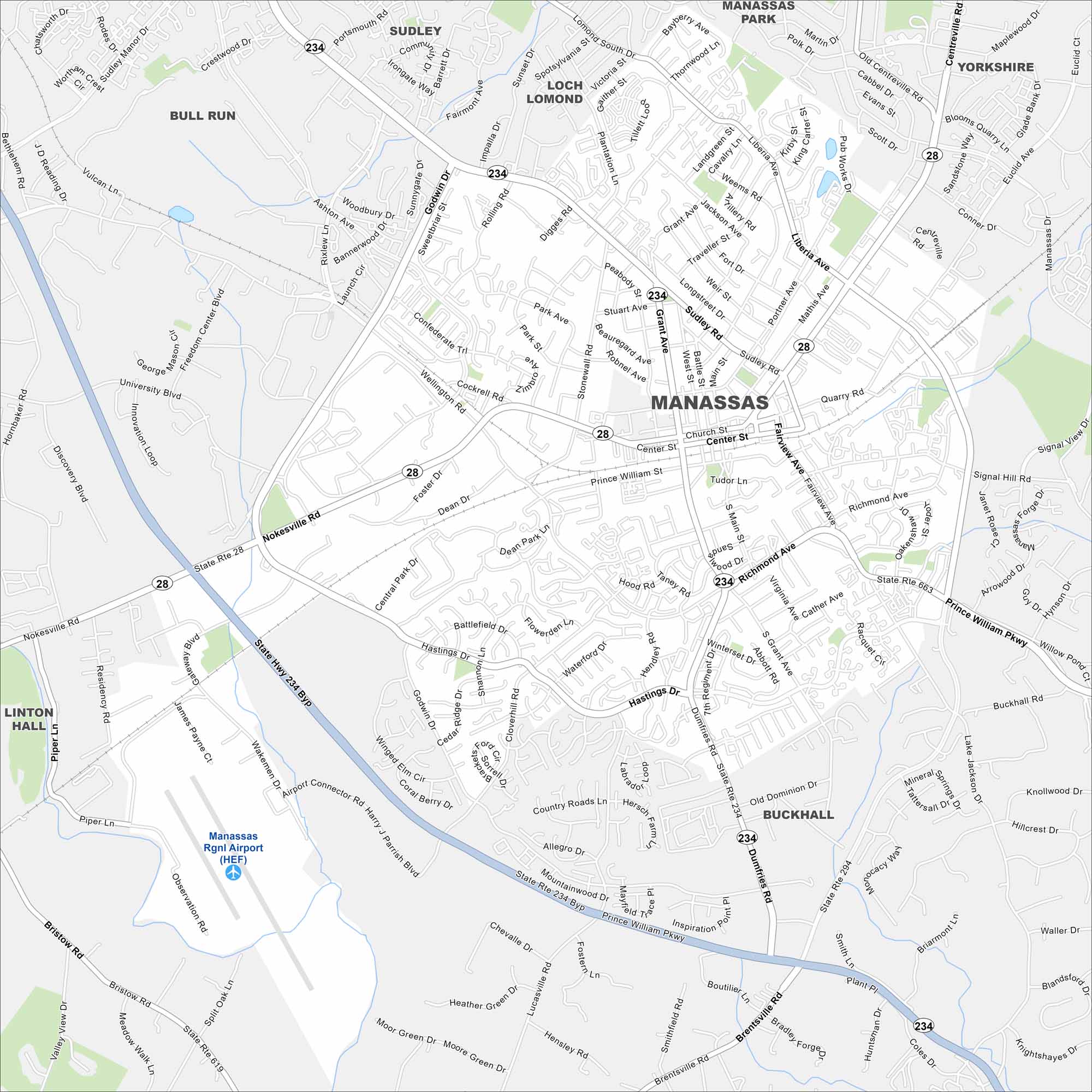
Our map of Manassas sits west of Washington, D.C. Highways and rail lines cross through its historic core. Suburbs spread into wooded surroundings.
Map Information
On the Map
Interstates/Highways: State Rte 234, State Rte 28, State Rte 663, State Rte 294, State Rte 619 Major Roads: Prince William Pkwy, Sudley Rd, Dumfries Rd, Nokesville Rd, Liberia Ave, Hastings Dr, Center St, Grant Ave, Wellington Rd, Fairview Ave, Signal Hill Rd, Richmond Ave, Church St, Portner Ave, Mathis Ave, Euclid Ct, Digges Rd, Godwin Dr, Lucasville Rd, Brentsville Rd Airports: Manassas Rgnl Airport (HEF) Nearby Communities: Bull Run, Sudley, Loch Lomond, Manassas Park, Yorkshire, Buckhall, Linton HallVirginia State Maps
Spanning coasts and mountains, here are our maps of Virginia.


City Maps of Virginia
Traverse Virginia using our city maps


