Map of Lynchburg, Virginia
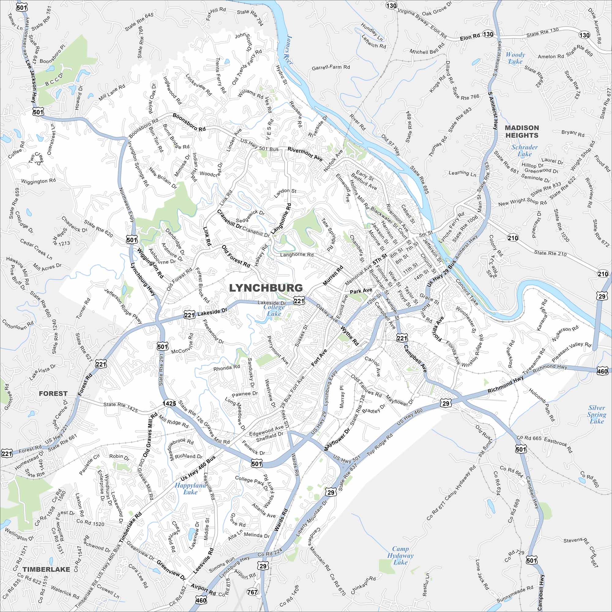
Our map of Lynchburg follows the James River at the city’s edge. Hills rise above the water, shaping the streets. Highways connect it to Roanoke and Richmond.
Map Information
On the Map
Interstates/Highways: US Hwy 501, US Hwy 29, US Hwy 460 Major Roads: Wards Rd, Timberlake Rd, Lynchburg Hwy, Old Forest Rd, Campbell Ave, Memorial Ave, Main St, Fort Ave, Richmond Hwy, Boonsboro Rd, Rivermont Ave, Expressway, Lakeside Dr, Graves Mill Rd, Leesville Rd, Candlers Mountain Rd, Wiggins Rd, Atherholt Rd, Langhorne Rd, Link Rd Lakes and Reservoirs: Woody Lake, Schrader Lake, College Lake, Happy Land Lake, Camp Hideaway Lake, Silver Spring Lake Major Rivers: James River Nearby Communities: Madison Heights, Forest, TimberlakeVirginia State Maps
Spanning coasts and mountains, here are our maps of Virginia.


City Maps of Virginia
Traverse Virginia using our city maps


