Louisiana Population Density Map
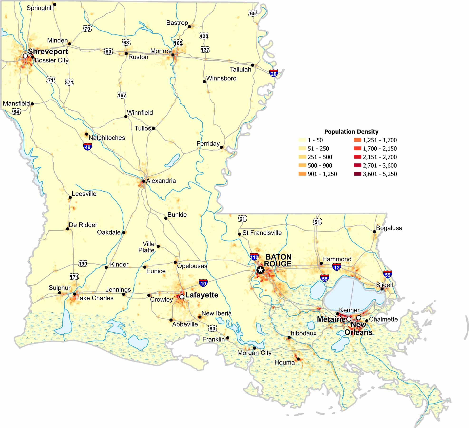
The Mississippi River corridor dominates population density in Louisiana. Major cities like New Orleans and Baton Rouge line this waterway. You’ll notice that our population density map shows sparse density in the coastal wetlands region.
Map Information