Map of Logan, Utah
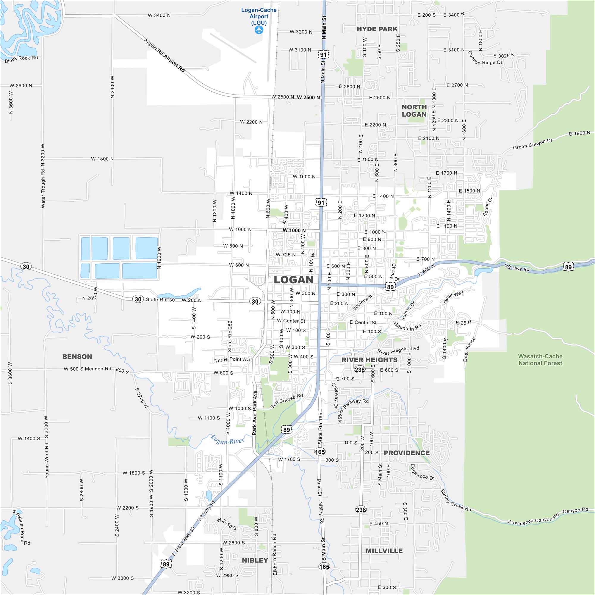
Explore Logan at the northern end of Utah’s Cache Valley. The Logan River winds through the southern section of the city. Highways connect it to Idaho and the Wasatch Range.
Map Information
On the Map
Interstates/Highways: US Hwy 89, US Hwy 91, State Rte 30, State Rte 252, State Rte 165, State Rte 238 Major Roads: Main St, 10th West St, 600 West St, 200 East St, 400 East St, 1200 East St, 1400 North St, 1000 North St, 400 North St, Center St, 300 South St, 600 South St, 1000 South St, 1400 South St, 1800 South St, 2200 South St, Airport Rd, Valley View Hwy, Canyon Rd, 10th North St Airports: Logan-Cache Airport Major Rivers: Logan River Parks and Preserves: Wasatch-Cache National Forest Nearby Communities: Hyde Park, North Logan, River Heights, Providence, Millville, Nibley, BensonUtah State Maps
Look through maps of deserts, parks, and cities.


City Maps of Utah
Here is Salt Lake City and Utah’s urban regions.


