Map of Lindon, Utah
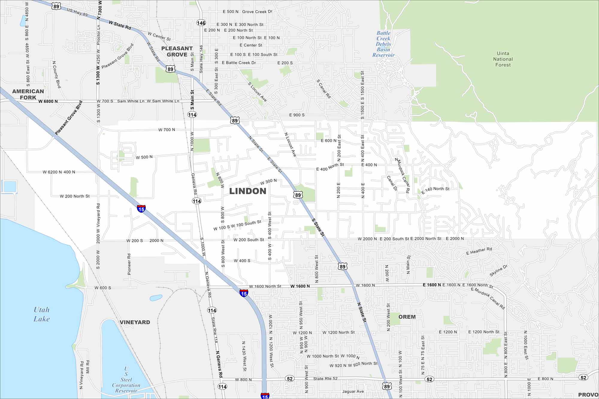
Lindon sits between Orem and Pleasant Grove in Utah Valley. Our map shows its highways and roads stretching toward Utah Lake. The Wasatch Mountains rise directly to the east.
Map Information
On the Map
Interstates/Highways: I-15, US Hwy 89, State Rte 114, State Rte 52, State Rte 146 Major Roads: State St, Geneva Rd, Main St, 1600 North St, 700 North St, 400 North St, 200 North St, 200 South St, 400 South St, 800 South St, 1200 South St, 2000 North St, 800 West St, 400 West St, 1200 West St, 2000 West St, Center St, Locust Ave, Canal Rd, Murdock Canal Rd Lakes and Reservoirs: Utah Lake Parks and Preserves: Uinta National Forest Nearby Communities: Pleasant Grove, American Fork, Vineyard, Orem, ProvoUtah State Maps
Look through maps of deserts, parks, and cities.


City Maps of Utah
Here is Salt Lake City and Utah’s urban regions.


