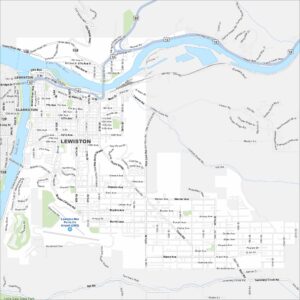
Map of Lewiston, Idaho
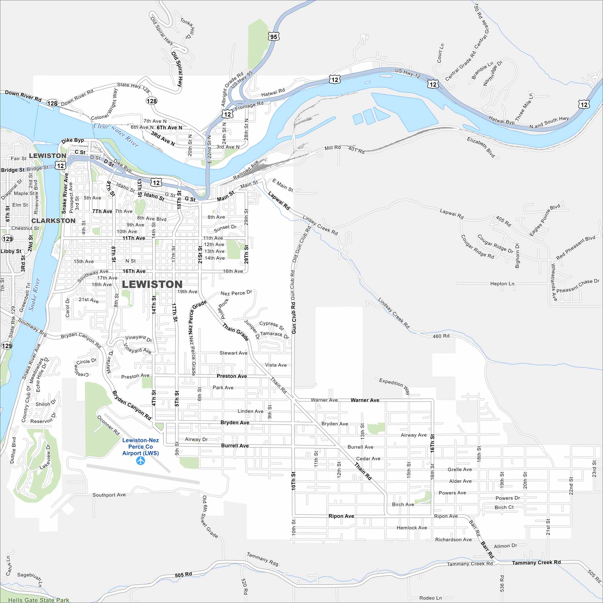
Lewiston appears on the map where the Snake and Clearwater Rivers meet. The city sits in a valley with mountains framing both sides. Its streets stretch along the riverbanks.


Map Information
On the Map
Interstates/Highways: US Hwy 12, US Hwy 95, State Rte 128, State Rte 129 Major Roads: Thain Rd, 21st St, Main St, 17th St, 5th St, 8th St, 10th St, 15th St, 16th St, 20th St, 21st Ave, Thain Grade, Bryden Ave, Burrell Ave, Gun Club Rd, Lapwai Rd, Tammany Creek Rd, Warner Ave, G St, 6th Ave Airports: Lewiston-Nez Perce Co Airport (LWS) Major Rivers: Clearwater River, Snake River Parks and Preserves: Hells Gate State Park Nearby Communities: ClarkstonIdaho City Maps
Boise and Idaho city maps right when you need them most