Map of Layton, Utah
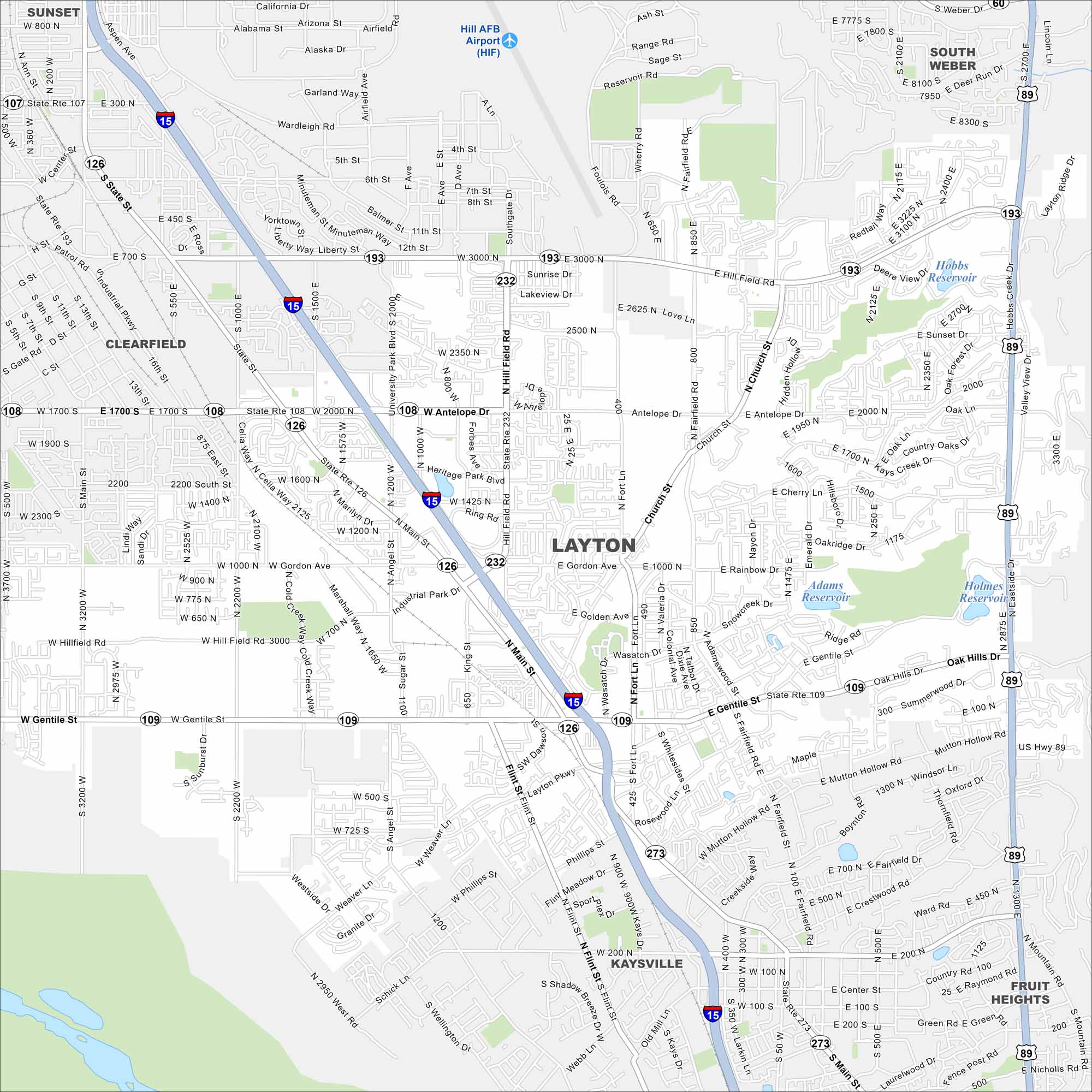
Layton stretches along the Wasatch Front. This map shows neighborhoods tucked between mountain slopes and the Great Salt Lake. Hill Air Force Base occupies most of the northern region.
Map Information
On the Map
Interstates/Highways: I-15, US Hwy 89, State Rte 193, State Rte 109, State Rte 126, State Rte 108, State Rte 273, State Rte 232, State Rte 107 Major Roads: Main St, Hill Field Rd, Antelope Dr, Gordon Ave, Gentile St, Fairfield Rd, Church St, Fort Lane St, Layton Pkwy, University Park Blvd, Minuteman Dr, Angel St, Flint St, 3000 North St, 1000 North St, 2200 West St, 1700 South St, Oak Hills Dr, Sun Hills Dr, Weaver Ln Airports: Hill AFB Airport (HIF) Lakes and Reservoirs: Adams Reservoir, Holmes Reservoir, Hobbs Reservoir Nearby Communities: Sunset, South Weber, Clearfield, Kaysville, Fruit HeightsUtah State Maps
Look through maps of deserts, parks, and cities.


City Maps of Utah
Here is Salt Lake City and Utah’s urban regions.


