Map of Lake Zurich, Illinois
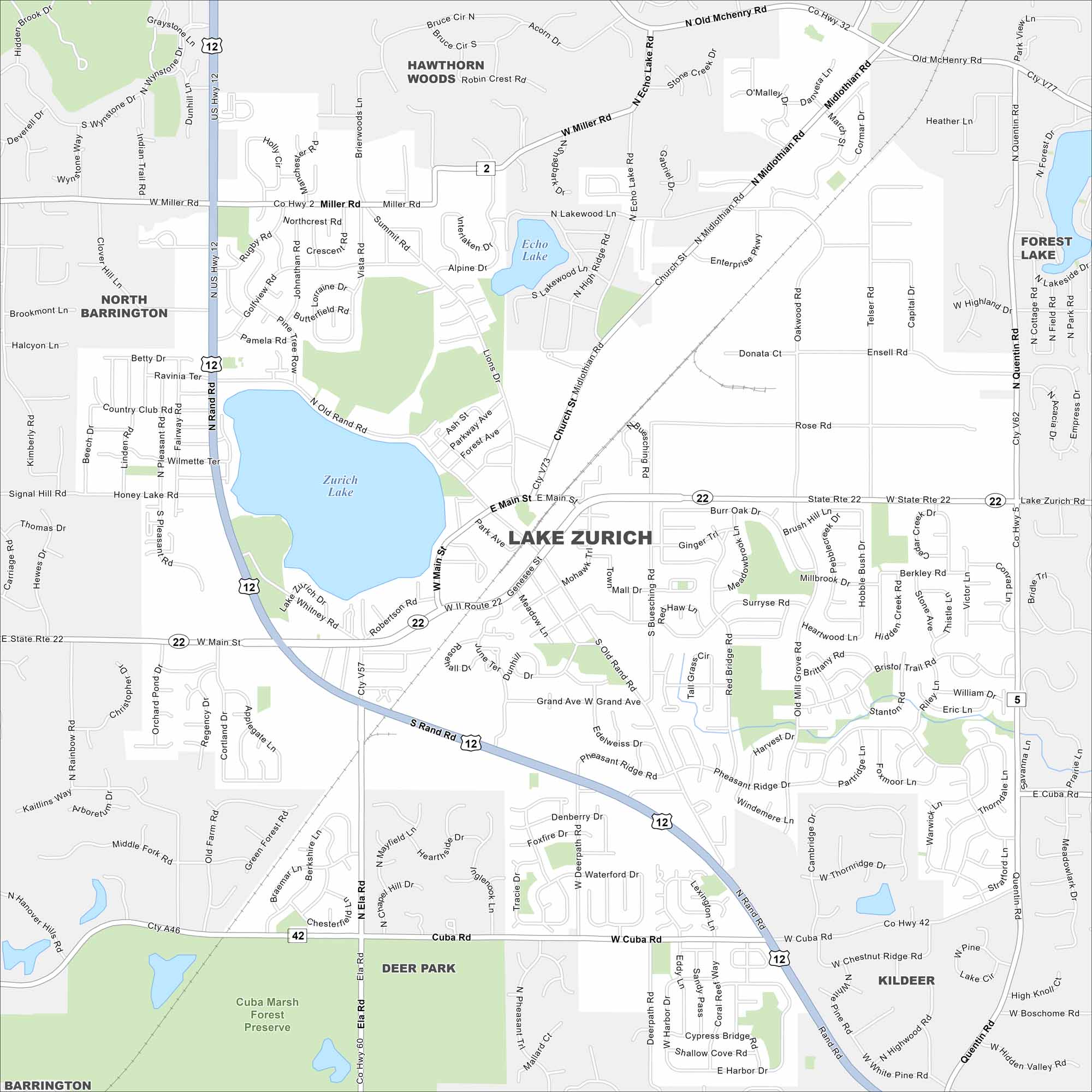
Lake Zurich fills the middle of the map with water. Suburban streets travel outward from the shoreline. Highways link it back to Chicago.
Illinois State Maps
Get to know Illinois with our state maps


Map Information
On the Map
Interstates/Highways: US Hwy 12, State Rte 22, State Rte 42 Major Roads: Rand Rd, Main St, Miller Rd, Cuba Rd, Midlothian Rd, Quentin Rd, Ela Rd, Old McHenry Rd, Echo Lake Rd, Old Rand Rd, Buesching Rd, Telser Rd, Ensell Rd, Whitney Rd, Genesee St, Oakwood Rd, Enterprise Pkwy, Honey Lake Rd, Northcrest Rd, Bristol Trail Rd Lakes and Reservoirs: Zurich Lake, Echo Lake Parks and Preserves: Cuba Marsh Forest Preserve Nearby Communities: Hawthorn Woods, Forest Lake, Kildeer, Deer Park, Barrington, North BarringtonIllinois City Maps
Explore Chicago and urban regions of Illinois


