Map of Joplin, Missouri
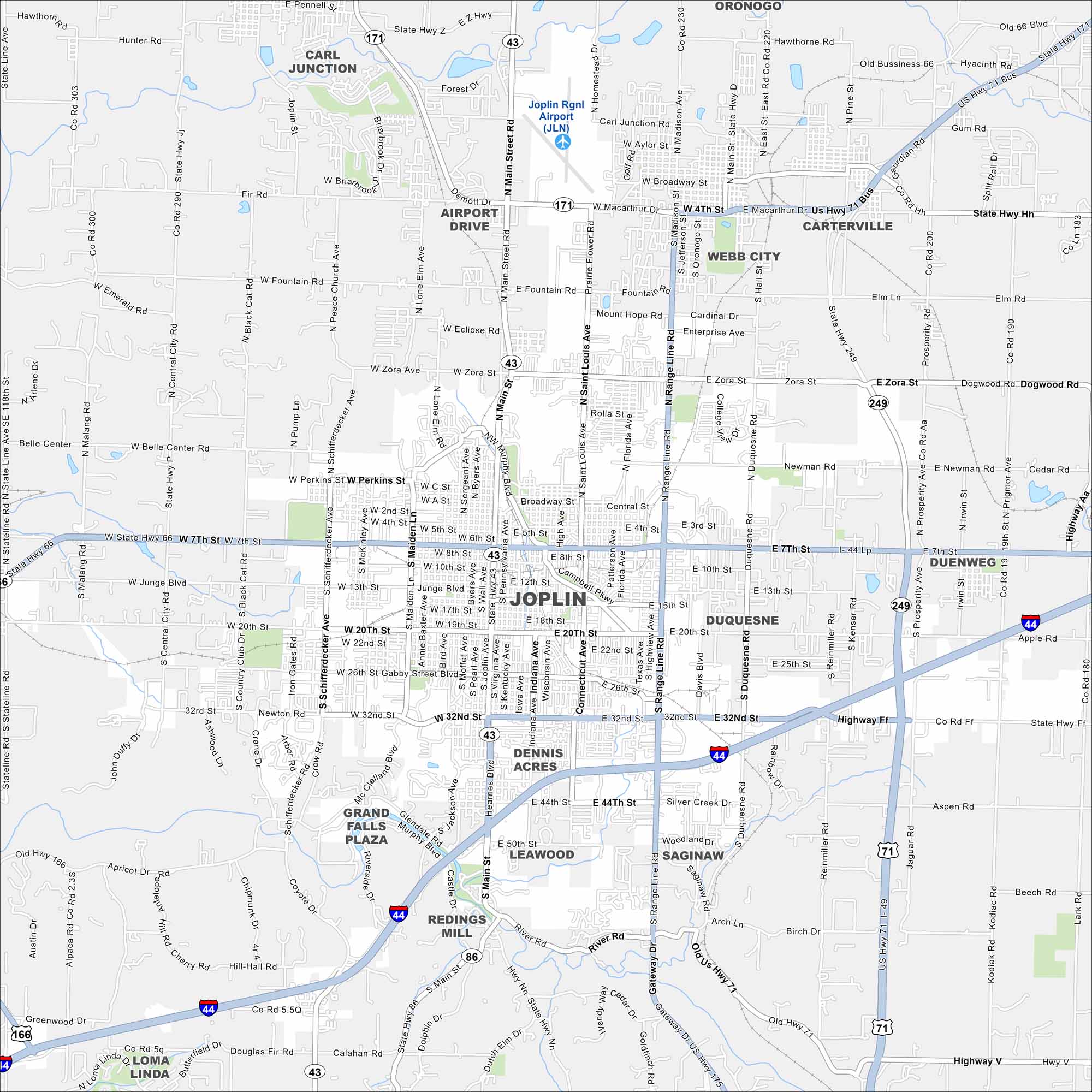
Joplin is near the meeting point of Missouri, Kansas, and Oklahoma. The map shows Interstate 44 running just south of the city. Mining history and Route 66 roots stand out here.
Map Information
On the Map
Interstates/Highways: I-44, US Hwy 71, US Hwy 166, State Rte 43, State Rte 66, State Rte 86, State Rte 171, State Rte 249 Major Roads: Main St, Range Line Rd, 32nd St, 7th St, 20th St, MacArthur Blvd, Zora Ave, Maiden Ln, Duquesne Rd, St Louis Ave, Florida Ave, Schifferdecker Ave, Newman Rd, Hall St, Madison Ave, Central City Rd, Prigmor Ave, Prosperity Ave, Gateway Dr, Junge Blvd Airports: Joplin Rgnl Airport (JLN) Nearby Communities: Webb City, Carterville, Duquesne, Carl Junction, Airport Drive, Oronogo, Duenweg, Leawood, Dennis Acres, Saginaw, Redings Mill, Grand Falls Plaza, Loma LindaMissouri State Maps
Check out state maps of the Show-Me State.


Missouri City Maps
Here are our city maps for Missouri


