Iowa Physical Map
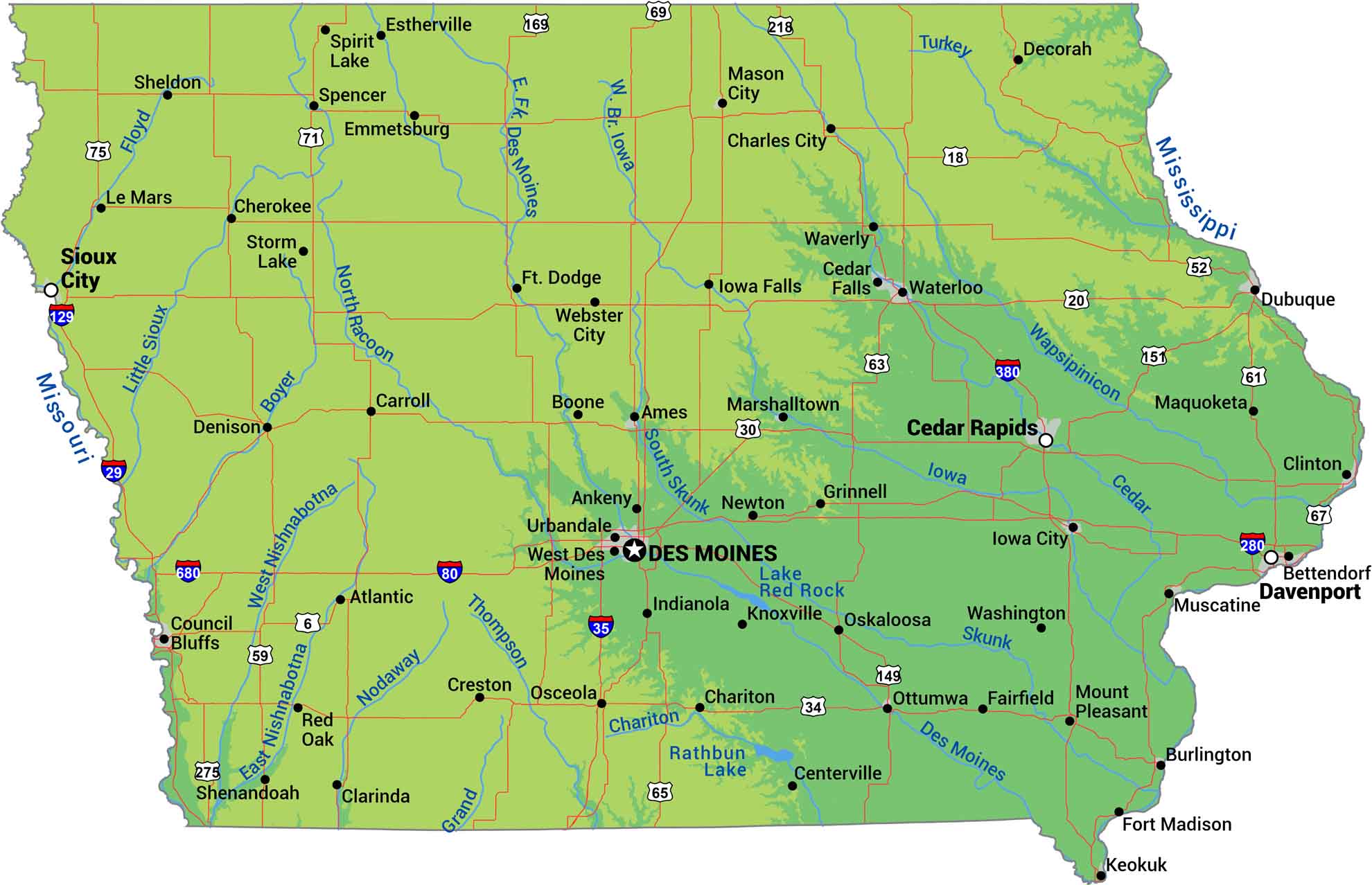
Let’s be honest. Iowa is flat farmland from border to border. It’s sandwiched by the Mississippi on the east and the Missouri on the west. The northeast corner has some bluffs, valleys, and actual topography break the monotony. Our physical map of Iowa shows America’s landscape and terrain.
Map Information
On the Map
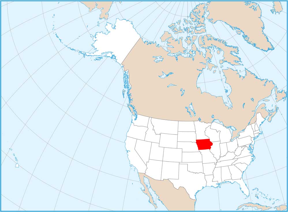
Physical State Maps
Select any state map below to view its physical map.


