Map of Hinsdale, Illinois
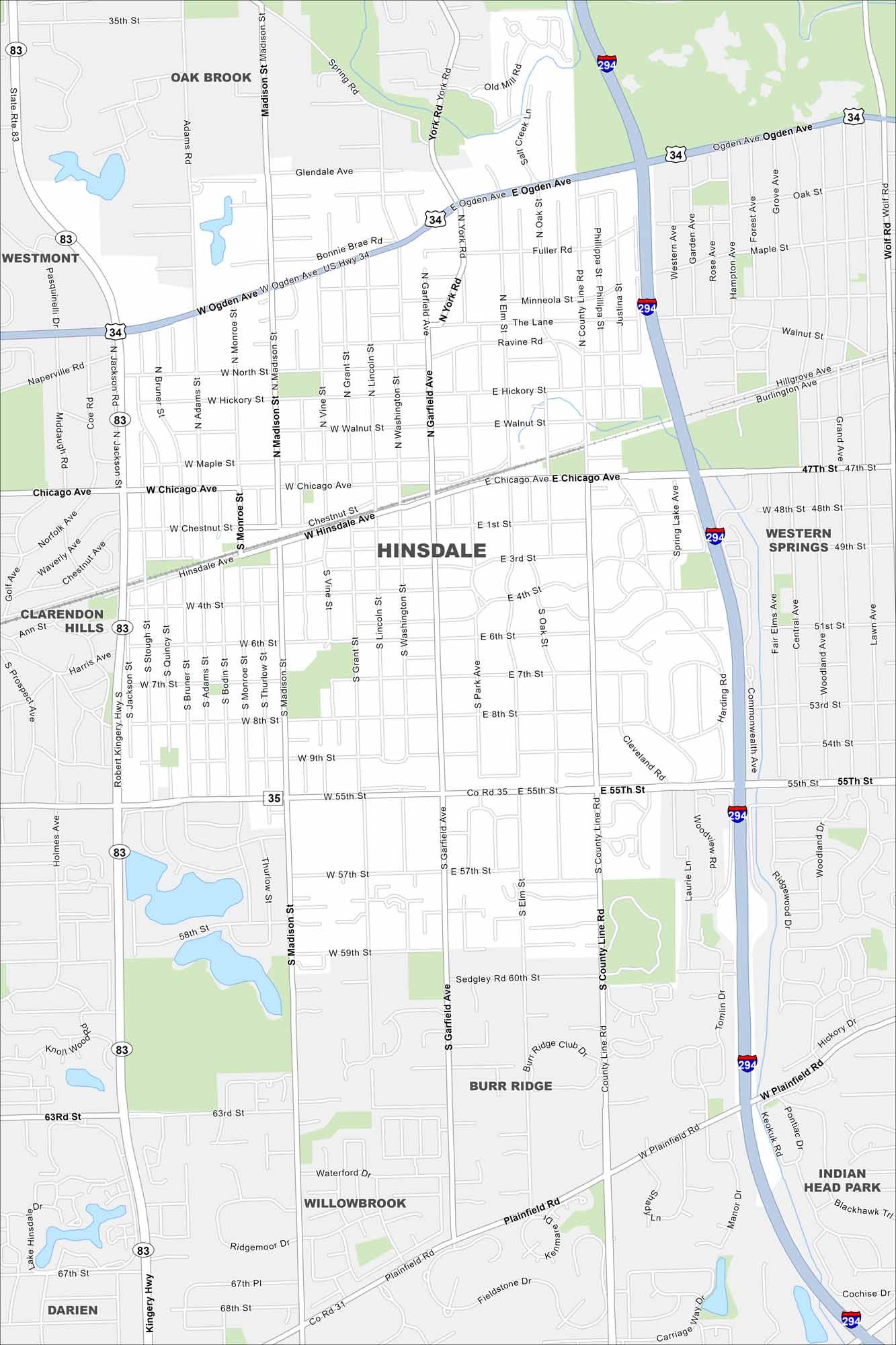
Hinsdale is a suburb west of Chicago. This map highlights its highways, roads and streams cutting through. It’s known for historic homes and easy access to the city.
Illinois State Maps
Get to know Illinois with our state maps


Map Information
On the Map
Interstates/Highways: I-294, US Hwy 34, State Rte 83, State Rte 56 Major Roads: Ogden Ave, 55th St, Chicago Ave, York Rd, County Line Rd, Plainfield Rd, Madison St, Garfield Ave, Robert Kingery Hwy, 63rd St, 31st St, 47th St, Oak St, Wolf Rd, Pasquinelli Dr, Salt Creek, Commonwealth Ave, Hinsdale Ave, 57th St Nearby Communities: Oak Brook, Westmont, Clarendon Hills, Willowbrook, Darien, Burr Ridge, Indian Head Park, Western SpringsIllinois City Maps
Explore Chicago and urban regions of Illinois


