Map of Highland Park, Illinois
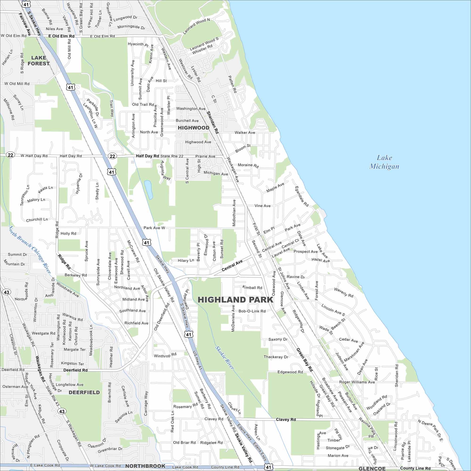
Highland Park lies on the shore of Lake Michigan north of Chicago. This map shows a mix of lakeshore and wooded areas. U.S. Route 41 runs through town.
Illinois State Maps
Get to know Illinois with our state maps


Map Information
On the Map
Interstates/Highways: US Hwy 41, State Rte 22, State Rte 43 Major Roads: Skokie Valley Rd, Half Day Rd, Deerfield Rd, Central Ave, Park Ave, Clavey Rd, Lake Cook Rd, Green Bay Rd, Sheridan Rd, Waukegan Rd, Ridge Rd, Berkeley Rd, Ridgelee Rd, Old Briar Rd, Sunnyside Ave, Second St, Roger Williams Ave, Summit Ave Lakes and Reservoirs: Lake Michigan Major Rivers: Skokie River, North Branch Chicago River Nearby Communities: Lake Forest, Highwood, Deerfield, Northbrook, GlencoeIllinois City Maps
Explore Chicago and urban regions of Illinois


