Home » State Maps » Hawaii Population Density Map

Hawaii Population Density Map

Hawaii Population Density Map

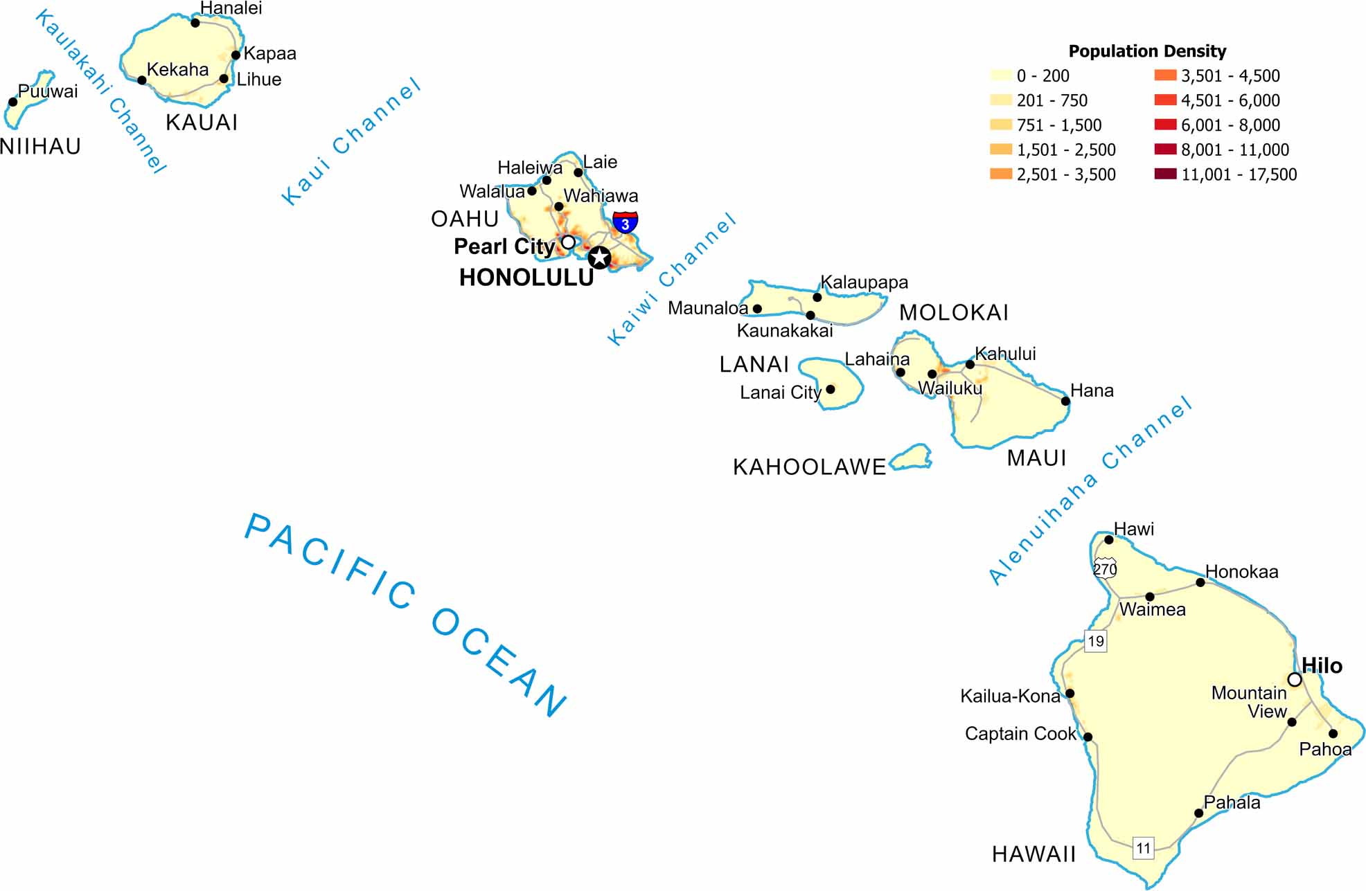
Population clusters tightly along island coastlines, especially near Honolulu. Mountain interiors show very low density. Check out our Hawaii population density map to see how ocean access shapes nearly all settlement here.

Map Information

  • Population Density Map of Hawaii
  • Data provided by NASA SEDAC Gridded Population of the World
  • Free for personal and commercial purpose. Attribution is required. How to attribute?

Hawaii City Maps

Here are Honolulu and Hawaii’s island cities

Leave a Reply

Your email address will not be published. Required fields are marked *