Map of Gurnee, Illinois
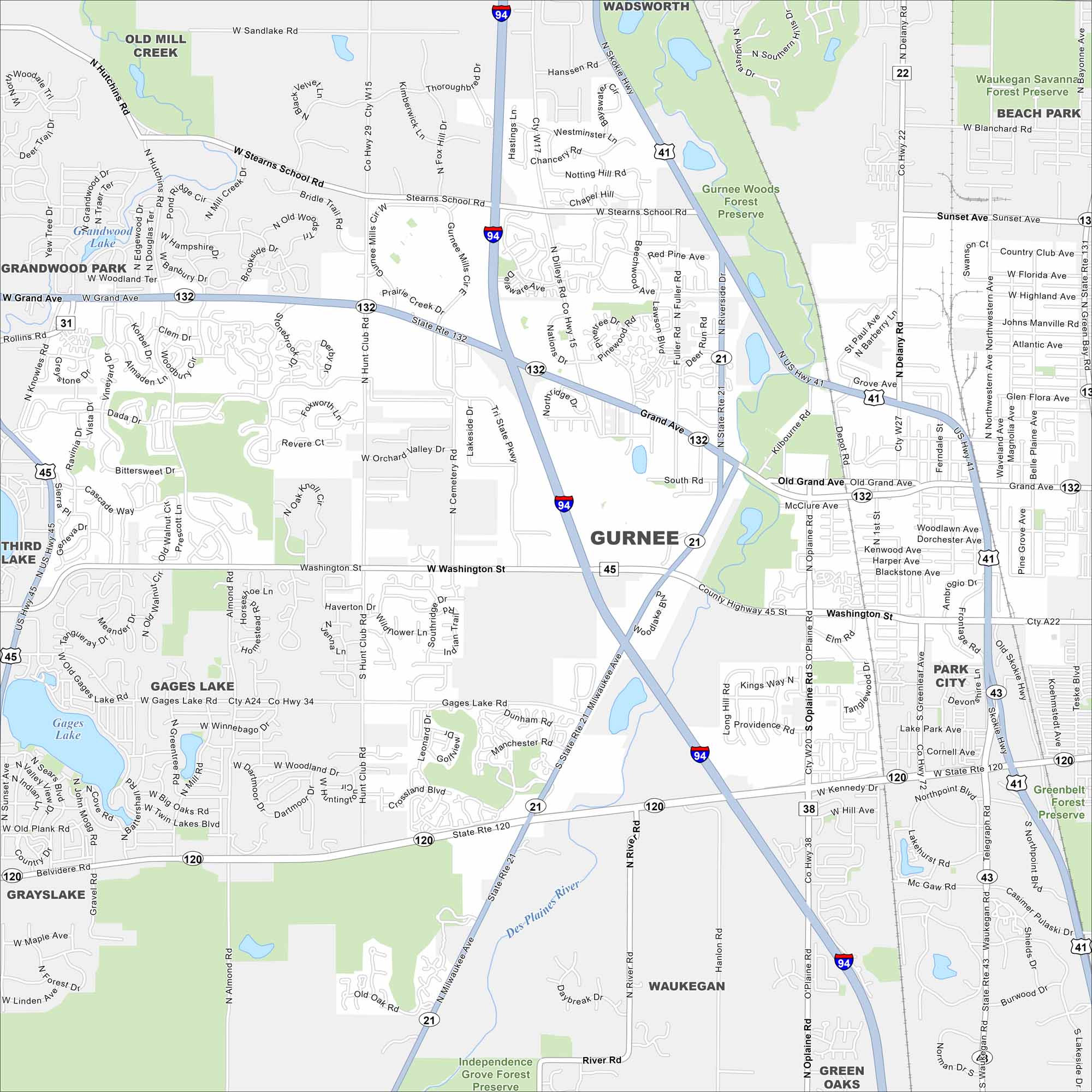
Gurnee, Illinois is in northern Illinois between Chicago and Milwaukee. Our map shows its location along I-94 and State Route 132.
Illinois State Maps
Get to know Illinois with our state maps


Map Information
On the Map
Interstates/Highways: I-94, US Hwy 41, US Hwy 45, State Rte 132, State Rte 120, State Rte 21 Major Roads: Grand Ave, Belvidere Rd, Washington St, Milwaukee Ave, Riverside Dr, Rollins Rd, Gurnee Mills Cir, Stearns School Rd, Dilley’s Rd, Hunt Club Rd, Almond Rd, O’Plaine Rd, Delany Rd, Waukegan Rd, Greenleaf St, Dada Dr, Woodlake Blvd, Hutchins Rd Lakes and Reservoirs: Gages Lake, Grandwood Lake Major Rivers: Des Plaines River Parks and Preserves: Gurnee Woods Forest Preserve, Waukegan Savanna Forest Preserve, Greenbelt Forest Preserve, Independence Grove Forest Preserve Nearby Communities: Old Mill Creek, Wadsworth, Beach Park, Park City, Waukegan, Green Oaks, Libertyville, Grayslake, Grandwood Park, Third LakeIllinois City Maps
Explore Chicago and urban regions of Illinois


