Map of Greer, South Carolina
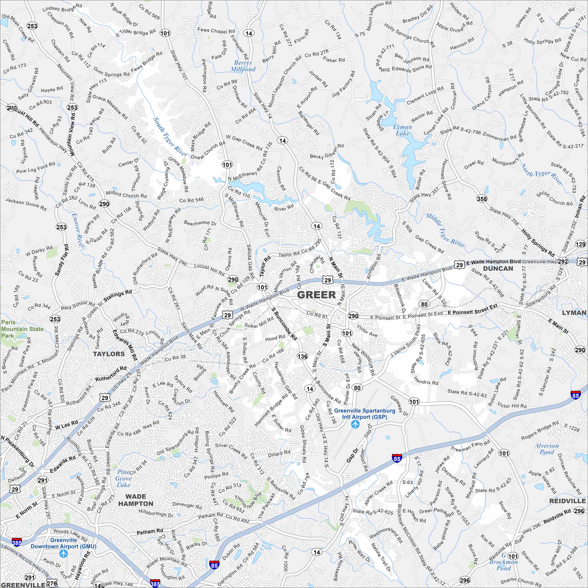
Take a look at our map of Greer between Greenville and Spartanburg. The city sits right along Interstate 85. Its location stands out near Greenville-Spartanburg International Airport.
Map Information
On the Map
Interstates/Highways: I-85, I-385, US Hwy 29, State Rte 14, State Rte 101, State Rte 290, State Rte 80, State Rte 296, State Rte 292, State Rte 358, State Rte 357, State Rte 417, State Rte 146 Major Roads: Wade Hampton Blvd, Poinsett St, Main St, Buncombe Rd, Gap Creek Rd, Highway 14, Gsp Dr, Pelham Rd, Brockman McClimon Rd, Brushy Creek Rd, Batesville Rd, Abner Creek Rd, Hammett Bridge Rd, Taylor Rd, Memorial Dr, Suber Rd, Snow Rd, Kist Rd, South Batesville Rd, The Parkway Airports: Greenville Spartanburg Intl Airport (GSP), Greenville Downtown Airport (GMU) Lakes and Reservoirs: Berry’s Millpond, Lyman Lake, South Tyger River, Middle Tyger River, North Tyger River, Piney Grove Lake, Brockman Pond, Alverson Pond Major Rivers: South Tyger River, Middle Tyger River, North Tyger River, Enoree River Parks and Preserves: Paris Mountain State Park Nearby Communities: Taylors, Wade Hampton, Duncan, Lyman, Reidville, GreenvilleSouth Carolina State Maps
Explore maps across the Palmetto State.


City Maps of South Carolina
Find our maps of Charleston and South Carolina cities here


