Map of Glen Ellyn, Illinois
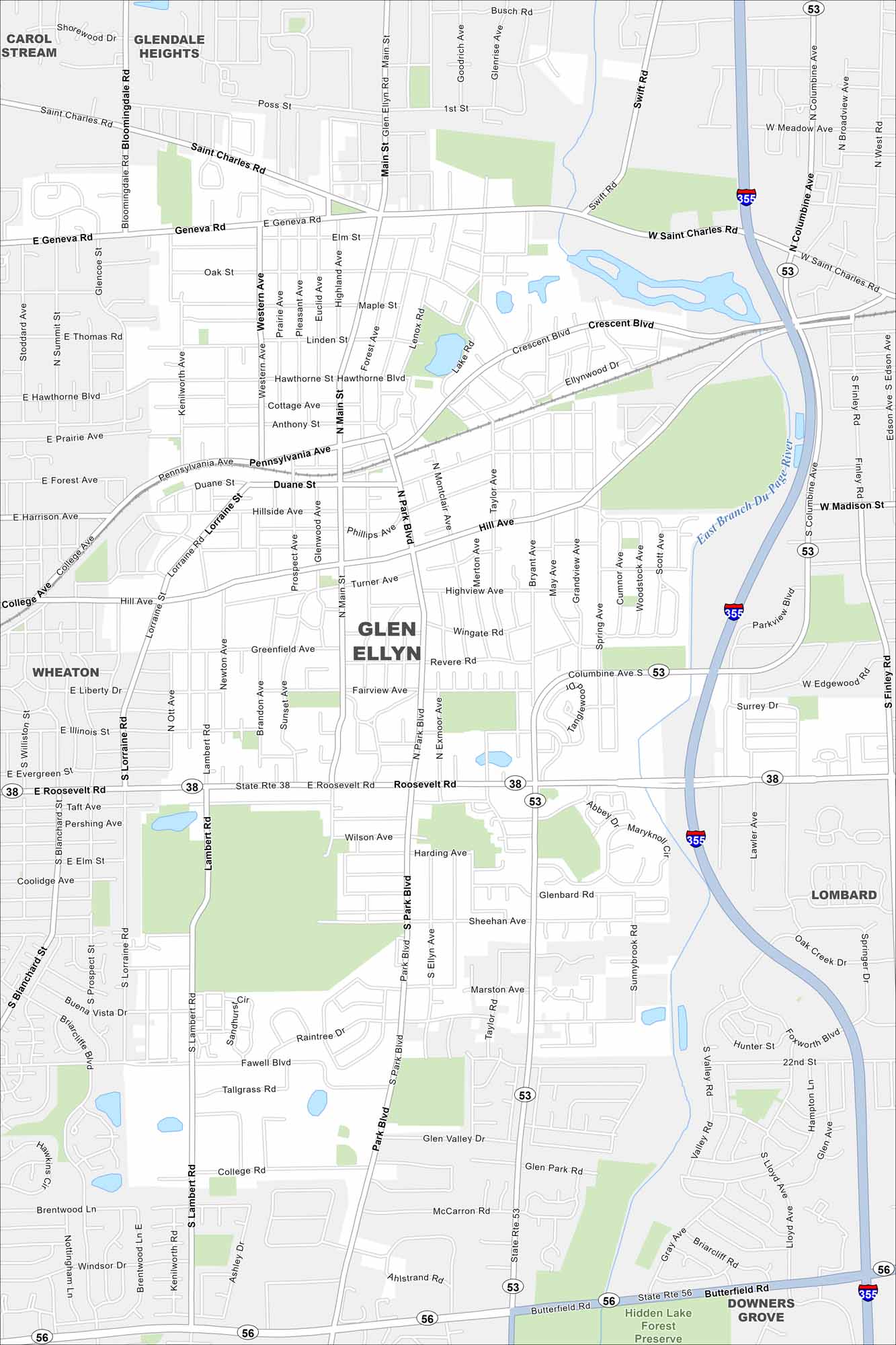
Glen Ellyn is west of Chicago. It feels suburban but still connects easily to the city by rail. Parks and forest preserves edge the map.
Illinois State Maps
Get to know Illinois with our state maps


Map Information
On the Map
Interstates/Highways: I-355, State Rte 38, State Rte 53, State Rte 56 Major Roads: Roosevelt Rd, Butterfield Rd, St Charles Rd, Geneva Rd, Main St, Park Blvd, Lambert Rd, College Rd, Briarcliffe Blvd, Pennsylvania Ave, Duane St, Crescent Blvd, Hill Ave, Fairview Ave, Wilson Ave, Glenbard Rd, 22nd St, Finley Rd, Nicoll Way Major Rivers: East Branch DuPage River Parks and Preserves: Hidden Lake Forest Preserve Nearby Communities: Glendale Heights, Carol Stream, Wheaton, Lombard, Downers GroveIllinois City Maps
Explore Chicago and urban regions of Illinois


