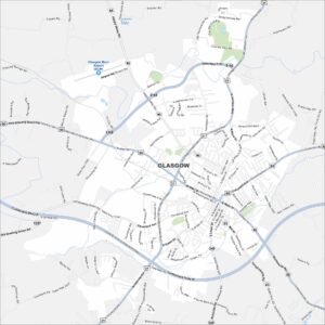
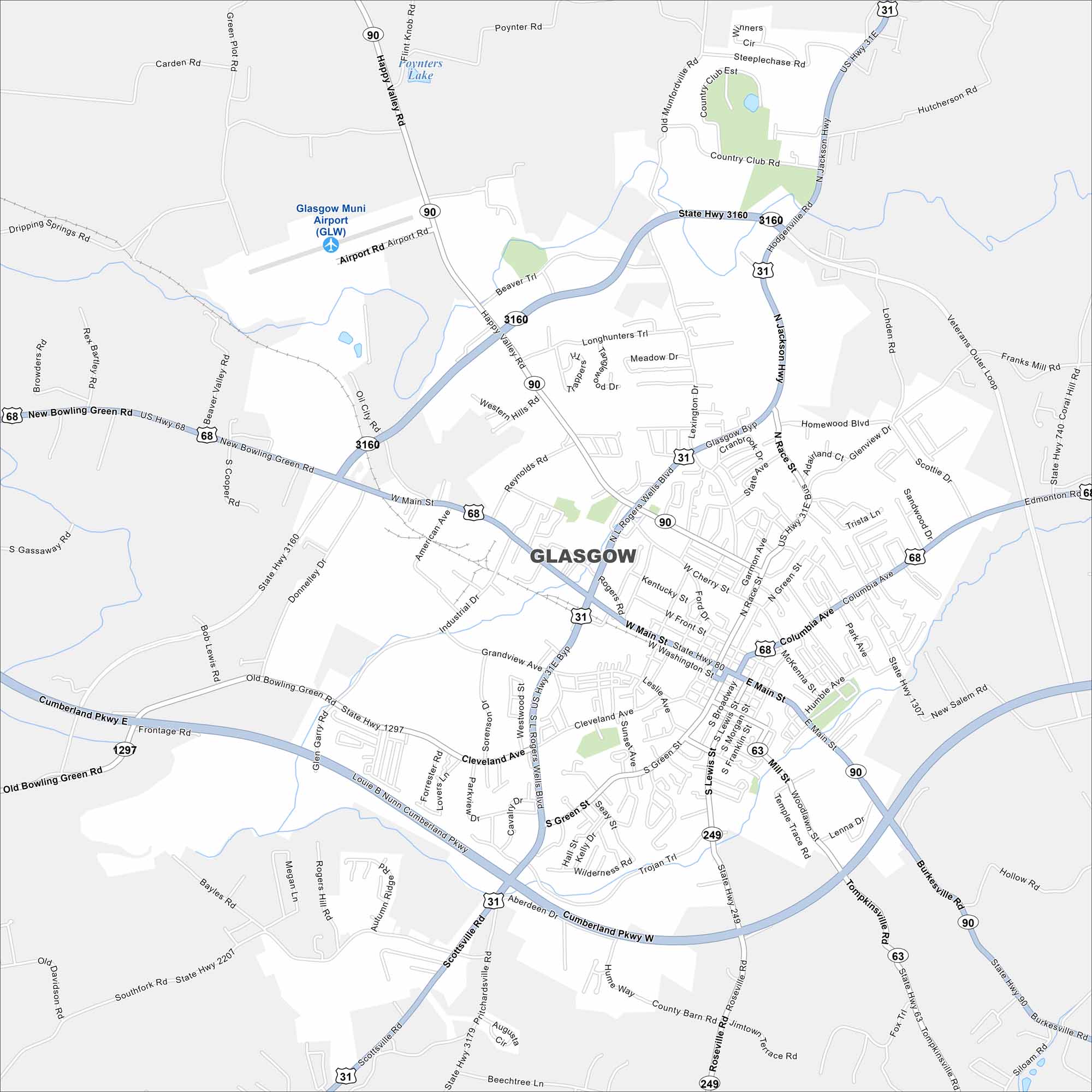
Map of Glasgow, Kentucky
Glasgow, Kentucky, sits among hills and farmland. It’s located in the southern part of the state and is close to Mammoth Cave National Park.
Kentucky State Maps
Our Kentucky maps reveal the Bluegrass State


Map Information
On the Map
Interstates/Highways: US Hwy 68, US Hwy 31E, State Rte 90, State Rte 249, State Rte 63, State Rte 1297, State Rte 3160, State Rte 1307, State Rte 740, State Rte 3179, State Rte 2207 Major Roads: Main St, Broadway, Columbia Ave, Happy Valley Rd, Rogers Wells Blvd, Scottsville Rd, Cumberland Pkwy, New Bowling Green Rd, Cleveland Ave, Race St, Green St, Southview Dr, Humble Ave, Park Ave, Tompkinsville Rd, Burkesville Rd, Roseville Rd, Jimtown Rd, Old Bowling Green Rd, Airport Rd Airports: Glasgow Muni Airport (GLW) Lakes and Reservoirs: Foynters LakeCity Maps of Kentucky
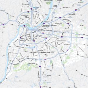
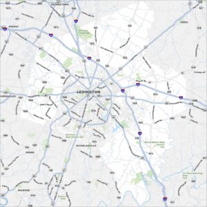
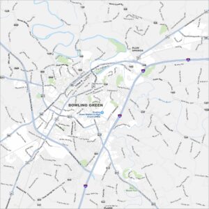
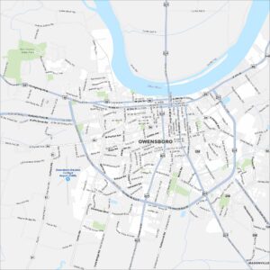
Here are Kentucky’s cities in full detail