Map of Fredericksburg, Virginia
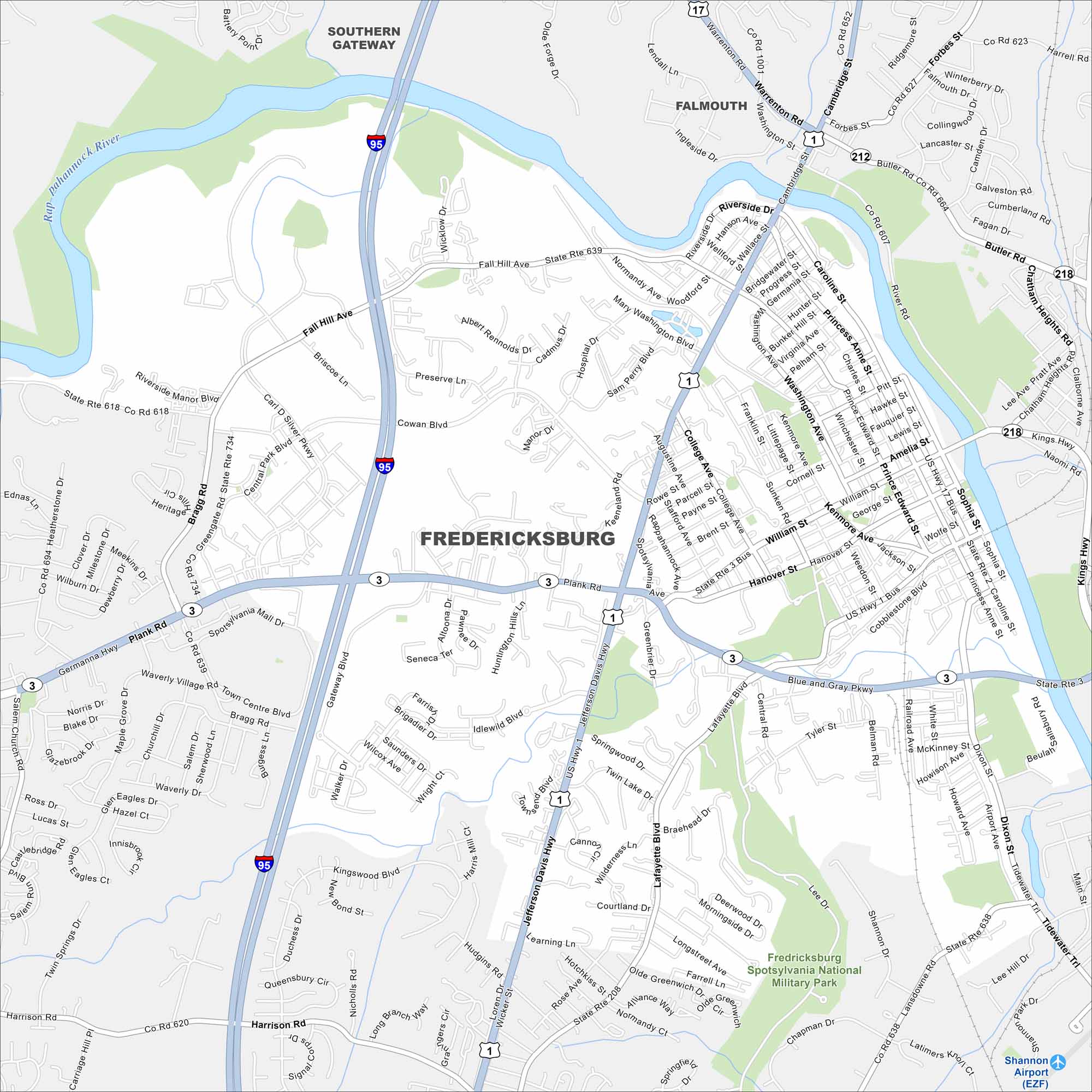
Explore our map of Fredericksburg along the Rappahannock River. The historic downtown sits near its banks. I-95 passes close, tying the city between D.C. and Richmond.
Map Information
On the Map
Interstates/Highways: I-95, US Hwy 1, US Hwy 1 Bus, US Hwy 17, US Hwy 17 Bus, State Rte 3, State Rte 3 Bus, State Rte 212, State Rte 218, State Rte 639, State Rte 607, State Rte 638, State Rte 208, State Rte 620 Major Roads: Plank Rd, Blue and Gray Pkwy, Jefferson Davis Hwy, Lafayette Blvd, William St, Princess Anne St, Dixon St, Fall Hill Ave, Cowan Blvd, Central Park Blvd, College Ave, Augustine Ave, Caroline St, Charles St, Prince Edward St, Tidewater Trail, Gateway Blvd, Carl Silver Pkwy, Riverside Dr, White Oak Rd Airports: Shannon Airport (EZF) Major Rivers: Rappahannock River Parks and Preserves: Fredericksburg Spotsylvania National Military Park Nearby Communities: Southern Gateway, FalmouthVirginia State Maps
Spanning coasts and mountains, here are our maps of Virginia.


City Maps of Virginia
Traverse Virginia using our city maps


