Map of Fort Mill, South Carolina
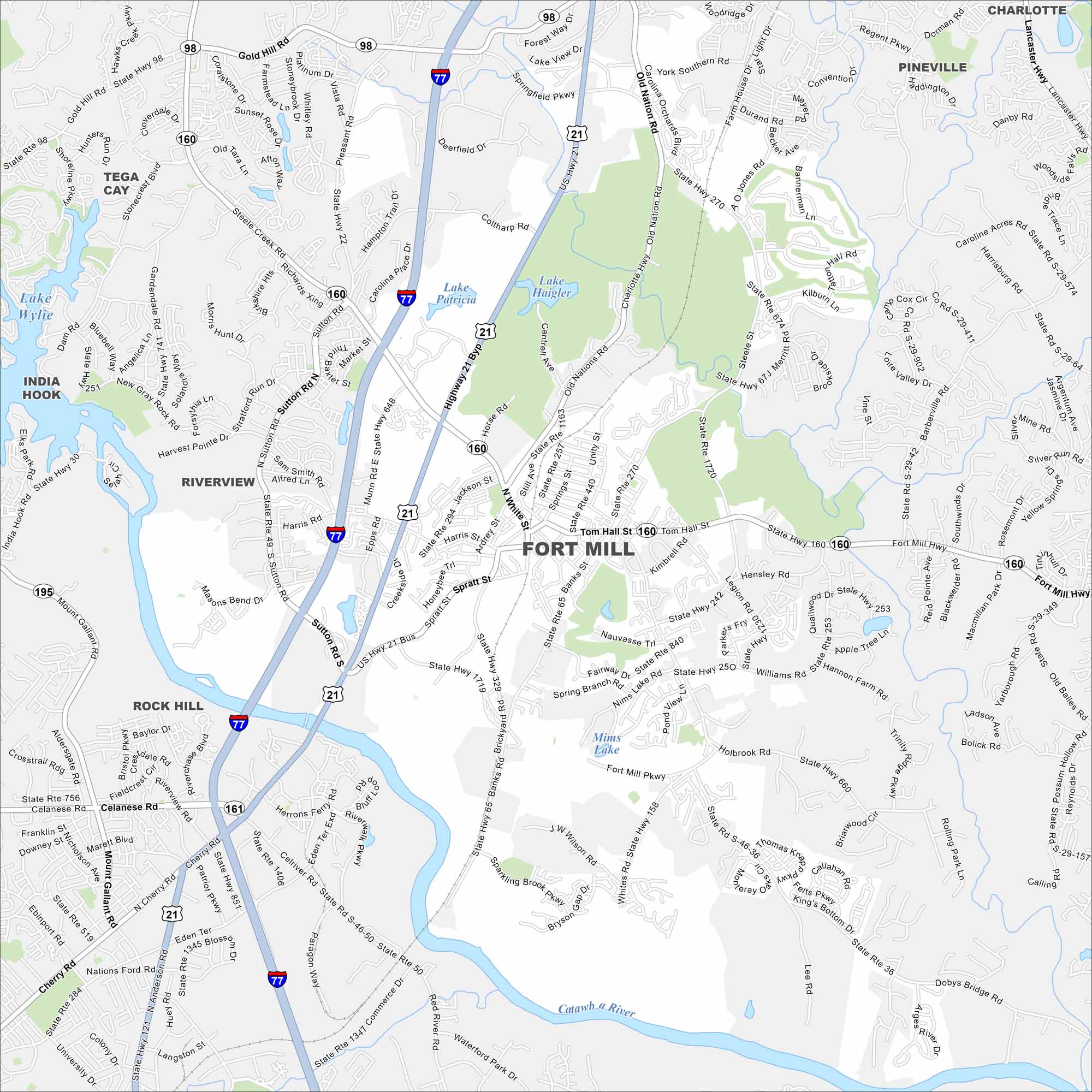
Explore our map of Fort Mill just south of Charlotte. The Catawba River flows nearby, giving the area a natural border.
Map Information
On the Map
Interstates/Highways: I-77, US Hwy 21, US Hwy 21 Bus, State Rte 160, State Rte 49, State Rte 161 Major Roads: Fort Mill Pkwy, Tom Hall St, Springfield Pkwy, Sutton Rd, Gold Hill Rd, Dobbs Bridge Rd, Dam Rd, Banks St, Harris Rd, Whites Rd, Munn Rd, Doby Bridge Rd, Holbrook Rd, Williams Rd, Hensley Rd, Kimbrell Rd, Spratt St, Jackson St, Ardrey St, Coltharp Rd Lakes and Reservoirs: Lake Wylie, Lake Patricia, Lake Haigler, Mims Lake Major Rivers: Catawba River Nearby Communities: Tega Cay, India Hook, Riverview, Rock HillSouth Carolina State Maps
Explore maps across the Palmetto State.


City Maps of South Carolina
Find our maps of Charleston and South Carolina cities here


