Map of Falls Church, Virginia
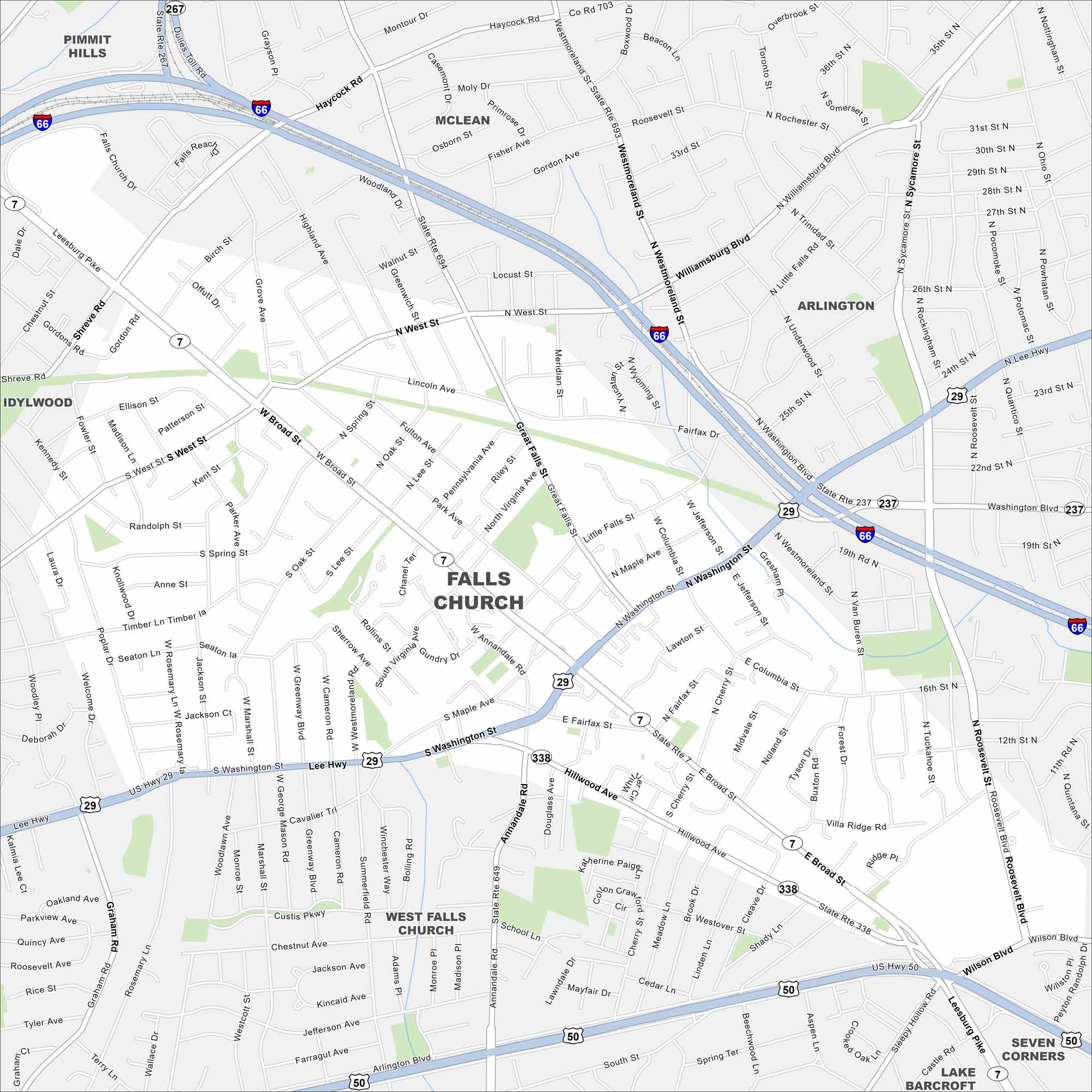
Our map of Falls Church shows it just outside Washington, D.C. Major routes like I-66 and Route 29 frame its edges. Its small size makes it easy to spot between bigger neighbors.
Map Information
On the Map
Interstates/Highways: I-66, US Hwy 50, US Hwy 29, State Rte 7, State Rte 237, State Rte 338, State Rte 649, State Rte 267 Major Roads: Broad St, Washington St, Leesburg Pike, Arlington Blvd, Annandale Rd, Westmoreland St, Great Falls St, Haycock Rd, Graham Rd, Sycamore St, Roosevelt St, Williamsburg Blvd, Little Falls St, Hillwood Ave, South St, Cherry St, Marshall St, West St, Maple Ave, Idylwood Rd Nearby Communities: Pimmitt Hills, Idylwood, McLean, Arlington, West Falls Church, Seven Corners, Lake BarcroftVirginia State Maps
Spanning coasts and mountains, here are our maps of Virginia.


City Maps of Virginia
Traverse Virginia using our city maps


