Map of Fairfax, Virginia
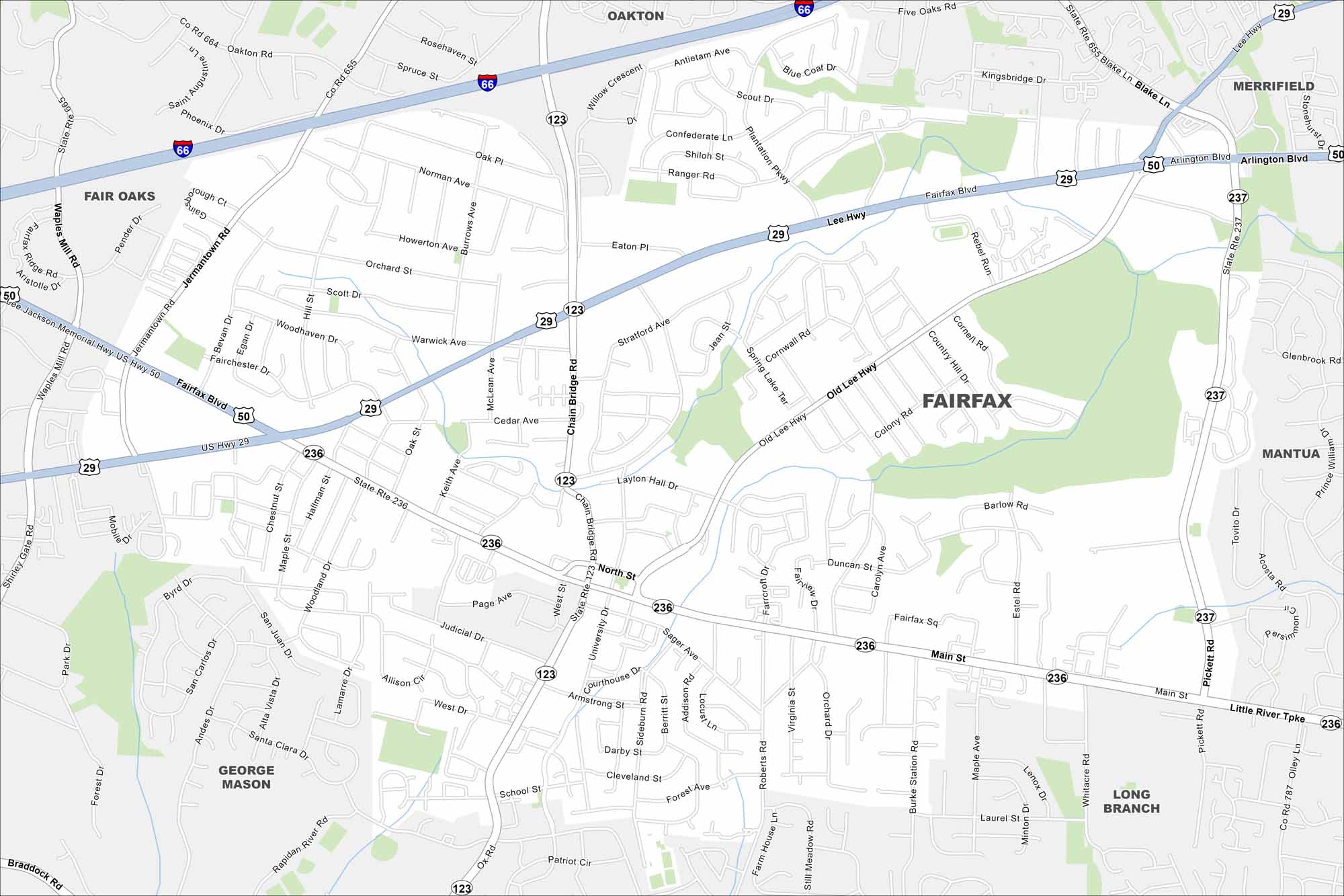
Our map of Fairfax places it west of Washington, D.C. Compact neighborhoods spread between highways like I-66 and Route 50.
Map Information
On the Map
Interstates/Highways: I-66, US Hwy 50, US Hwy 29, State Rte 123, State Rte 236, State Rte 237, State Rte 655 Major Roads: Main St, Lee Hwy, Fairfax Blvd, Chain Bridge Rd, Little River Tpk, University Dr, Jermantown Rd, Pickett Rd, Old Lee Hwy, Roberts Rd, Shirley Gate Rd, Braddock Rd, North St, Judicial Dr, Eaton Pl, Prosperity Ave, Blake Ln, Waples Mill Rd, Monument Dr, Ridge Top Rd Nearby Communities: Oakton, Fair Oaks, George Mason, Merrifield, Mantua, Long BranchVirginia State Maps
Spanning coasts and mountains, here are our maps of Virginia.


City Maps of Virginia
Traverse Virginia using our city maps


