Map of Elmhurst, Illinois
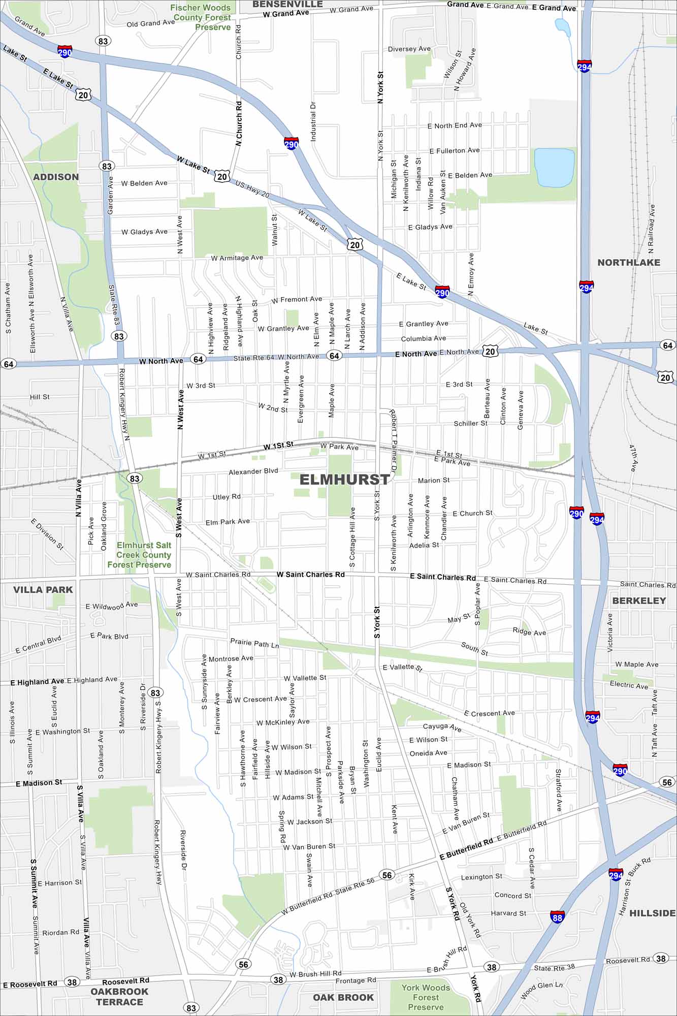
Elmhurst is a western suburb of Chicago with lots of parks. Our map of Elmhurst highlights its main routes like I-290. Salt Creek winds through parts of the city.
Illinois State Maps
Get to know Illinois with our state maps


Map Information
On the Map
Interstates/Highways: I-290, I-294, I-88, US Hwy 20, State Rte 64, State Rte 38, State Rte 56, Robert Kingery Hwy Major Roads: North Ave, Lake St, Roosevelt Rd, Butterfield Rd, York St, Grand Ave, St Charles Rd, Villa Ave, Madison St, West Ave, Salt Creek, Brush Hill Rd, Frontage Rd, Vallette St, Poplar Ave, Spring Rd, Commonwealth Ave, Clinton Ave, Berteau Ave Major Rivers: Parks and Preserves: Fischer Woods County Forest Preserve, Elmhurst Salt Creek County Forest Preserve, York Woods Forest Preserve Nearby Communities: Addison, Bensenville, Northlake, Villa Park, Berkeley, Oakbrook Terrace, Hillside, Oak BrookIllinois City Maps
Explore Chicago and urban regions of Illinois


