Map of Elgin, Illinois
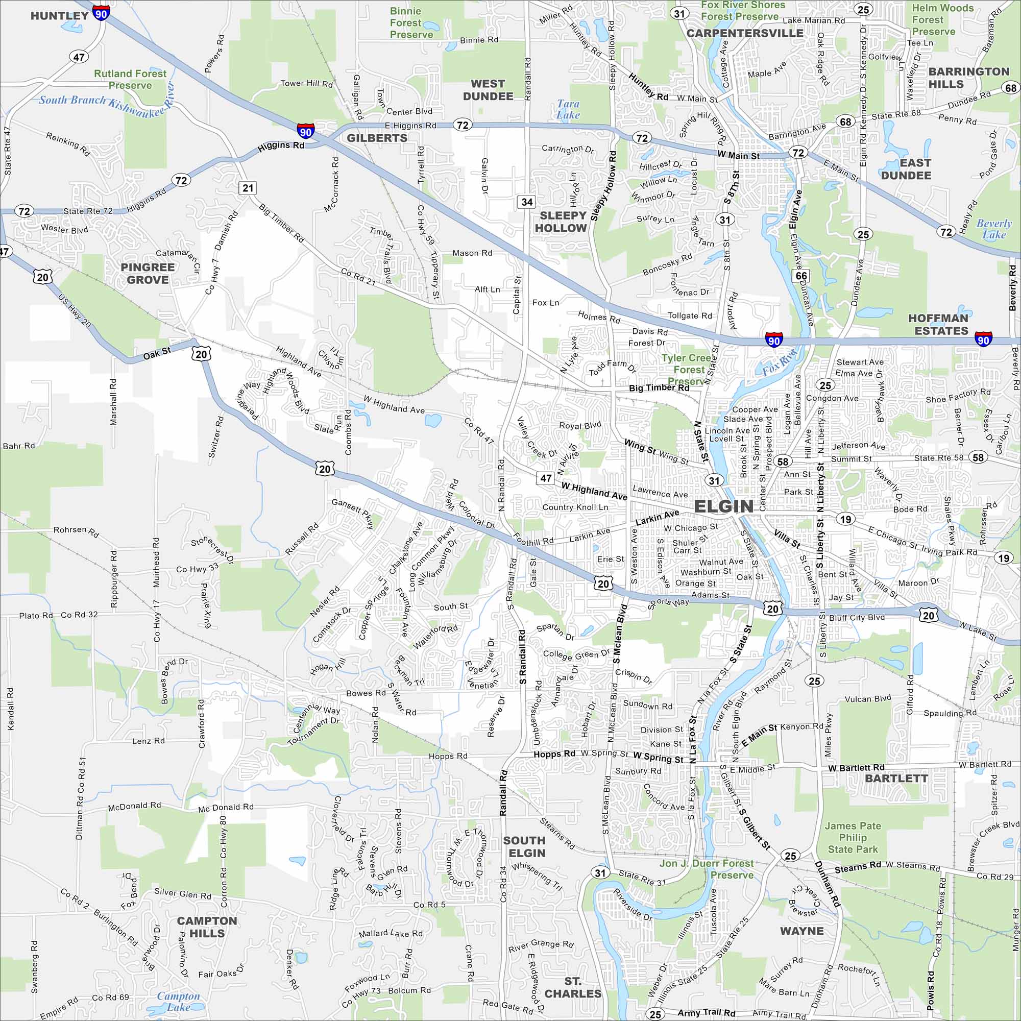
Our map of Elgin highlights the Fox River. Green parks and trails line both riverbanks. It’s known as “The City in the Suburbs” because it blends urban living with nearby nature.
Illinois State Maps
Get to know Illinois with our state maps


Map Information
On the Map
Interstates/Highways: I-90, US Hwy 20, State Rte 31, State Rte 25, State Rte 72, State Rte 19, State Rte 47, State Rte 58, State Rte 68 Major Roads: Main St, Chicago St, Summit St, Larkin Ave, Highland Ave, Randall Rd, McLean Blvd, State St, Villa St, Dundee Ave, Bowes Rd, Big Timber Rd, Hopps Rd, Stearns Rd, Bartlett Rd, Shales Pkwy, Rohrson Rd, Nesler Rd, Coombs Rd, Tyrrell Rd Lakes and Reservoirs: Tara Lake, Beverly Lake, Mallard Lake Major Rivers: Fox River, South Branch Kishwaukee River Parks and Preserves: Jon J. Duerr Forest Preserve, James Pate Philip State Park, Tyler Creek Forest Preserve, Binnie Forest Preserve, Rutland Forest Preserve, Burnidge Forest Preserve, Jelke Creek Bird Sanctuary Nearby Communities: Huntley, Gilberts, West Dundee, Sleepy Hollow, Carpentersville, Barrington Hills, East Dundee, Hoffman Estates, Bartlett, Wayne, St. Charles, South Elgin, Campton Hills, Pingree GroveIllinois City Maps
Explore Chicago and urban regions of Illinois


