Map of Des Plaines, Illinois

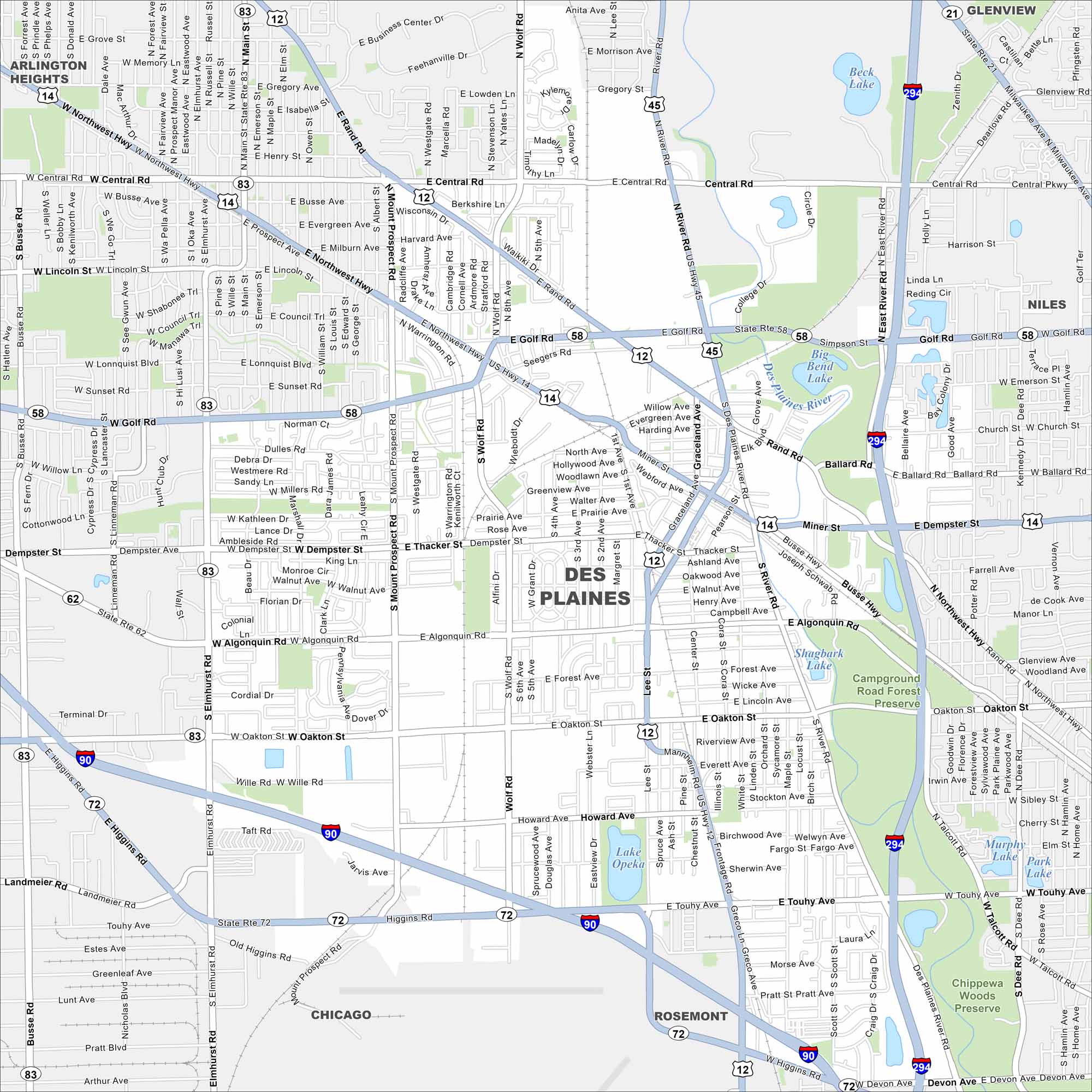
Des Plaines is northwest of Chicago near O’Hare Airport. On our map, the Des Plaines River winds through the city’s road network. Its location ties it closely to the greater Chicago area.
Illinois State Maps
Get to know Illinois with our state maps
Map Information
On the Map
Interstates/Highways: I-90, I-294, US Hwy 12, US Hwy 14, US Hwy 45, State Rte 83, State Rte 58, State Rte 72, State Rte 21, Northwest Hwy Major Roads: Golf Rd, Touhy Ave, Central Rd, Dempster St, Oakton St, Rand Rd, River Rd, Wolf Rd, Mount Prospect Rd, Main St, Elmhurst Rd, Lee St, Busse Hwy, Algonquin Rd, Ballard Rd, Potter Rd, Howard Ave, Wille Rd, Landmeier Rd Lakes and Reservoirs: Lake Opeka, Shagbark Lake, Big Bend Lake, Beck Lake, Murphy Lake, Park Lake Major Rivers: Des Plaines River Nearby Communities: Glenview, Niles, Rosemont, Chicago, Arlington HeightsIllinois City Maps
Explore Chicago and urban regions of Illinois


