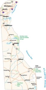
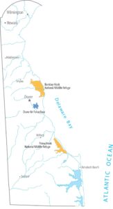
Delaware Outline Map

Our Delaware outline map displays Delaware Bay and the Atlantic Ocean shaping the eastern shore. Up north, the border with Pennsylvania is actually a perfect curved arc. The western side runs mostly straight down the Delmarva Peninsula.
Map Information
State Outline Maps
Click on a map below to check out outline maps of each state.


Delaware State Maps
Uncover Delaware with our state maps