Map of Danville, Virginia
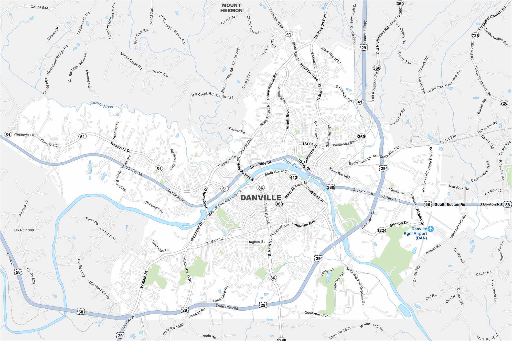
Our map of Danville shows the streets, highways, and the Dan River cutting through. The city grew as a tobacco and textile hub. While rolling hills spread around the edges, its riverbanks still shape the landscape
Map Information
On the Map
Interstates/Highways: US Hwy 29, US Hwy 29 Bus, US Hwy 58, US Hwy 360, State Rte 51, State Rte 41, State Rte 86, State Rte 1224, State Rte 726, State Rte 1507, State Rte 1503, State Rte 265, State Rte 1128, State Rte 736 Major Roads: Main St, Memorial Dr, Riverside Dr, Central Blvd, Mount Cross Rd, Piedmont Dr, Piney Forest Rd, Industrial Ave, Goodyear Blvd, Airport Dr, Franklin Tpk, South Boston Rd, Holland Rd, Westover Dr, Richmond Blvd, Moorefield Bridge Rd, Arnett Blvd, Claiborne St, Henry St, Craghead St Airports: Danville Rgnl Airport (DAN) Major Rivers: Dan River Nearby Communities: Mount HermonVirginia State Maps
Spanning coasts and mountains, here are our maps of Virginia.


City Maps of Virginia
Traverse Virginia using our city maps


