Map of Crystal Lake, Illinois
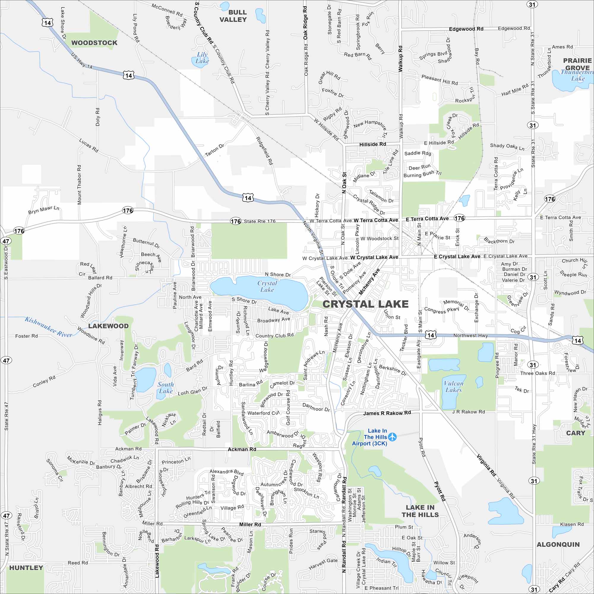
Northwest of Chicago, Crystal Lake is built around parks and open water. Our map shows its major roads, highways, and its namesake lake at the center. Trails and greenways connect the neighborhoods.
Illinois State Maps
Get to know Illinois with our state maps


Map Information
On the Map
Interstates/Highways: US Hwy 14, State Rte 31, State Rte 47, State Rte 176 Major Roads: Main St, Terra Cotta Ave, Crystal Lake Ave, Ackman Rd, Miller Rd, Virginia Rd, Rakow Rd, Pingree Rd, Pyott Rd, Walkup Rd, Ridgefield Rd, Woodstock St, Hillside Rd, Barlina Rd, Golf Course Rd, McHenry Ave, Dole Ave, Berkshire Dr, Manor Rd, Teckler Blvd Airports: Lake In The Hills Airport (3CK) Lakes and Reservoirs: Crystal Lake, Lily Lake, South Lake, Vulcan Lakes Major Rivers: Kishwaukee River Nearby Communities: Woodstock, Bull Valley, Prairie Grove, Lakewood, Lake in the Hills, Cary, Algonquin, HuntleyIllinois City Maps
Explore Chicago and urban regions of Illinois


