Map of Columbia, Missouri
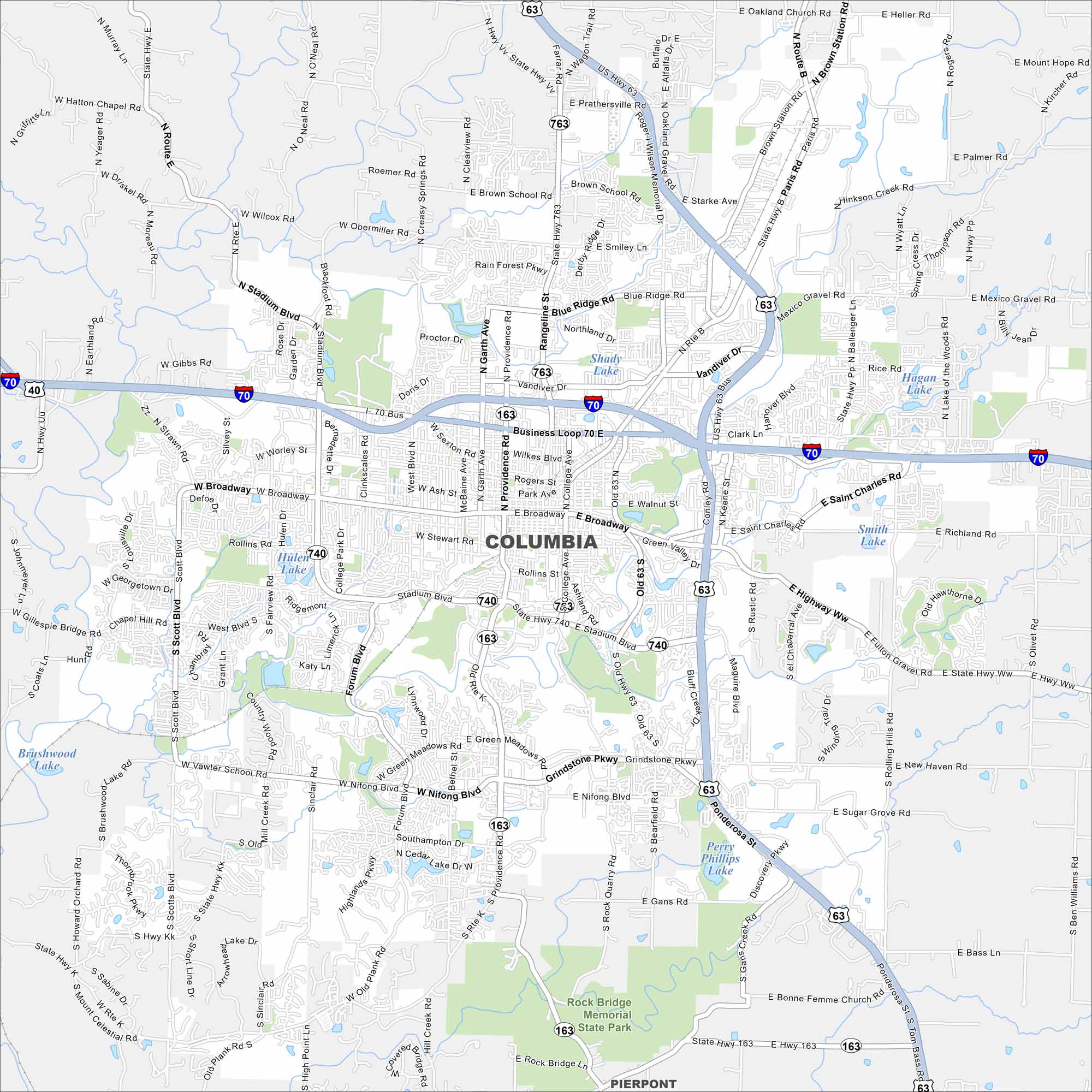
Our map of Columbia shows the layout of streets, highways, and surrounding countryside. Between Kansas City and St. Louis, this city is home to the University of Missouri. Rolling farmland is a key feature of the region.
Map Information
On the Map
Interstates/Highways: I-70, US Hwy 63, US Hwy 40, State Rte 163, State Rte 740, State Rte 763 Major Roads: Broadway, Stadium Blvd, Providence Rd, College Ave, Business Loop 70, Grindstone Pkwy, Nifong Blvd, Paris Rd, Range Line St, Garth Ave, West Blvd, Forum Blvd, Scott Blvd, Chapel Hill Rd, Rock Quarry Rd, Mexico Gravel Rd, Brown Station Rd, St Charles Rd, Smiley Ln, Blue Ridge Rd Lakes and Reservoirs: Shady Lake, Hulen Lake, Smith Lake, Hagan Lake, Perry Phillips Lake Parks and Preserves: Rock Bridge Memorial State Park Nearby Communities: PierpontMissouri State Maps
Check out state maps of the Show-Me State.


Missouri City Maps
Here are our city maps for Missouri


