Home » State Maps » Colorado Population Density Map

Colorado Population Density Map

Colorado Population Density Map

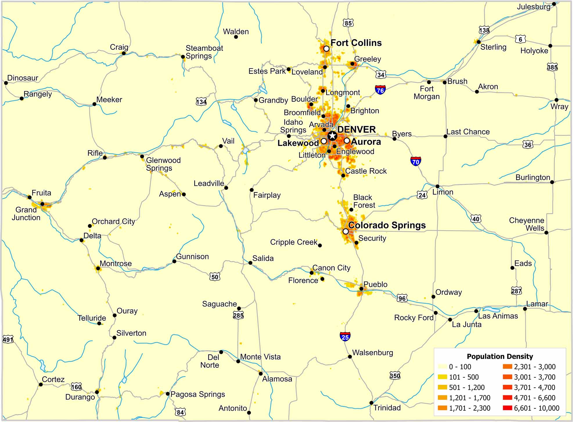
Most residents in Colorado live along the eastern edge of the Rockies. The Front Range forms a clear north–south corridor. Check out our map to see density fall quickly westward as elevation strongly limits settlement.

Map Information

  • Population Density Map of Colorado
  • Data provided by NASA SEDAC Gridded Population of the World
  • Free for personal and commercial purpose. Attribution is required. How to attribute?

Leave a Reply

Your email address will not be published. Required fields are marked *