Map of Chesterfield, Missouri
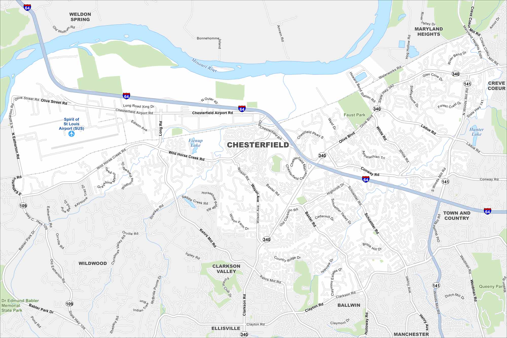
Our map of Chesterfield highlights its neighborhoods, interstates, and green parkland. West of St. Louis, it stretches along the Missouri River valley. Floodplains and bluffs both are key features of the city.
Map Information
On the Map
Interstates/Highways: I-64, US Hwy 40, State Rte 141, State Rte 340, State Rte 109 Major Roads: Chesterfield Airport Rd, Olive Blvd, Clarkson Rd, Wild Horse Creek Rd, Kehrs Mill Rd, Baxter Rd, Wilson Rd, Clayton Rd, Schoettler Rd, Conway Rd, Ladue Rd, Woods Mill Rd, Weidman Rd, White Rd, Eatherton Rd, Strecker Rd, Orville Rd, Long Rd, Edison Ave, Spirit of St Louis Blvd Airports: Spirit of St Louis Airport (SUS) Lakes and Reservoirs: Fienup Lake, Hunter Lake Major Rivers: Missouri River Parks and Preserves: Faust Park, Dr Edmund Babler Memorial State Park, Queeny Park Nearby Communities: Weldon Spring, Maryland Heights, Creve Coeur, Town and Country, Ballwin, Manchester, Ellisville, Clarkson Valley, WildwoodMissouri State Maps
Check out state maps of the Show-Me State.


Missouri City Maps
Here are our city maps for Missouri


