Map of Chesapeake, Virginia
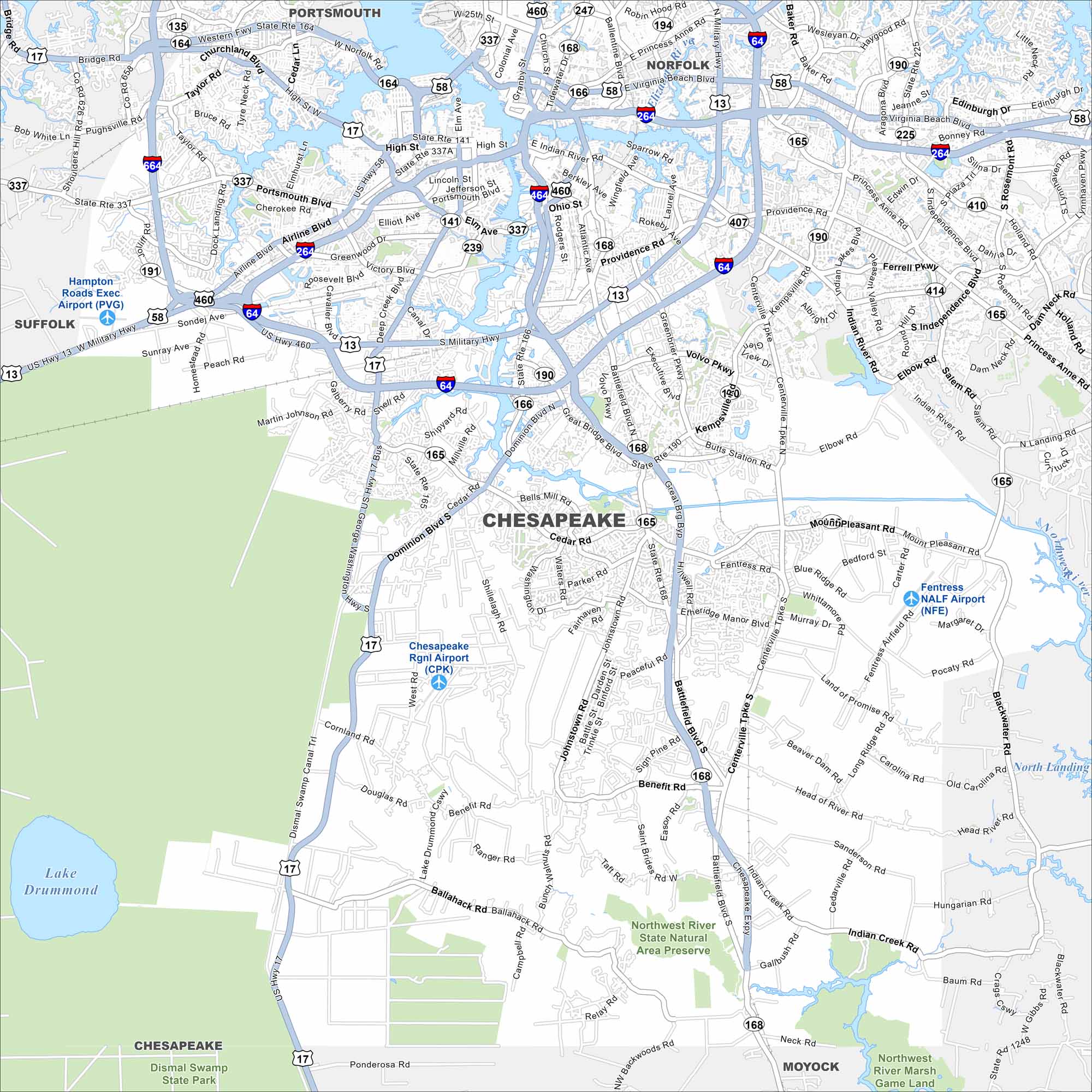
See Chesapeake with its highways, and winding waterways. Part of the Hampton Roads region, the city is known for the Great Dismal Swamp. Marshes and forests dominate most of the southern half.
Map Information
On the Map
Interstates/Highways: I-64, I-464, I-264, US Hwy 13, US Hwy 17, US Hwy 58, US Hwy 460, State Rte 168, State Rte 165, State Rte 190, State Rte 194, State Rte 337, State Rte 407, State Rte 135 Major Roads: Battlefield Blvd, Military Hwy, Portsmouth Blvd, Cedar Rd, Mount Pleasant Rd, Providence Rd, Kempsville Rd, Indian River Rd, Volvo Pkwy, Greenbrier Pkwy, George Washington Hwy, Dominion Blvd, Moses Grandy Trail, Ballahack Rd, Centerville Tpk, Hanbury Rd, Butts Station Rd, Fentress Rd, Blackwater Rd, Joliff Rd Airports: Hampton Roads Exec Airport (PVG), Chesapeake Rgnl Airport (CPK), Fentress NALF Airport (NFE) Lakes and Reservoirs: Lake Drummond Major Rivers: Elizabeth River, Southern Branch Elizabeth River Parks and Preserves: Northwest River State Natural Area Preserve, Dismal Swamp State Park, Northwest River Marsh Game Land Nearby Communities: Portsmouth, Norfolk, Suffolk, MoyockVirginia State Maps
Spanning coasts and mountains, here are our maps of Virginia.


City Maps of Virginia
Traverse Virginia using our city maps


