Map of Charlottesville, Virginia
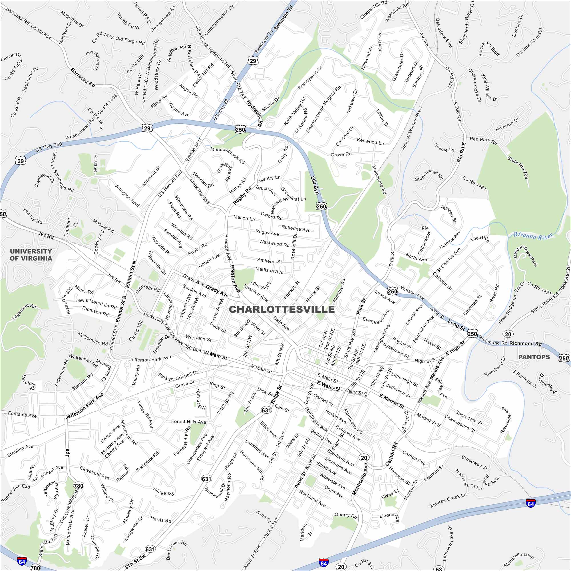
Our map of Charlottesville includes neighborhood streets, the highway network, and parkways. Nestled at the base of the Blue Ridge Mountains, it’s home to the University of Virginia. The Rivanna River runs nearby.
Map Information
On the Map
Interstates/Highways: I-64, US Hwy 29, US Hwy 250, US Hwy 250 Bus, State Rte 20, State Rte 631, State Rte 743, State Rte 654, State Rte 656, State Rte 780, State Rte 742, State Rte 317 Major Roads: Main St, Emmet St, High St, Preston Ave, Jefferson Park Ave, Barracks Rd, Hydraulic Rd, Rio Rd, Market St, Water St, Monticello Ave, Ivy Rd, Ridge St, Cherry Ave, Elliott Ave, Harris St, McIntire Rd, Park St, Locust Ave, Avon St Major Rivers: Rivanna River Nearby Communities: University of Virginia, PantopsVirginia State Maps
Spanning coasts and mountains, here are our maps of Virginia.


City Maps of Virginia
Traverse Virginia using our city maps


