Map of Charleston, South Carolina
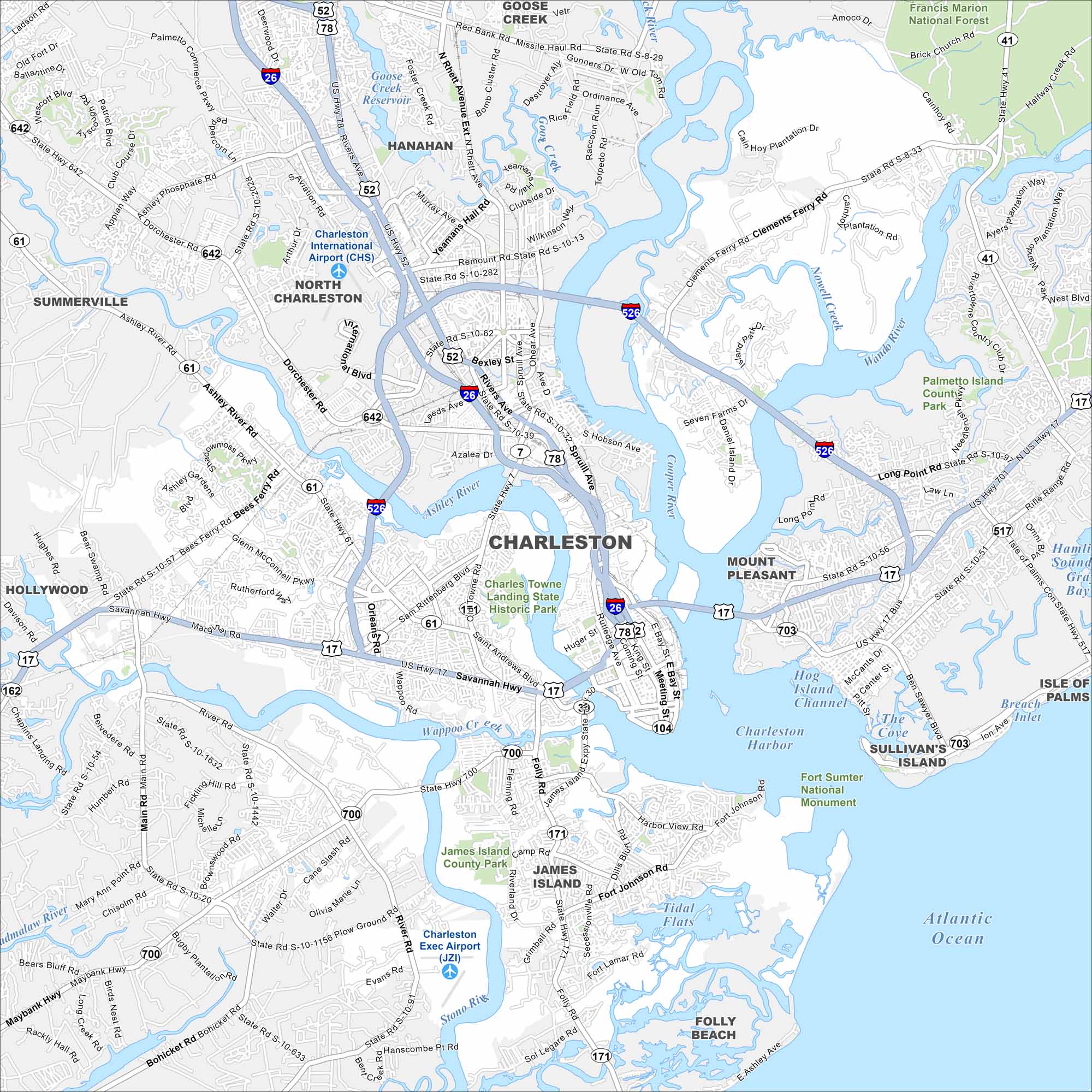
Our map of Charleston highlights the peninsula, waterways, and historic districts. Known as the “Holy City”, it sits where the Ashley and Cooper Rivers meet. The Atlantic coastline shapes much of its character.
Map Information
On the Map
Interstates/Highways: I-26, I-526, US Hwy 17, US Hwy 52, US Hwy 78, State Rte 7, State Rte 30, State Rte 41, State Rte 61, State Rte 171, State Rte 642, State Rte 700, State Rte 703 Major Roads: Savannah Hwy, Septima Clark Pkwy, Meeting St, King St, East Bay St, Rivers Ave, Dorchester Rd, Ashley River Rd, Glenn McConnell Pkwy, Sam Rittenberg Blvd, Folly Rd, Clements Ferry Rd, Long Point Rd, Coleman Blvd, Ben Sawyer Blvd, Maybank Hwy, Bohicket Rd, Harbor View Rd, James Island Expwy, Aviation Ave Airports: Charleston International Airport (CHS), Charleston Exec Airport (JZI) Lakes and Reservoirs: Atlantic Ocean, Charleston Harbor, The Cove, Goose Creek Reservoir, Hamlin Sound, Gray Bay Major Rivers: Ashley River, Cooper River, Wando River, Stono River, Wappoo Creek, Beresford Creek, Nowell Creek Parks and Preserves: Francis Marion National Forest, Charles Towne Landing State Historic Park, James Island County Park, Fort Sumter National Monument, Palmetto Island County Park Nearby Communities: North Charleston, Mount Pleasant, Summerville, Goose Creek, Hanahan, James Island, Folly Beach, Sullivan’s Island, Isle of Palms, Hollywood Neighborhoods: Downtown CharlestonSouth Carolina State Maps
Explore maps across the Palmetto State.


City Maps of South Carolina
Find our maps of Charleston and South Carolina cities here


