Map of Champaign, Illinois
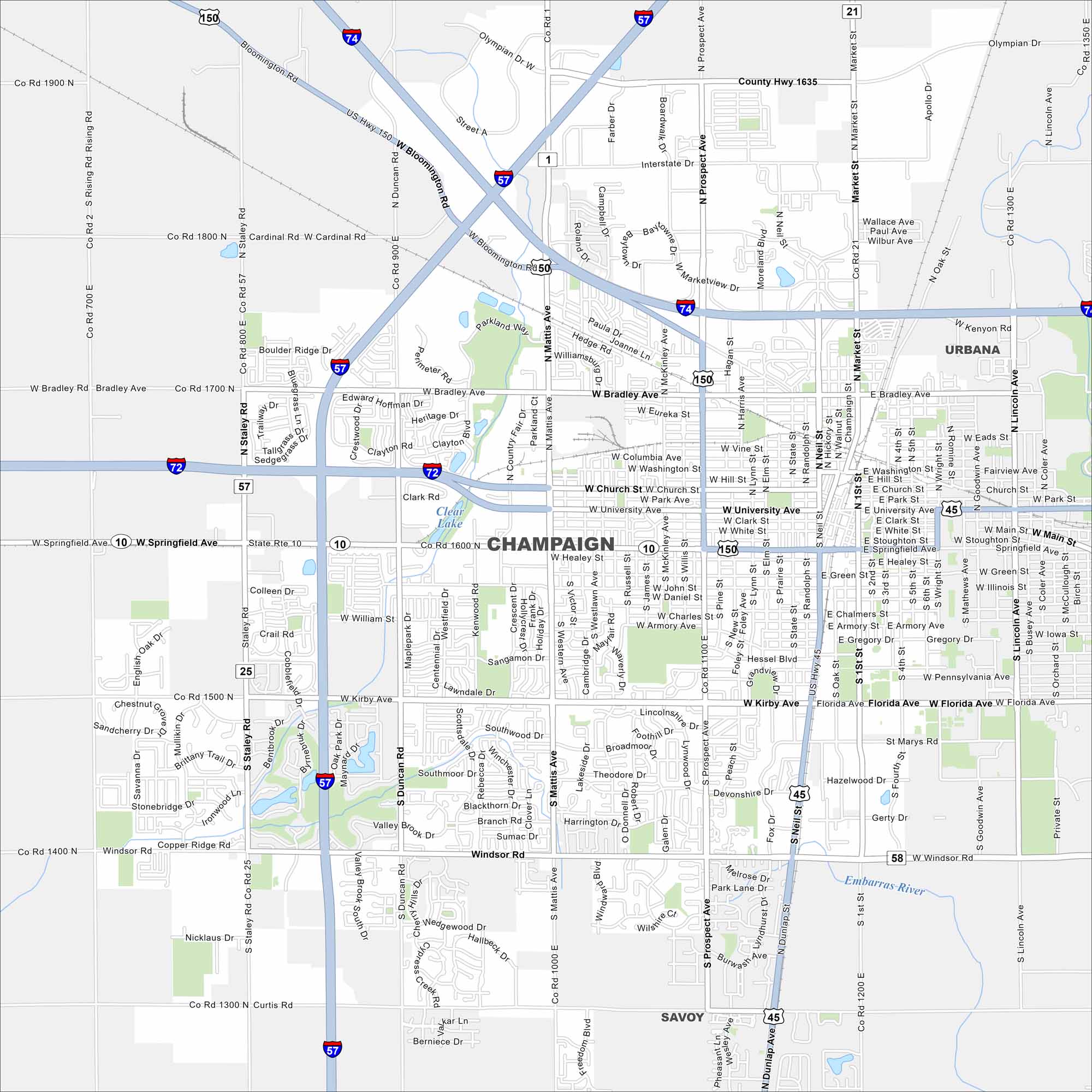
Champaign is surrounded by vast farmland. Our map shows its neighborhoods spreading outward from a lively downtown. It thrives with the University of Illinois anchoring the community.
Illinois State Maps
Get to know Illinois with our state maps


Map Information
On the Map
Interstates/Highways: I-57, I-72, I-74, US Hwy 45, US Hwy 150, State Rte 10 Major Roads: Springfield Ave, Kirby Ave, Bradley Ave, Prospect Ave, Mattis Ave, Market St, University Ave, Church St, Neil St, Windsor Rd, Curtis Rd, Staley Rd, First St, Wright St, Lincoln Ave, Florida Ave, Olympian Dr, Bloomington Rd, Duncan Rd, Philo Rd Major Rivers: Embarras River Nearby Communities: Urbana, SavoyIllinois City Maps
Explore Chicago and urban regions of Illinois


