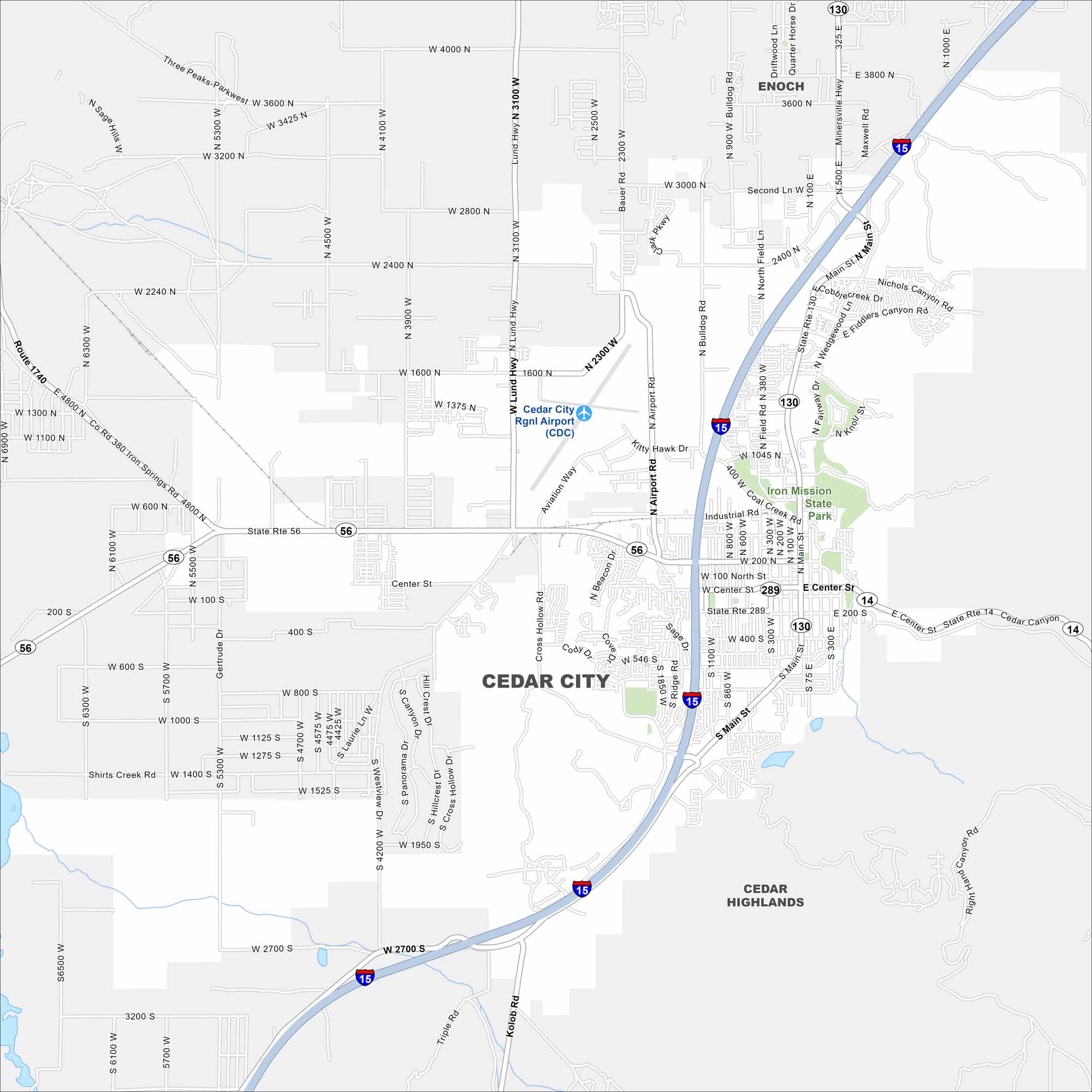
Map of Cedar City, Utah
Cedar City is framed by mountains and high desert landscapes. Our map shows how it connects with nearby canyons and open land. The city is often called “Festival City” because of its arts and culture events.
Map Information
On the Map
Interstates/Highways: I-15, State Rte 56, State Rte 14, State Rte 130, State Rte 289 Major Roads: Main St, Center St, Lund Hwy, Airport Rd, Bulldog Rd, Cross Hollow Rd, Royal Hunte Dr, 200 North St, 400 South St, 800 South St, 1100 West St, 2300 West St, 3100 West St, 3000 North St, 3900 North St, 4100 North St, Fiddlers Canyon Rd, Nichols Canyon Rd, Shirts Creek Rd, Kolob Rd Airports: Cedar City Rgnl Airport (CDC) Parks and Preserves: Iron Mission State Park Nearby Communities: Enoch, Cedar HighlandsUtah State Maps
Look through maps of deserts, parks, and cities.


City Maps of Utah
Here is Salt Lake City and Utah’s urban regions.


