Wabash River Map
Take a look at our Wabash River map stretching across Indiana. The river moves from Ohio’s border to the Illinois boundary line.
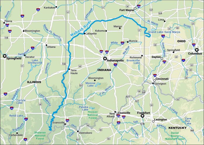
Take a look at our Wabash River map stretching across Indiana. The river moves from Ohio’s border to the Illinois boundary line.

Our map of the White River follows its winding path through the Ozarks and into eastern Arkansas. It’s especially known for trout fishing.
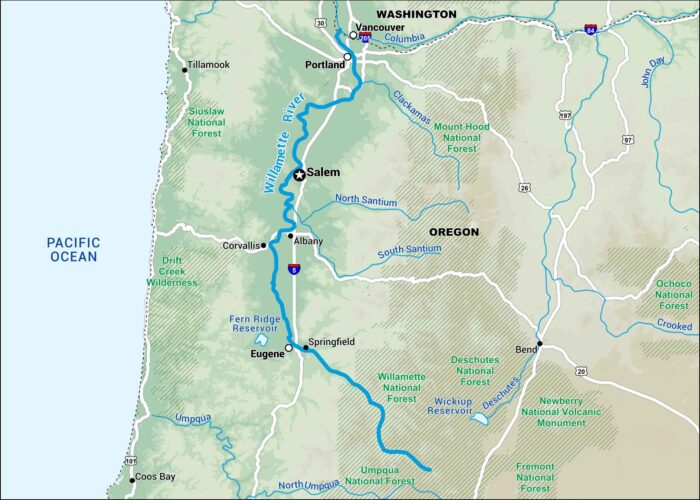
Here’s our map of the Willamette River flowing through western Oregon. It runs past Eugene, Salem, and Portland.
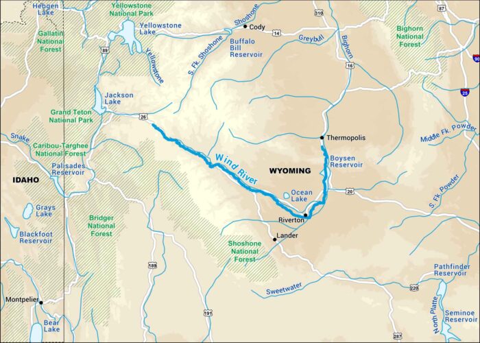
Our Wind River map highlights its run through the mountains of western Wyoming. It cuts through some of the most scenic country in the Rockies.
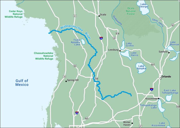
This map of the Withlacoochee River displays its slow curve through west-central Florida. It passes small rural towns on its way to the Gulf.
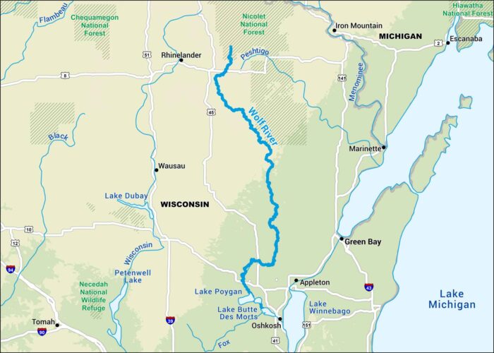
Our map of the Wolf River follows its path through northern Wisconsin. It winds past before reaching Fox River near Lake Butte des Morts.
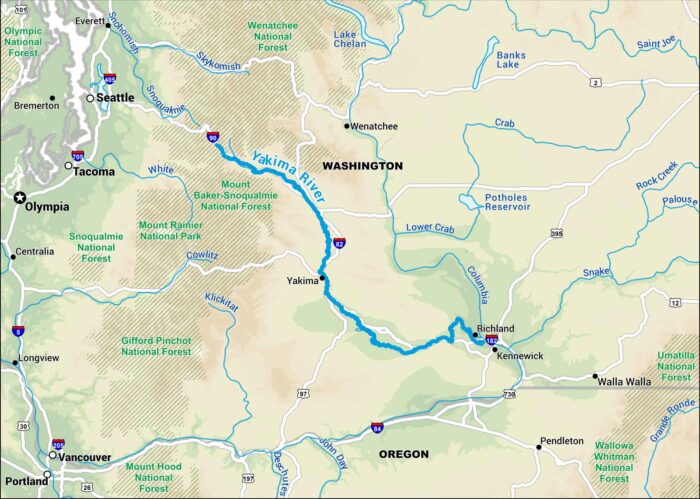
Our map of the Yakima River shows its route through central Washington. You’ll notice it passes by Richland, Kennewick and Yakima.
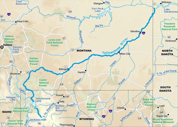
Here’s our map of the Yellowstone River running across southern Montana. It’s one of the last free-flowing rivers in the West.
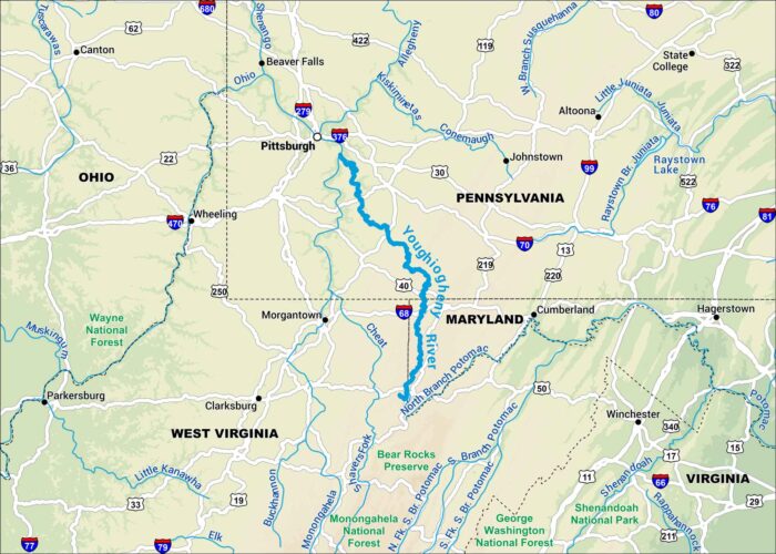
Our map of the Youghiogheny River follows its winding path through the Allegheny Mountains of southwestern Pennsylvania.
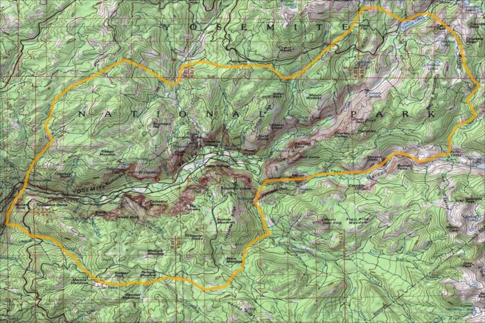
Our map of Yosemite Valley shows its contours. Landmarks like El Capitan and Half Dome stand out. It’s the heart of Yosemite National Park.

Our map of the Yukon River follows its path through Alaska and the Yukon Territory in Canada. It goes for thousands of miles in North America