United States Precipitation Map
Our US precipitation map shows a huge split. The eastern half and the Northwest are green, while the west interior is a giant dry zone.
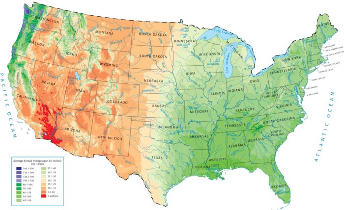
Our US precipitation map shows a huge split. The eastern half and the Northwest are green, while the west interior is a giant dry zone.

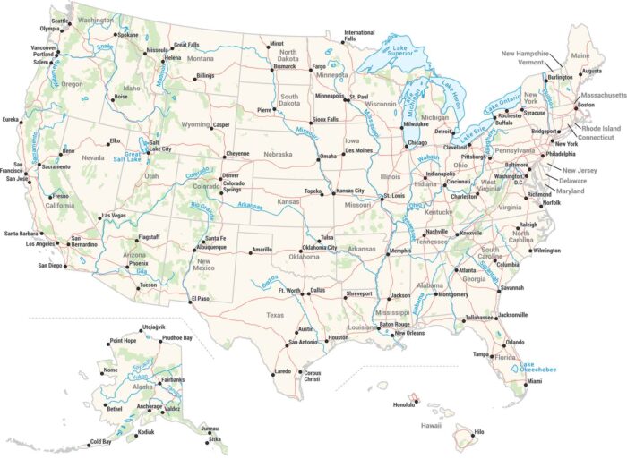
Our map of America’s lakes and rivers shows the major waterways and lakes that define the country’s landscape.
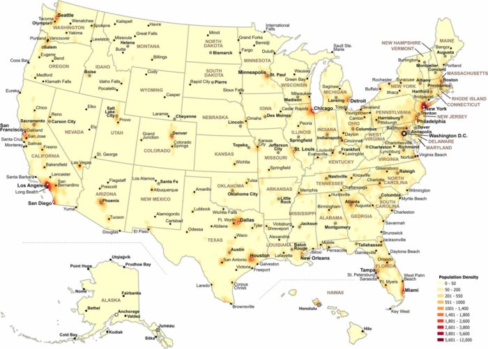
Our map shows how population density changes across the United States. Check out our map to see where people are most concentrated.
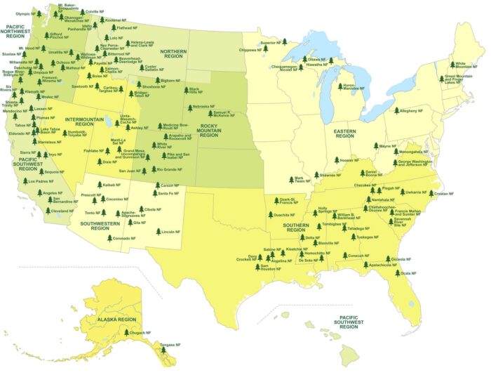
Our map shows where America’s national forests stretch across the country. It highlights forest regions, state boundaries and lakes.
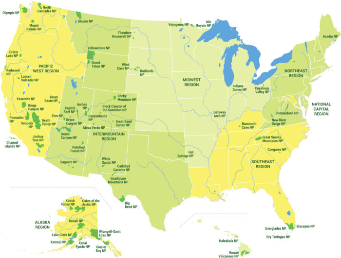
Our map showcases all 63 national parks across five distinct US regions. See national park locations, state boundaries, and regions.
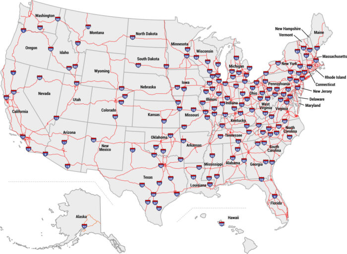
Our US interstate map displays the entire highway system with all major routes labeled. See I-5 to I-95, state boundaries, and freeways.
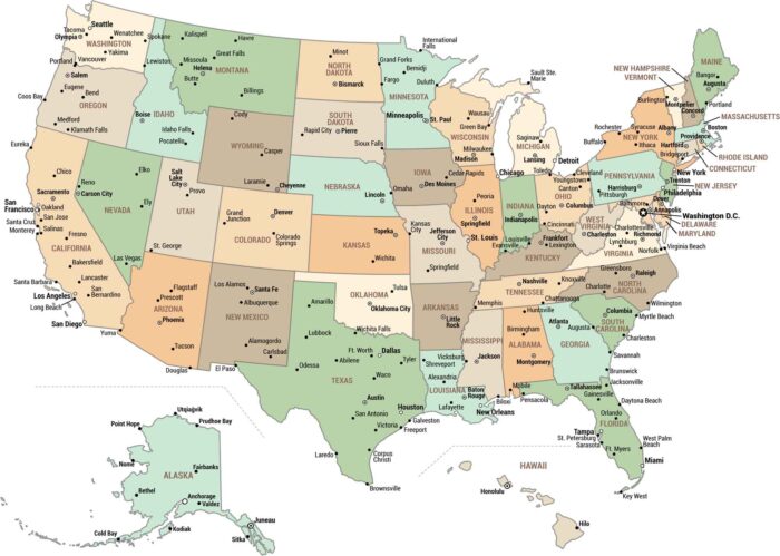
Our map highlights Washington DC, all 50 state capitals, and major cities nationwide. From coast to coast, see all of America’s big cities.
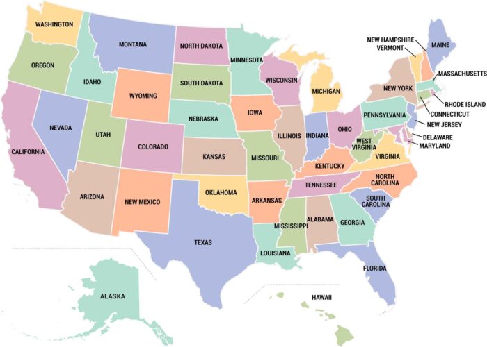
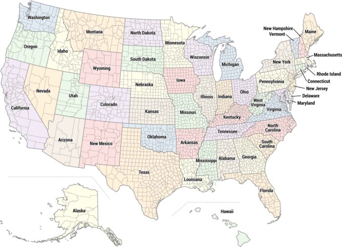
Our US states map displays all 50 states color-coded and clearly labeled. See state boundaries, Hawaii and Alaska insets.
This is a high-resolution map with every detail you could need. Our USA detailed map has cities, physical features, state outlines, and more.
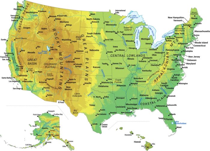
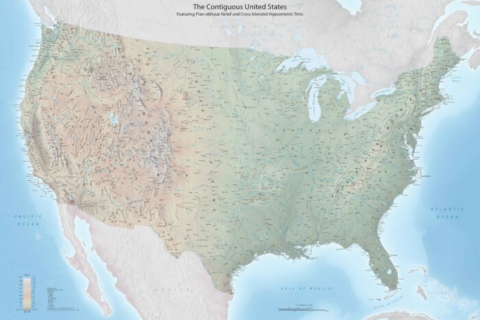
Our map shows the major physical features of the United States. We built this map to show you the geography that makes America what it is.
Our US map packs in everything. All 50 states, major cities, rivers, lakes, and coastlines. Interstate highways connect cities across the USA.
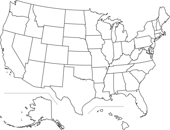
Our US blank map shows state boundaries without any labels or colors. It’s a USA outline map with just the state lines inside.
Our US county map shows all 3,000+ counties across the country. Each state is colored differently so you can easily tell them apart.
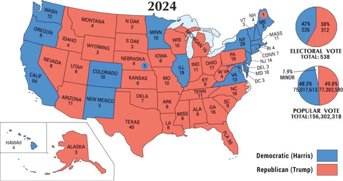
Our map from the 2024 U.S. election shows red stretching across the nation. The outcome made Donald Trump the nation’s 47th president.
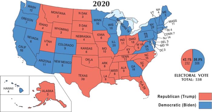
Our 2020 U.S. election map shows how the presidency flipped back to blue. Joe Biden defeated incumbent Donald Trump in a close race.