Map of Riverview, Michigan
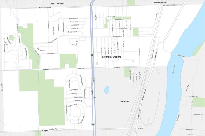
Here’s a map of Riverview, along the Detroit River. You can see the waterfront, neighborhoods, and main streets that define the city.
Here’s a map of Riverview, along the Detroit River. You can see the waterfront, neighborhoods, and main streets that define the city.
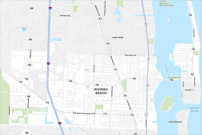
Our map of Riviera Beach shows the shoreline and the neighborhoods tucked just inland. It’s easy to spot Singer Island and major routes.
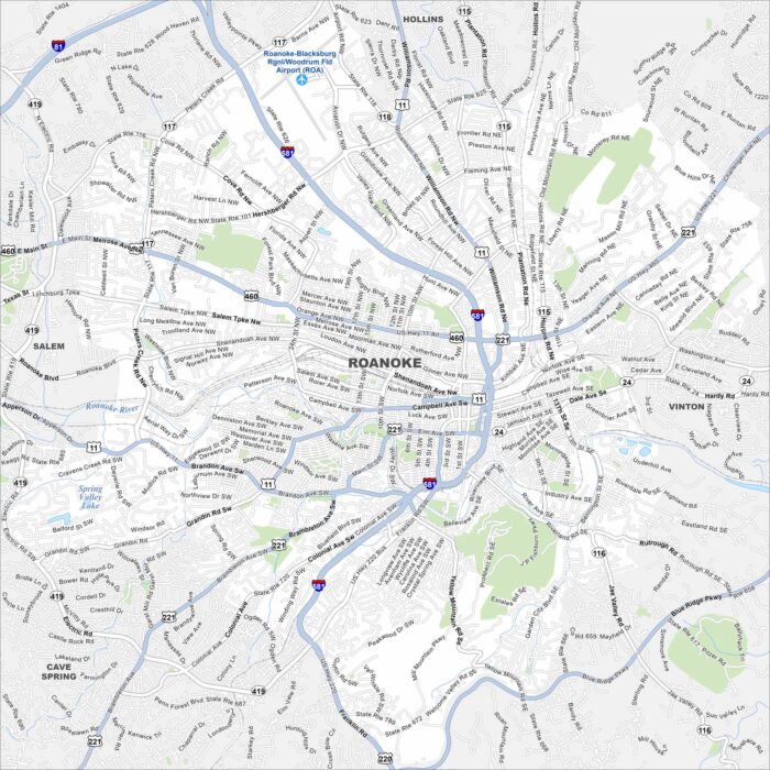
Our map of Roanoke shows the city center drawn out clearly. You can trace the roads toward the Blue Ridge Mountains.
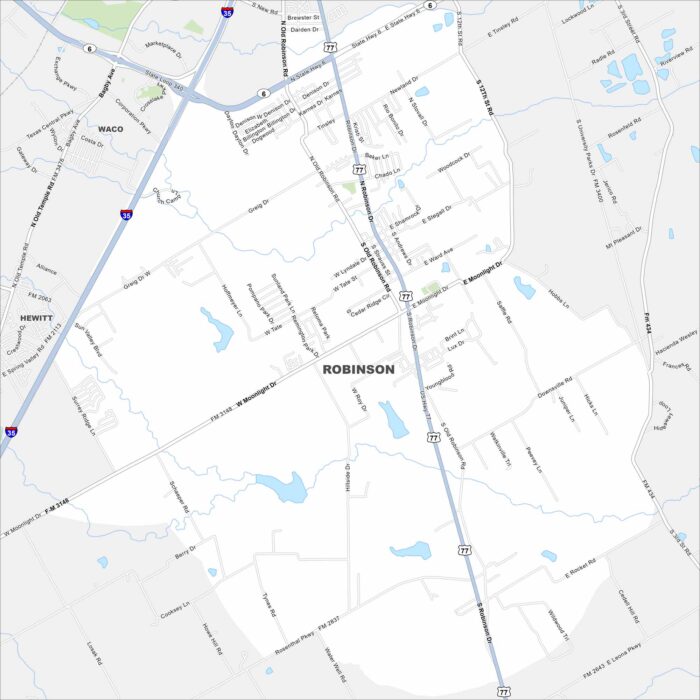
Get oriented with our Robinson, Texas map. The layout makes it simple to move through town and find quick routes into Waco.
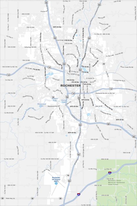
Our map of Rochester, Minnesota displays the parks and the busy roads around downtown. It gives you a sense of how the city is arranged.
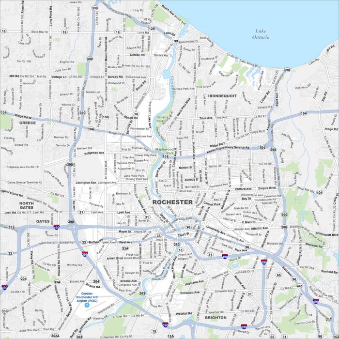
This street map of Rochester lays out the Genesee River and the streets running off it. You’ll also see the highways that circle the city.
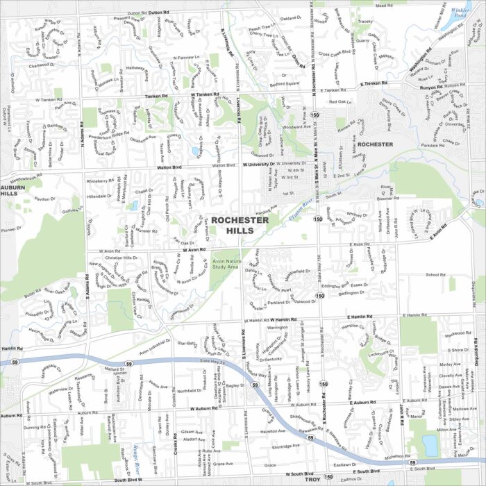
We’ve mapped out every major road in Rochester Hills. Find out how the neighborhoods connect and where the green spaces sit.
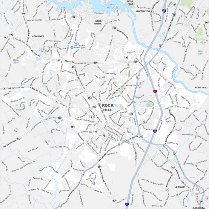
Our map of Rock Hill shows the downtown blocks and the routes running north toward Charlotte. Lake Wylie sits in the north of the city.
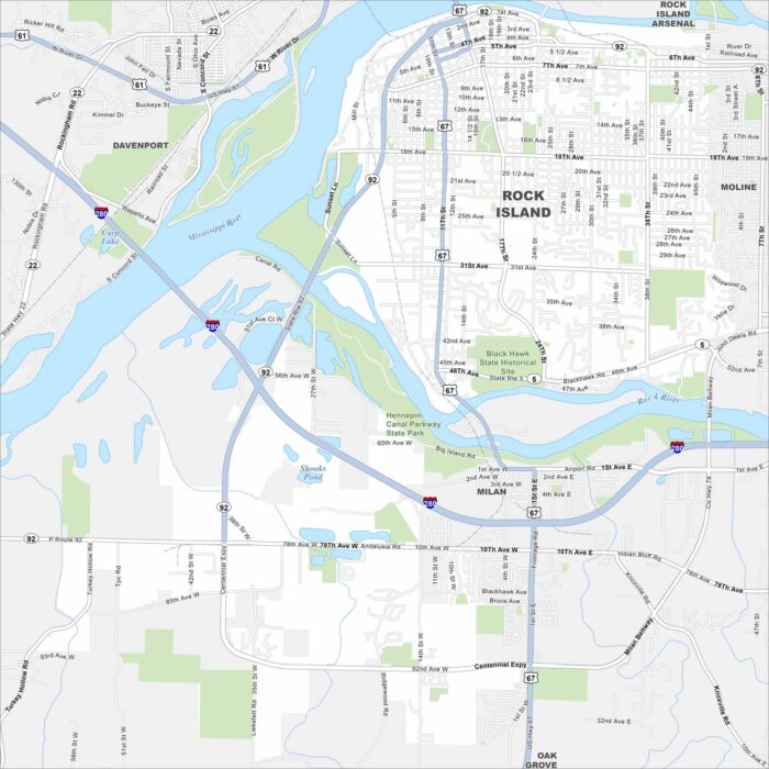
Our map of Rock Island displays the bridges, the riverfront, and the grid of city streets. You’ll know how it links across the Mississippi.
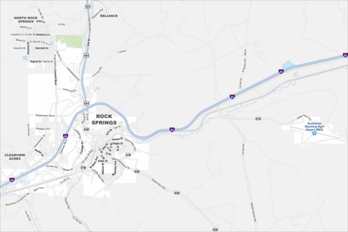
Our Rock Springs map shows the main roads and the open landscape around them. It’s a clear look at how the city spreads through wide country.
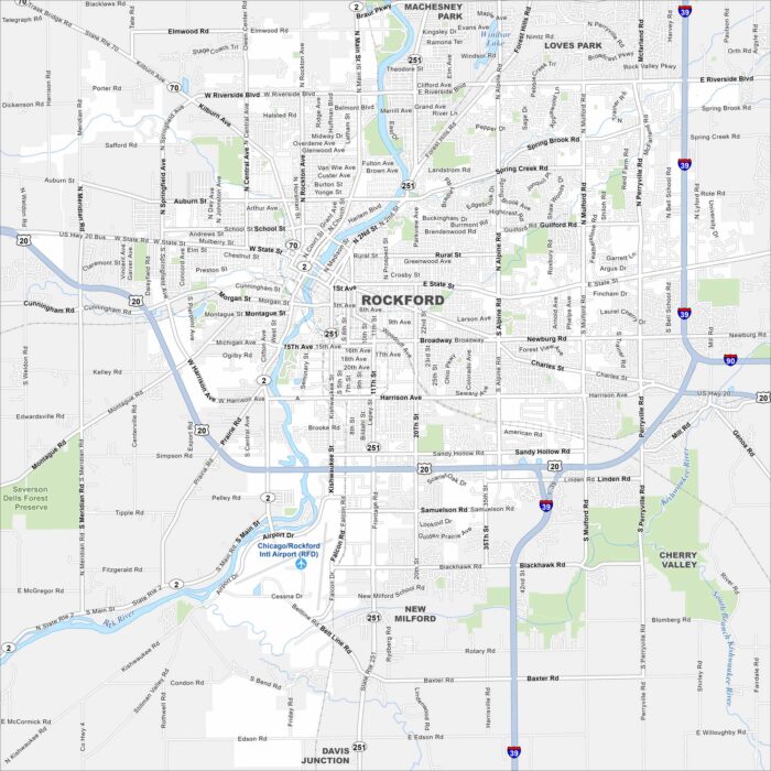
Get oriented with our Rockford, Illinois map. The streets and parks stand out. You’ll also notice the Rock River that cuts through the city.
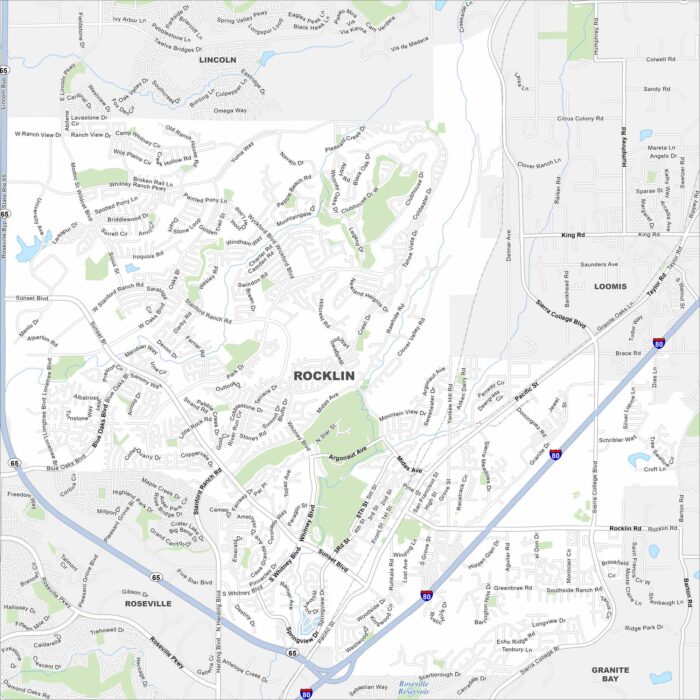
Our map of Rocklin highlights neighborhoods, schools, and parks. You’ll see how the city is connected and all the routes into Sacramento.
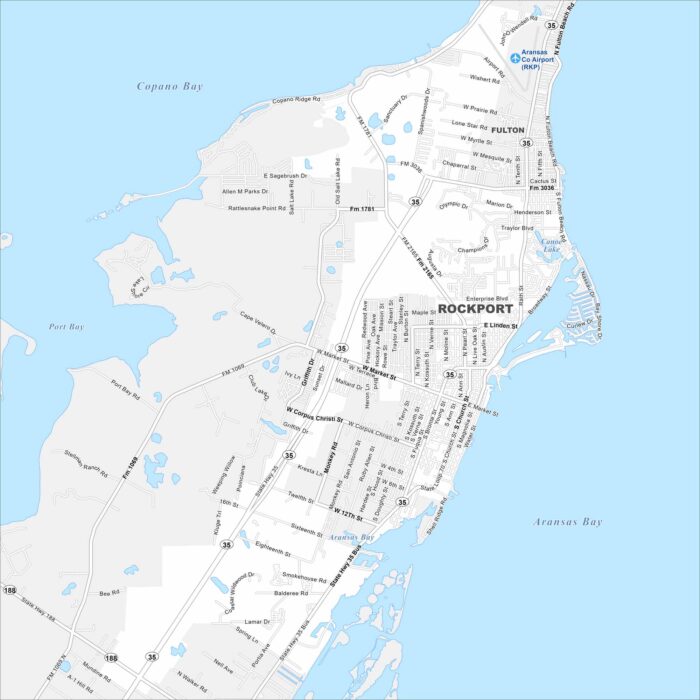
Here’s our map of Rockport with its waterfront, harbors, and streets. You’ll notice how the town spreads along the Gulf coast.
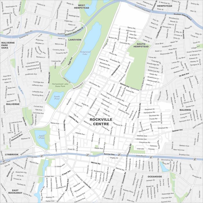
Get oriented with our Rockville Centre (RVC) map. Everything you need is clearly marked for this village on the South Shore of Long Island.
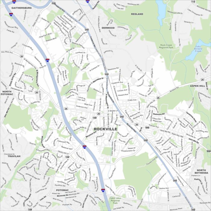
Our map of Rockville shows the downtown area, neighborhoods, and major roads. It also reveals how the city ties into the D.C. metro area.