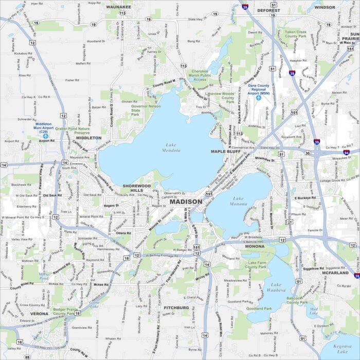
Map of Madison, Wisconsin
Our map of Madison highlights its setting between Lake Mendota and Lake Monona. Highways wrap around the isthmus.
Our map of Madison highlights its setting between Lake Mendota and Lake Monona. Highways wrap around the isthmus.
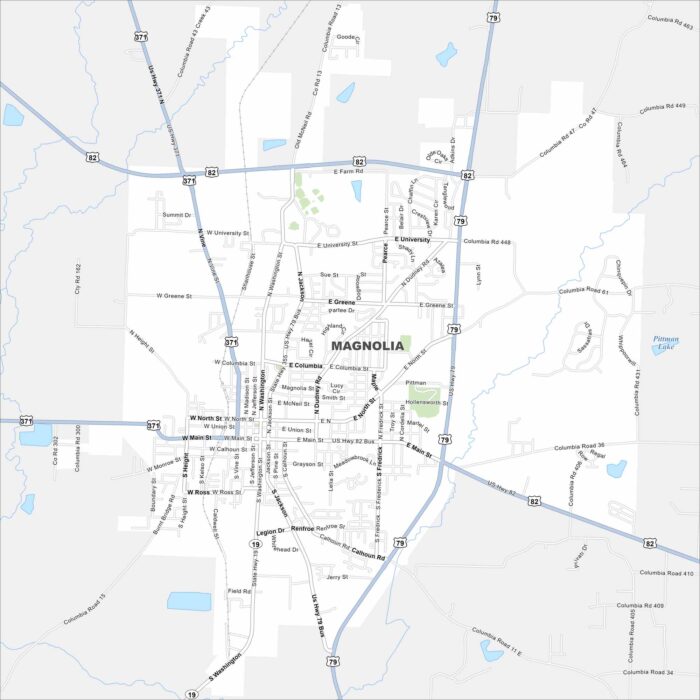
Explore Magnolia, located in southern Arkansas. Our map shows its highways that connect the town to forests and farmland.
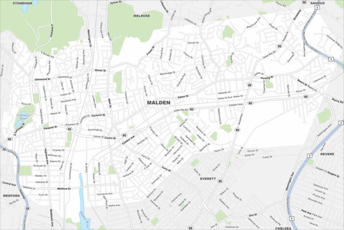
Malden lies just north of Boston. Our map shows its dense neighborhoods and rail connections. Highways link it quickly into the metro area.
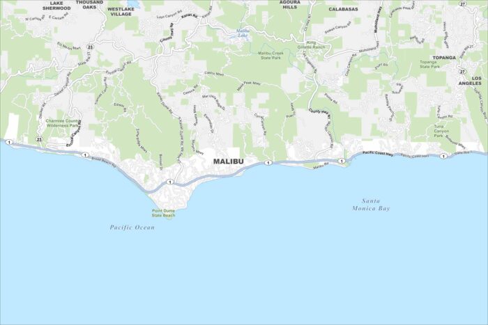
Check out Malibu stretched along the Pacific Coast Highway. Our map shows beaches lining the ocean side and mountains rising inland.
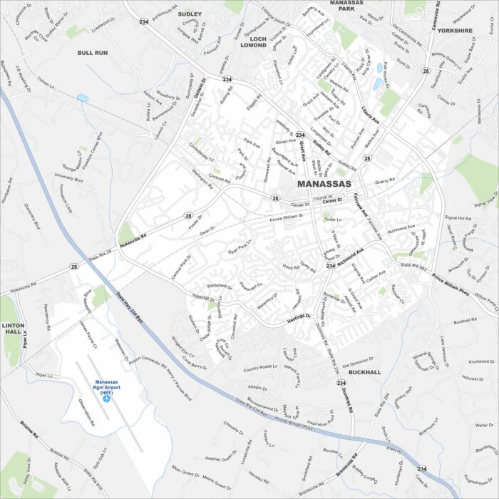
Our map of Manassas sits west of Washington, D.C. Highways and rail lines cross through its historic core.
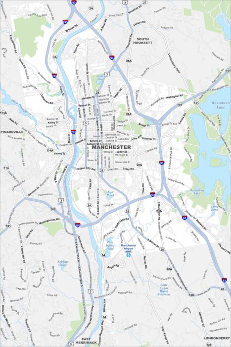
Manchester anchors southern New Hampshire. Our map displays the Merrimack River, which runs through its center.
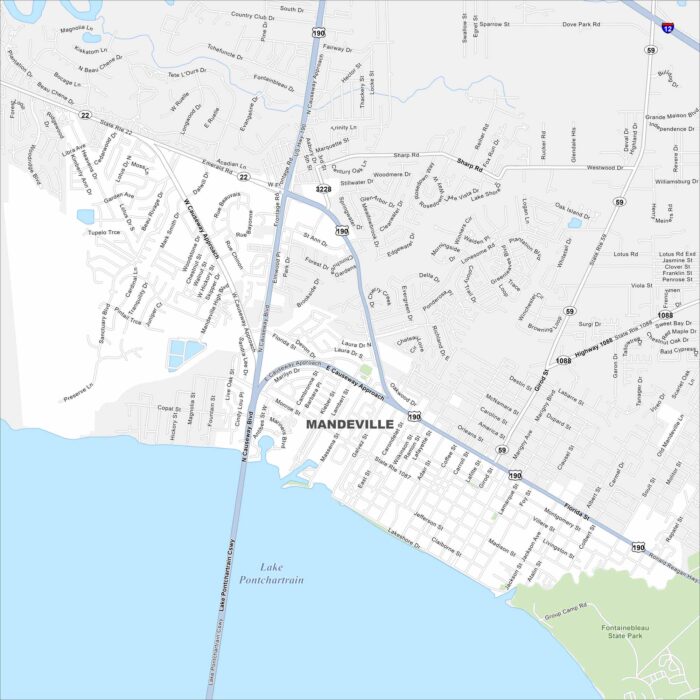
Take a look at Mandeville on the north shore of Lake Pontchartrain. Our map shows its highways curving toward New Orleans.
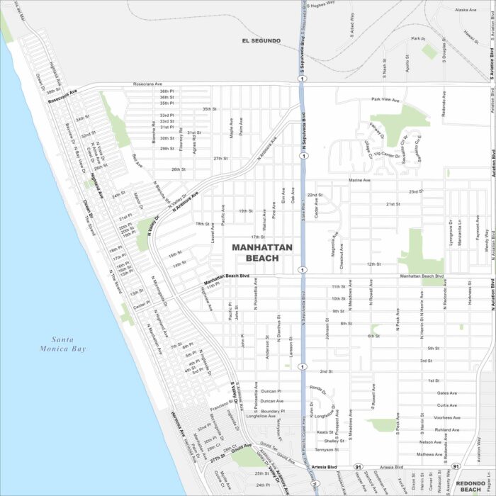
Our map of Manhattan Beach follows the shoreline south of Los Angeles. A grid of neighborhoods leads straight to the sand.
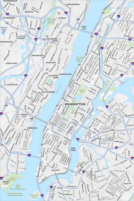
Manhattan rises between the Hudson and East Rivers. Our map shows Central Park, bridges, dense streets and skyscrapers all around.
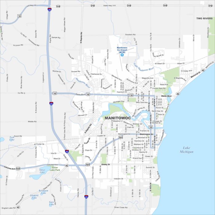
See Manitowoc, Wisconsin on our map along Lake Michigan. Highways connect the city to Green Bay and Milwaukee.
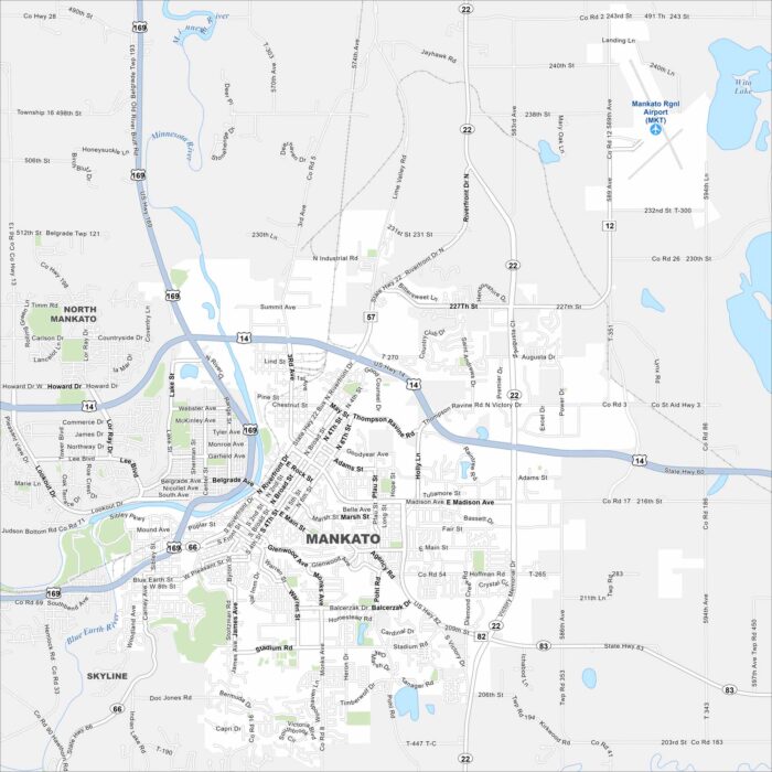
Our map of Mankato shows the Minnesota and Blue Earth Rivers meeting. Highways cross through the downtown and connect to nearby towns.
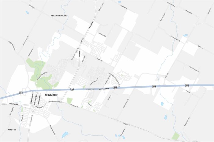
Explore Manor with our road map. Manor is just east of Austin, Texas. Highways link it directly into the metro area.
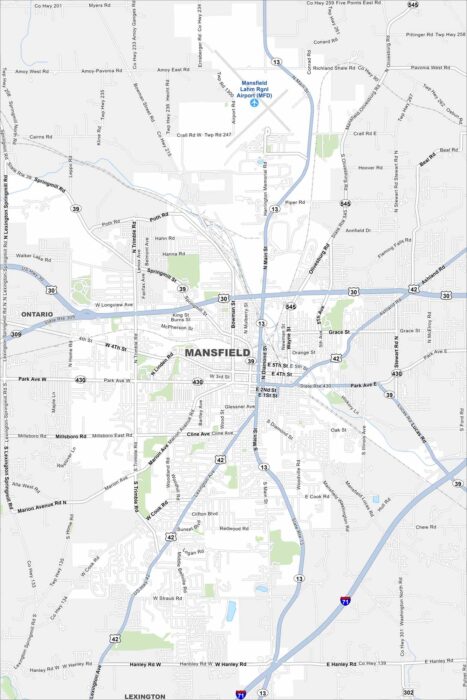
Mansfield sits between Cleveland and Columbus. Our map shows its highway network and the rail lines cutting through.
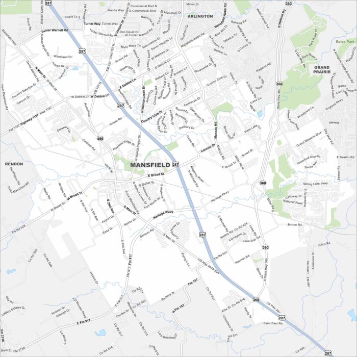
Check out Mansfield, Texas on our road map. Highways circle around the city, connecting residential areas and parks.
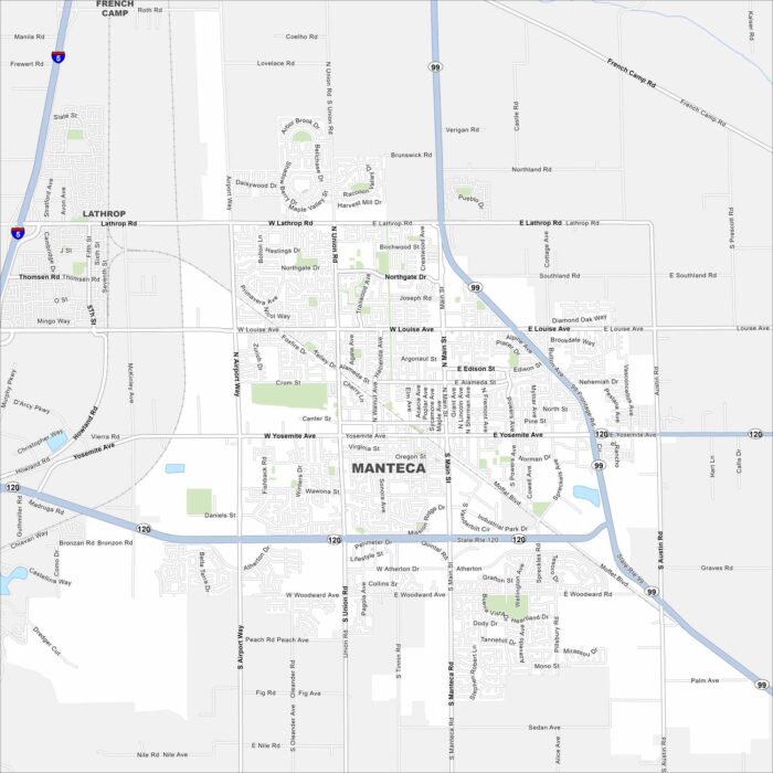
Our road map of Manteca highlights its crossroads of Highway 99 and 120. Rail lines run through its center.