Map of Los Banos, California
Los Banos sits in the San Joaquin Valley near wetlands and farmland. Our map shows Highway 33 cutting east-west through town.
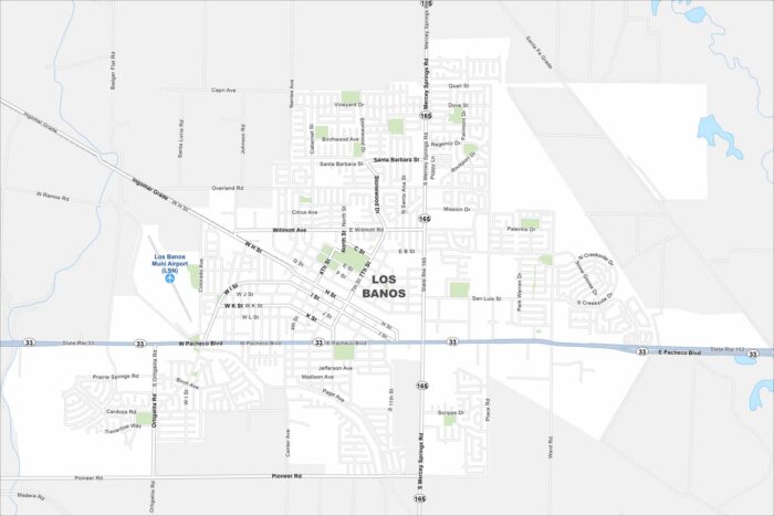
Los Banos sits in the San Joaquin Valley near wetlands and farmland. Our map shows Highway 33 cutting east-west through town.
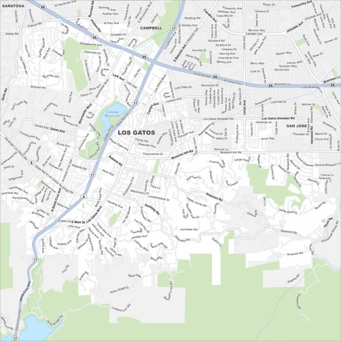
Explore Los Gatos at the foothills of the Santa Cruz Mountains. Our map shows winding streets heading into the hills.
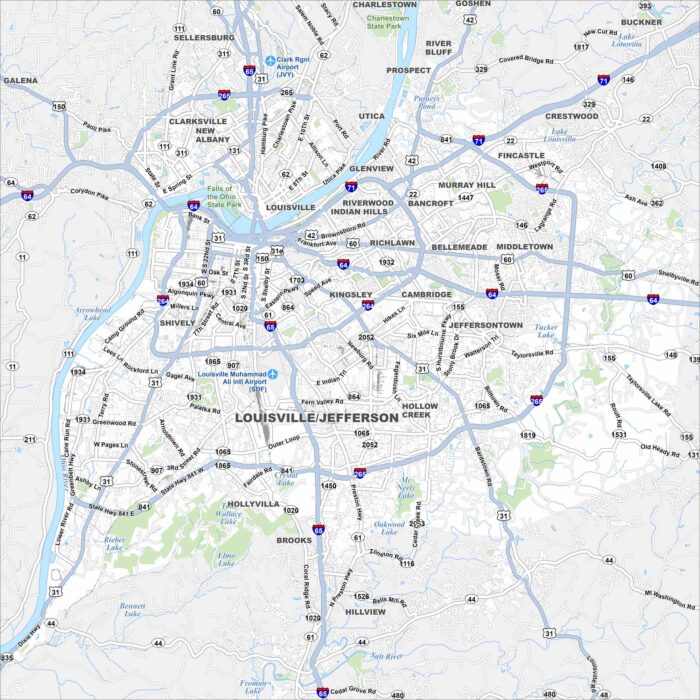
Our map of Louisville shows the Ohio River curving along its northern border. Bridges tie the city to Indiana and beyond.
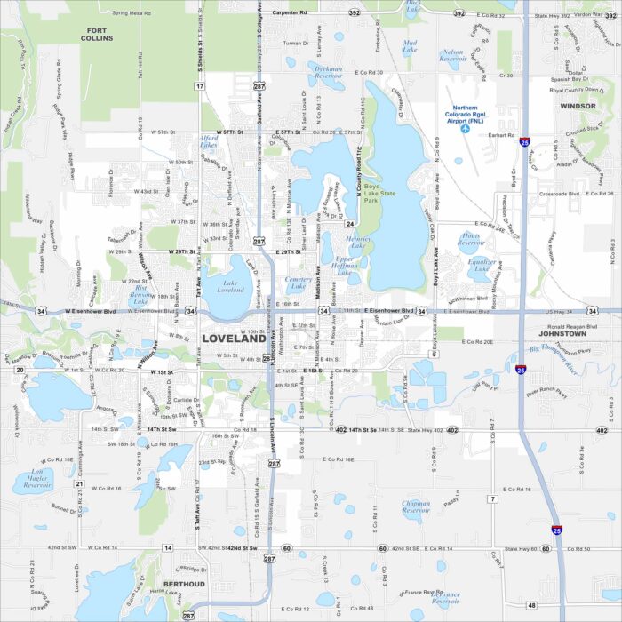
Loveland lies along the Front Range of the Rockies. Our map shows its lakes and access to Rocky Mountain canyons.
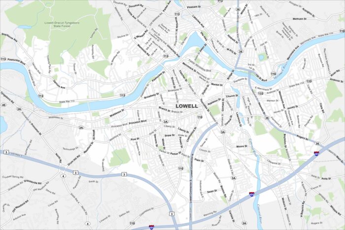
See Lowell on our map with the Merrimack River running trough. The city’s canals still mark its industrial past.
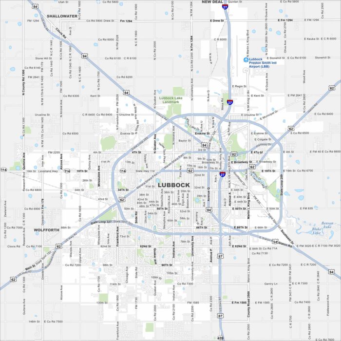
Our map of Lubbock shows highways fanning out across the South Plains. The city sits in northwest Texas cotton country.
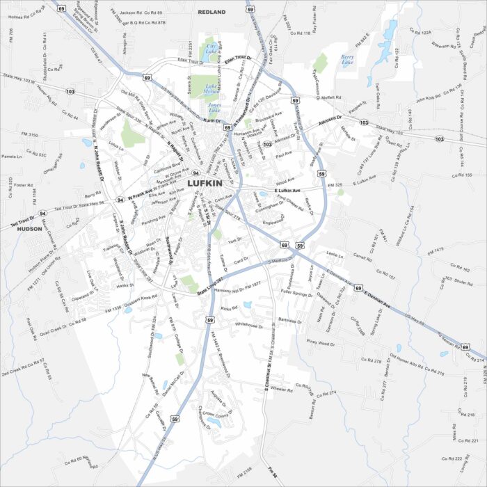
Explore Lufkin in deep East Texas. Forests surround the city, with highways cutting through toward Houston and Dallas.
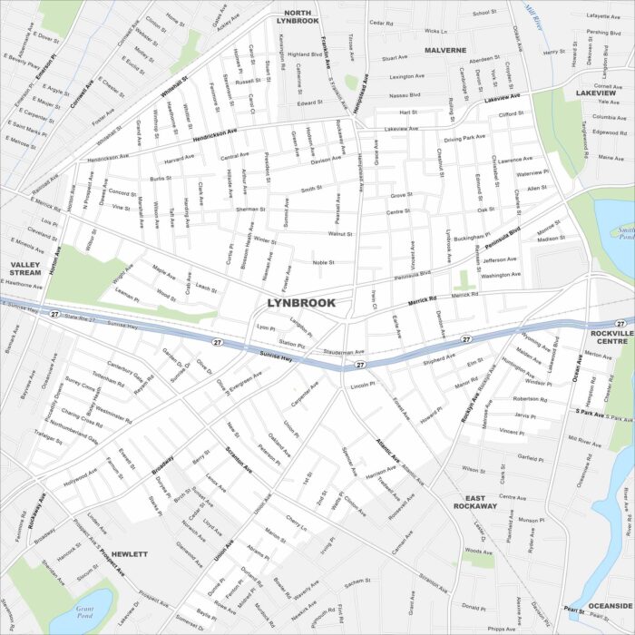
Lynbrook lies on Long Island just east of Queens. Our map shows the commuter roads, waterways, parks and rail lines.
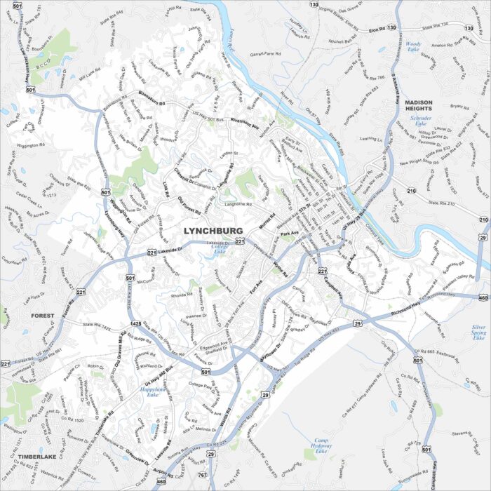
Our map of Lynchburg follows the James River at the city’s edge. Hills rise above the water, shaping the streets.
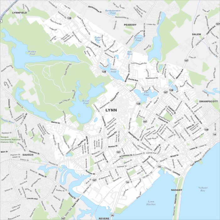
Check out Lynn, situated on the Massachusetts coast north of Boston. Our map shows its shoreline and dense city blocks.
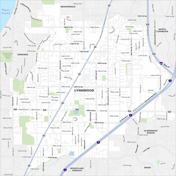
Our map of Lynnwood, Washington highlights its spot north of Seattle. Interstates and highways converge here.
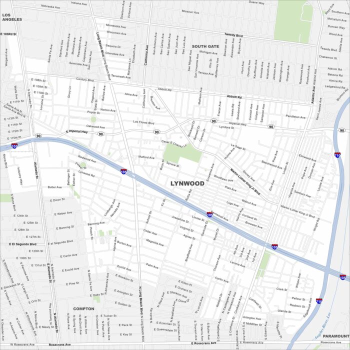
Lynwood sits in Los Angeles County near the 105 and 710 freeways. Our map shows a compact grid of streets.
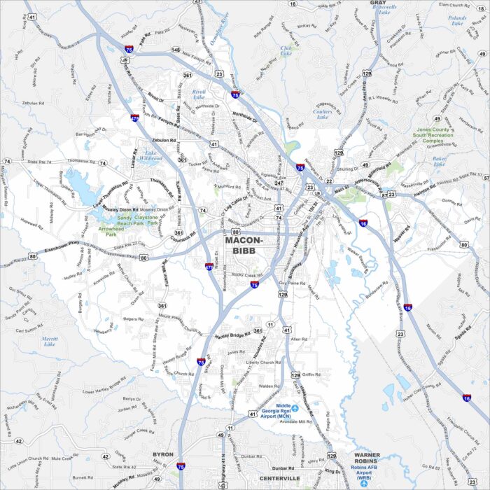
See Macon in central Georgia on our map. A key feature is the Ocmulgee River, which runs past downtown. I-16 and I-75 cross through the city.
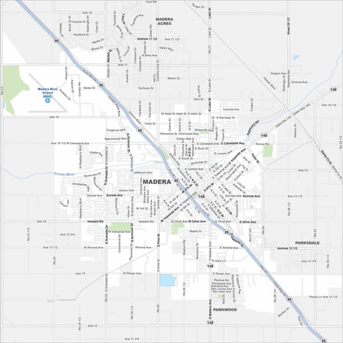
Our map of Madera shows its location in the San Joaquin Valley. Highways link it north to Merced and south to Fresno.
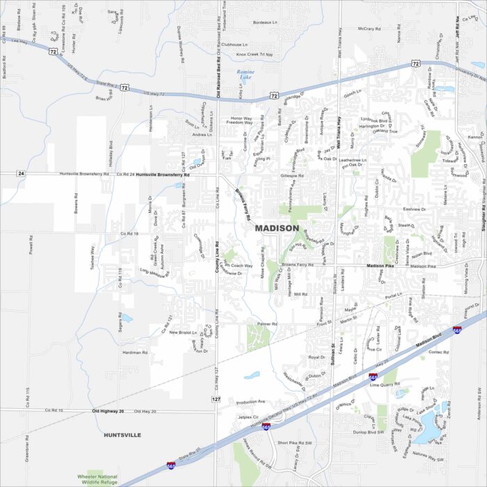
Madison lies west of Huntsville along I-565. Our map shows neighborhoods spreading between highways and creeks.