Map of Atlantic Beach, Florida
See the streets, highways, and coastal edges on this map. Our map of Atlantic Beach follows its long roads along the oceanfront.
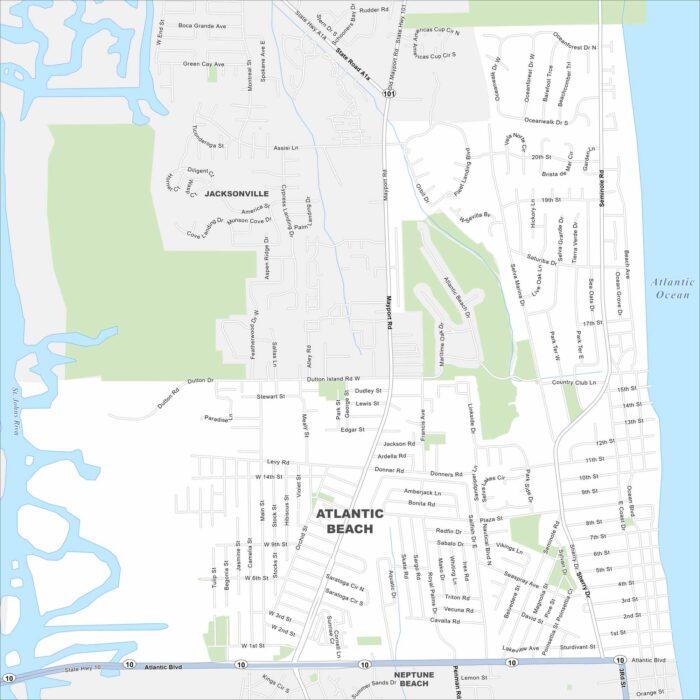
See the streets, highways, and coastal edges on this map. Our map of Atlantic Beach follows its long roads along the oceanfront.
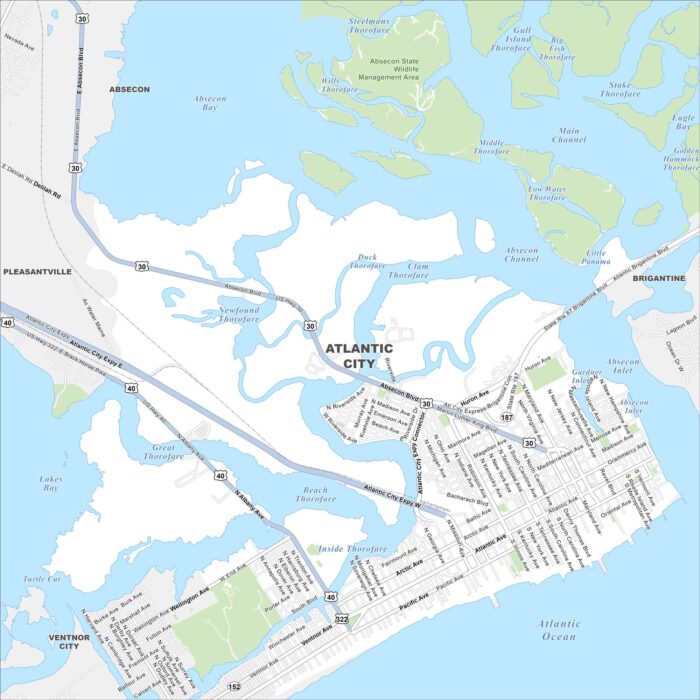
Our map of Atlantic City shows the highways, streets, and boardwalk routes. Roads cut toward the shore for seaside visitors.
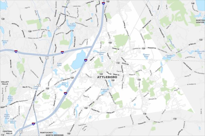
Here’s our map of Attleboro with its highways, streets, and park areas. Attleboro is known as the “Jewelry Capital of the World”.
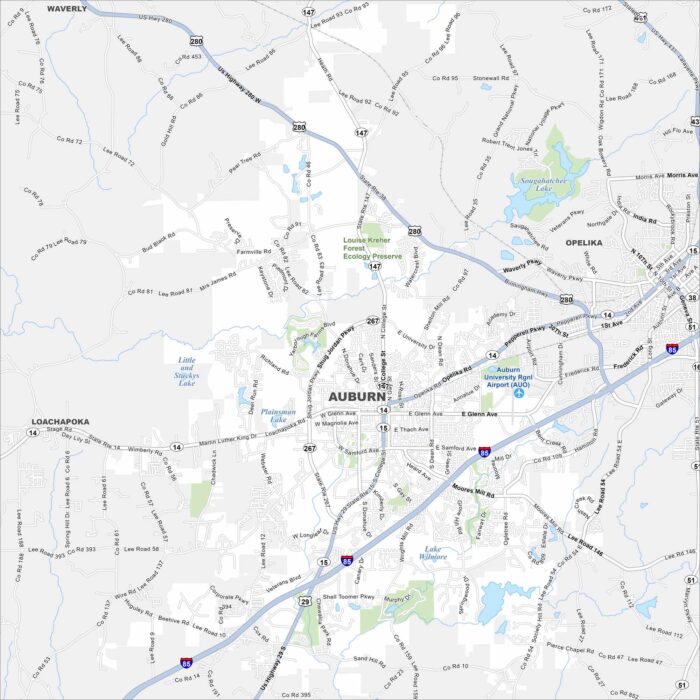
Our map of Auburn displays its highways, streets, and parks. The Auburn University campus is a key location within the city.
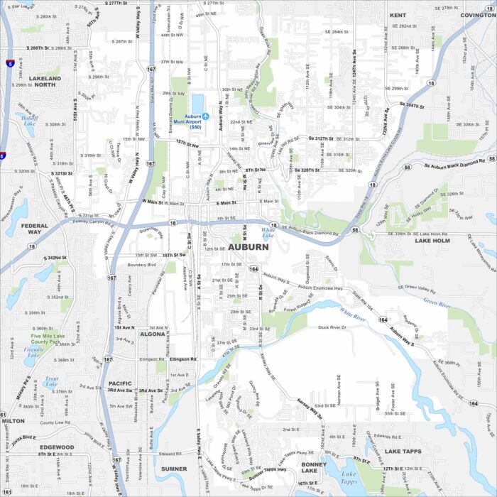
See the highways, streets, and river paths marked here. Our map of Auburn shows roads that run between Seattle and Tacoma.
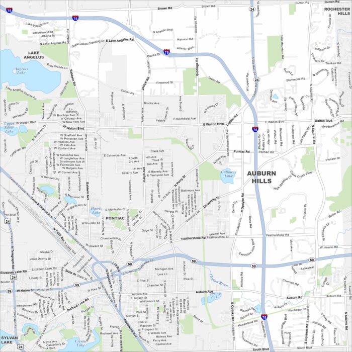
Our map of Auburn Hills shows the highways, streets, and open park spaces. Roads stretch toward the Detroit area.
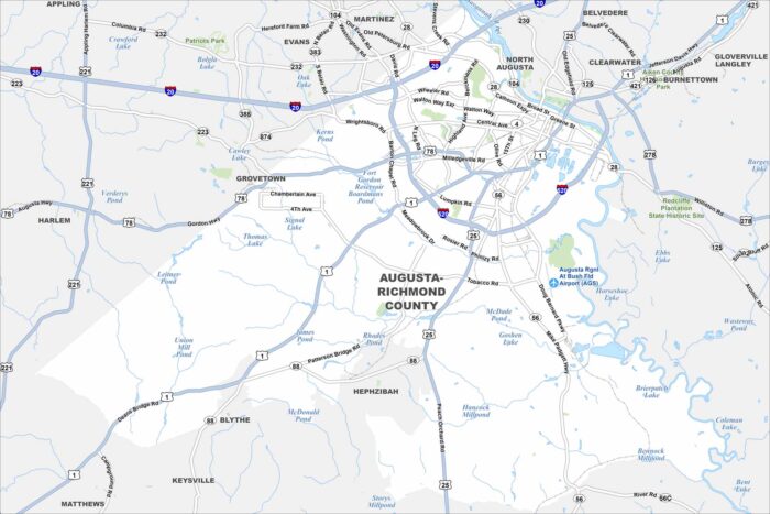
Augusta is mapped with its highways, streets, and rivers. It’s world-famous for hosting the Masters golf tournament.
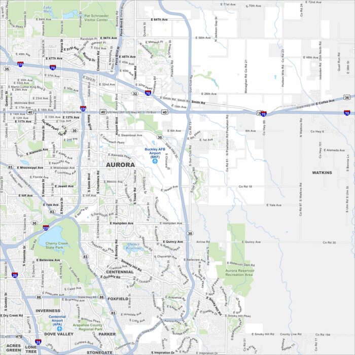
Our map of Aurora highlights the highways, streets, and parkland. It connects to Denver but still covers a wide area.
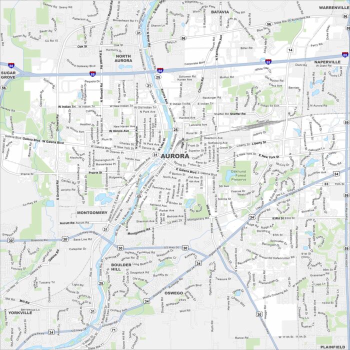
Our map of Aurora shows the highways, streets, and river crossings. Roads follow the Fox River because the city grew along its banks.
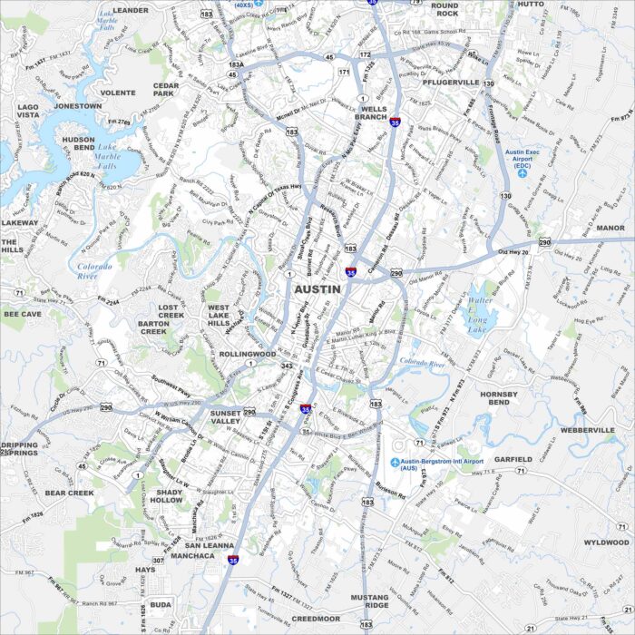
We’ve mapped out Austin with its highways, streets, and lakeside routes. The city is known as the “Live Music Capital of the World”.
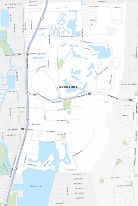
See the streets, highways, and waterways laid out here. Our map of Aventura highlights its coastal layout with canals.
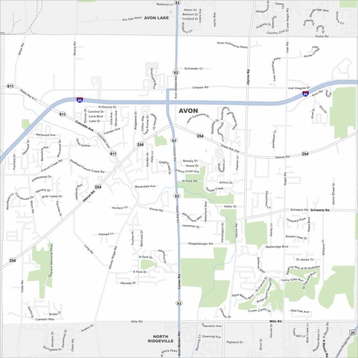
Our map of Avon shows the highways, streets, and green areas. Roads link toward Cleveland, specifically Interstate 90.
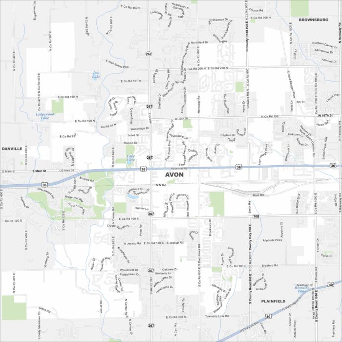
Avon is mapped with its streets, highways, and parkland. This town is known for its strong school system and family-friendly fun.
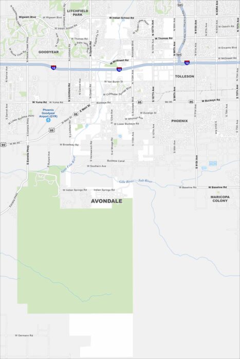
Our map of Avondale highlights the highways, streets, and desert surroundings. Roads stretch all the way to the Phoenix metro area.
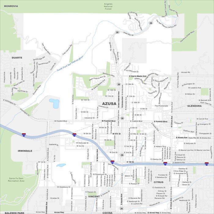
Azusa is mapped with its streets, highways, and mountain edges. The roads climb toward the San Gabriels but also run into the LA Basin.