Map of Irvine, California
Explore our map of Irvine, California to see its master-planned neighborhoods. Freeways frame the city on every side.
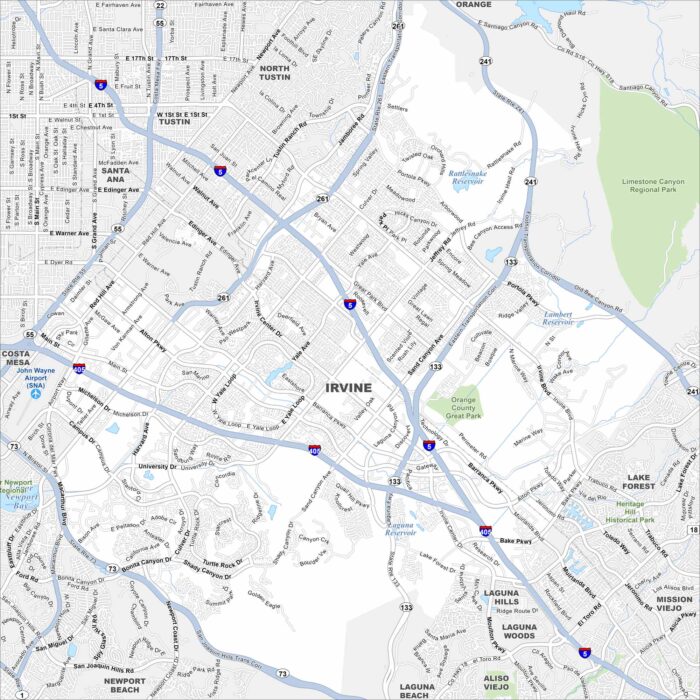
Explore our map of Irvine, California to see its master-planned neighborhoods. Freeways frame the city on every side.
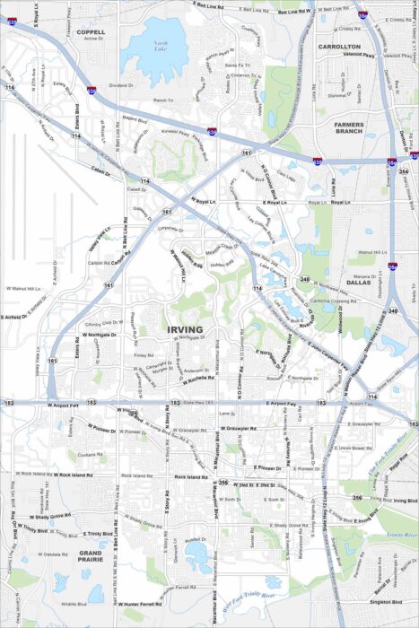
Our map of Irving shows its position between Dallas and Fort Worth. The Trinity River bends across the southern edge.
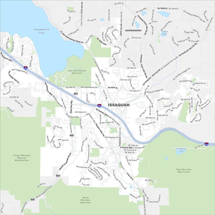
Issaquah sits at the base of the Cascade foothills with Lake Sammamish in the northwest. Our map shows I-90 cutting through the valley.
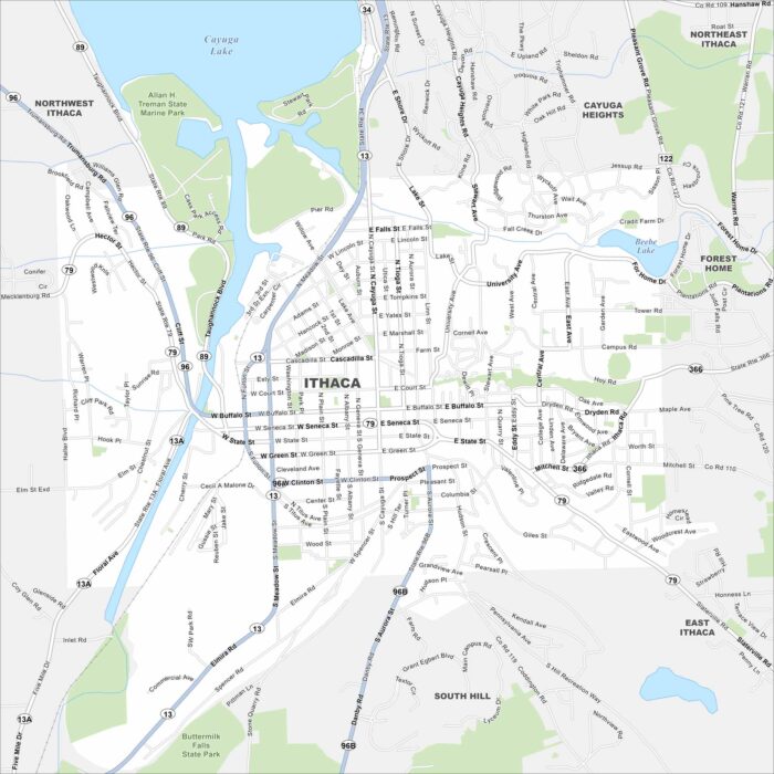
Check out our map of Ithaca, New York on the southern tip of Cayuga Lake. Gorges and waterfalls cut through the city.
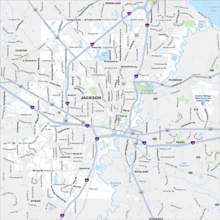
Jackson is centered on the Pearl River. Our map shows highways circling the city and roads. State government buildings stand near the river.
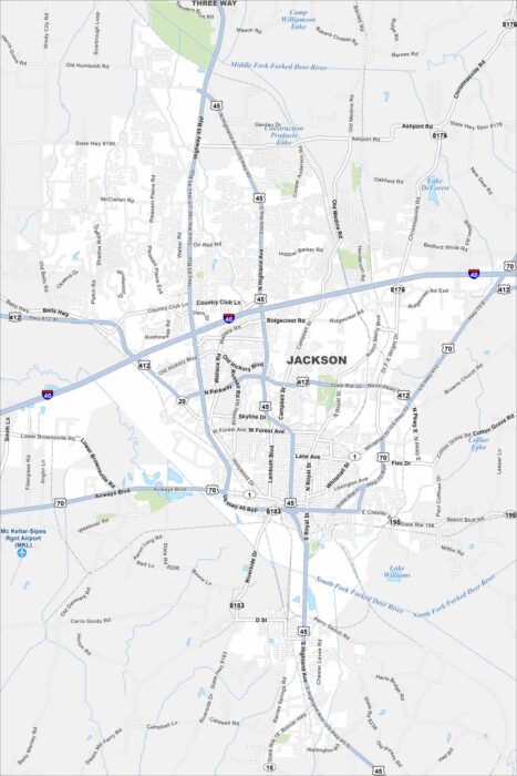
Get to know Jackson, which sits along I-40 in western Tennessee. This map shows rail lines and highways meeting in the city.
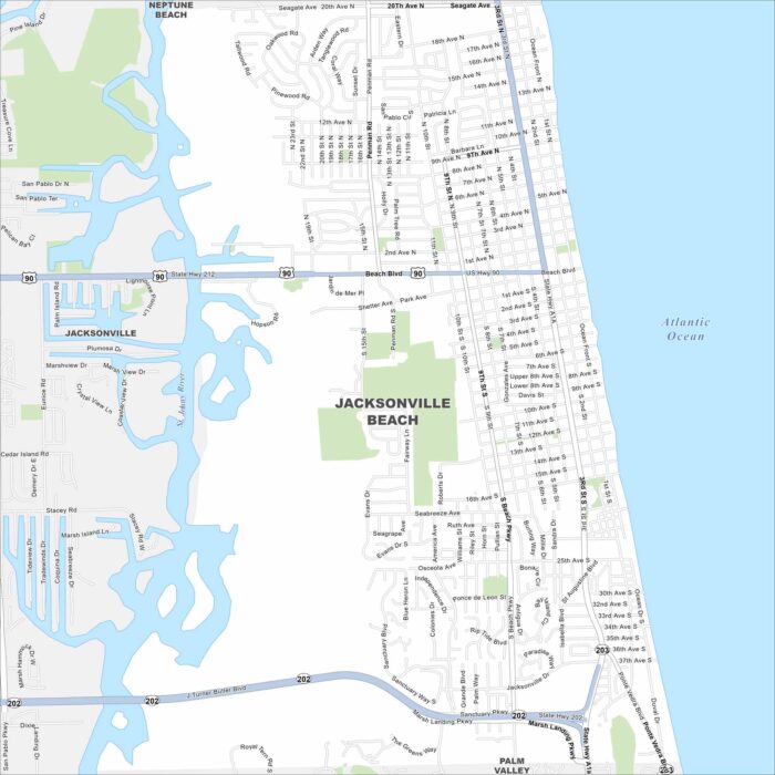
Our map of Jacksonville Beach highlights the Atlantic shoreline. A long stretch of beach runs the length of the city.
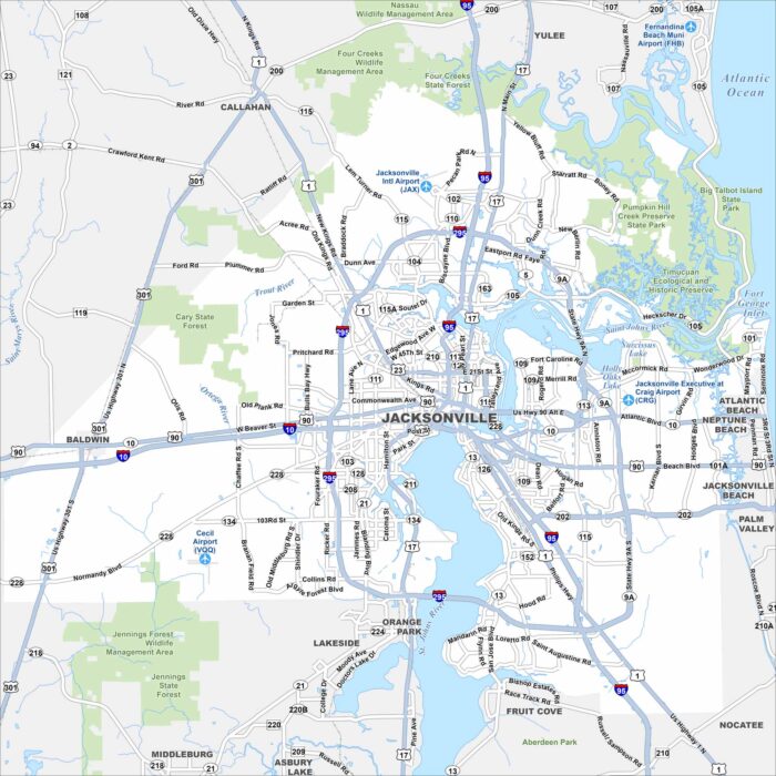
Jacksonville spreads along the St. Johns River. Find the state parks and highways looping the city. Beaches and suburbs extend to the east.
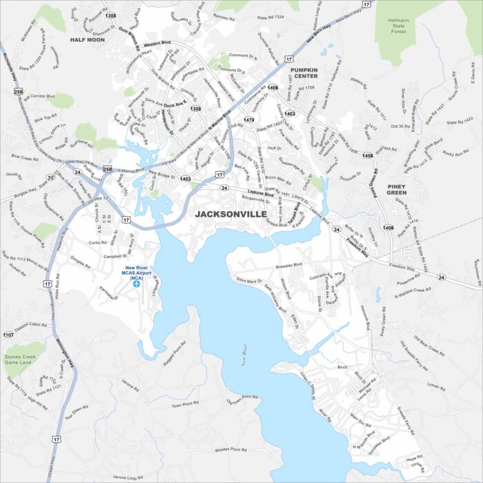
Our map shows Jacksonville with the New River cutting across. It’s close to Camp Lejeune. Otherwise, neighborhoods dominate the area.
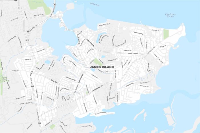
James Island sits between Charleston Harbor and Folly Beach. This map shows marshes and tidal creeks occupying across the island.
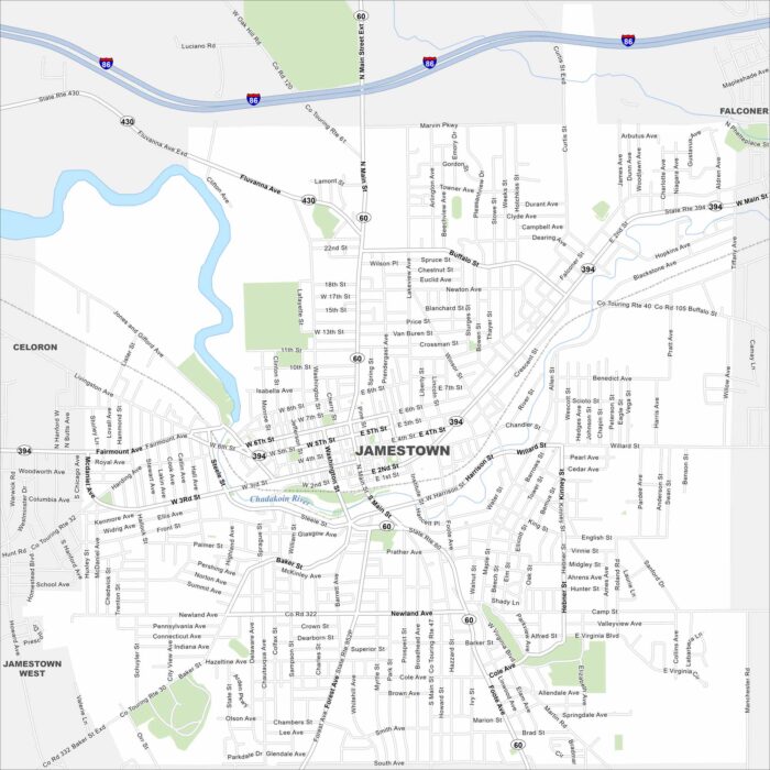
Jamestown sits at the south end of Chautauqua Lake. Our map shows a compact downtown near the Chadakoin River.
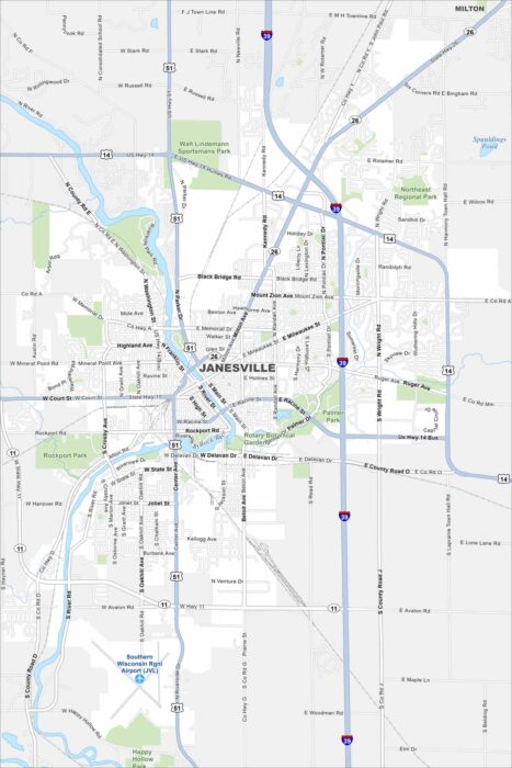
Janesville is built along the Rock River. The map shows parks and trails running beside the water. Highways connect it to Madison.
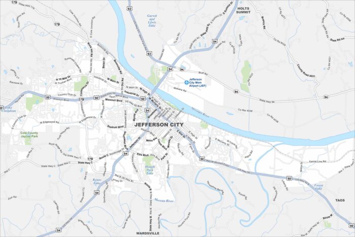
Our map of Jefferson City highlights its spot on the Missouri River. The state capitol stands out near the riverfront.
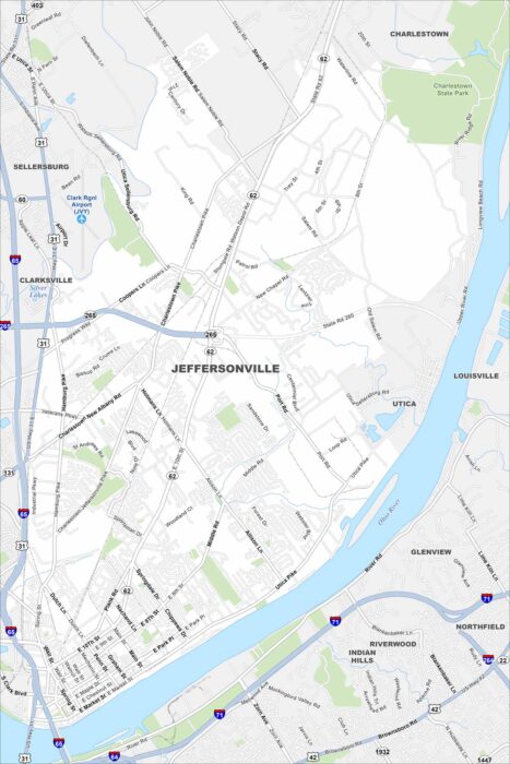
Jeffersonville sits right across the Ohio River from Louisville. Our map shows bridges linking the two cities.
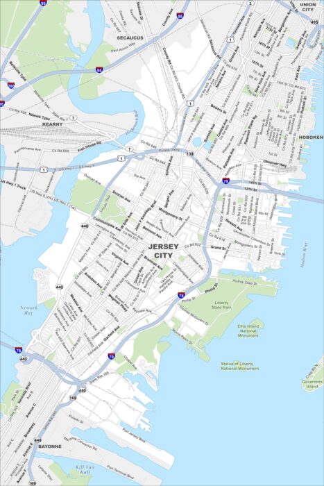
Jersey City stretches along the Hudson River across from Manhattan. Our map shows the dense waterfront skyline.