Map of Garden Grove, California
Garden Grove is in northern Orange County, just south of Anaheim. Our map shows dense neighborhoods mixed with major roads.
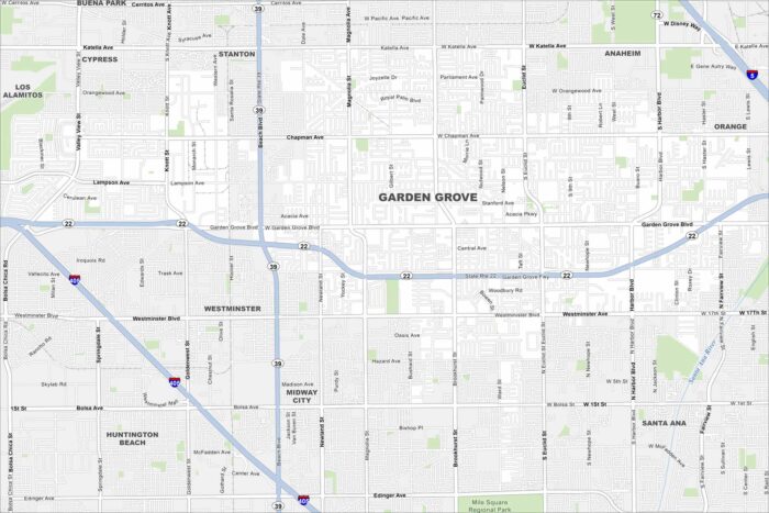
Garden Grove is in northern Orange County, just south of Anaheim. Our map shows dense neighborhoods mixed with major roads.
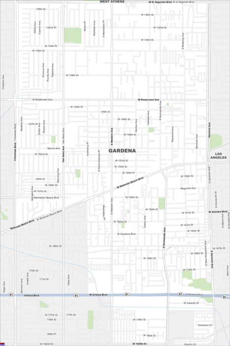
Follow the streets, highways, and streams with our map of Gardena. The city lies just south of downtown Los Angeles.
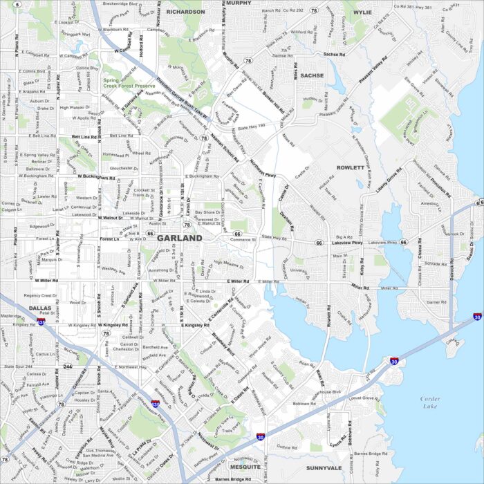
Our map of Garland shows its highways, streets, and open parks. Roads stretch wide here because it’s part of the Dallas-Fort Worth area.
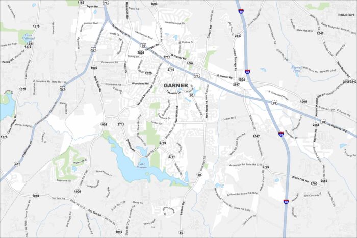
Garner is shown with its roadways, parks, and nearby waterways. You can see how the highways connect to Raleigh.
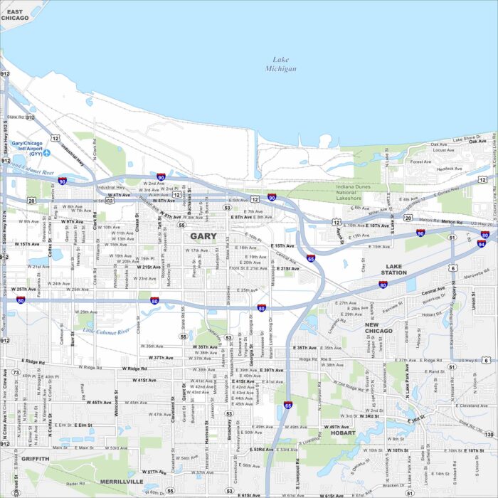
Get to know the major highways, city streets, and green areas. Our map of Gary shows its layout next to Lake Michigan.
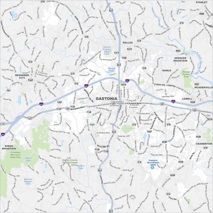
Our map of Gastonia lays out the city streets, highways, and local parks. The roads tie into the larger Charlotte area.
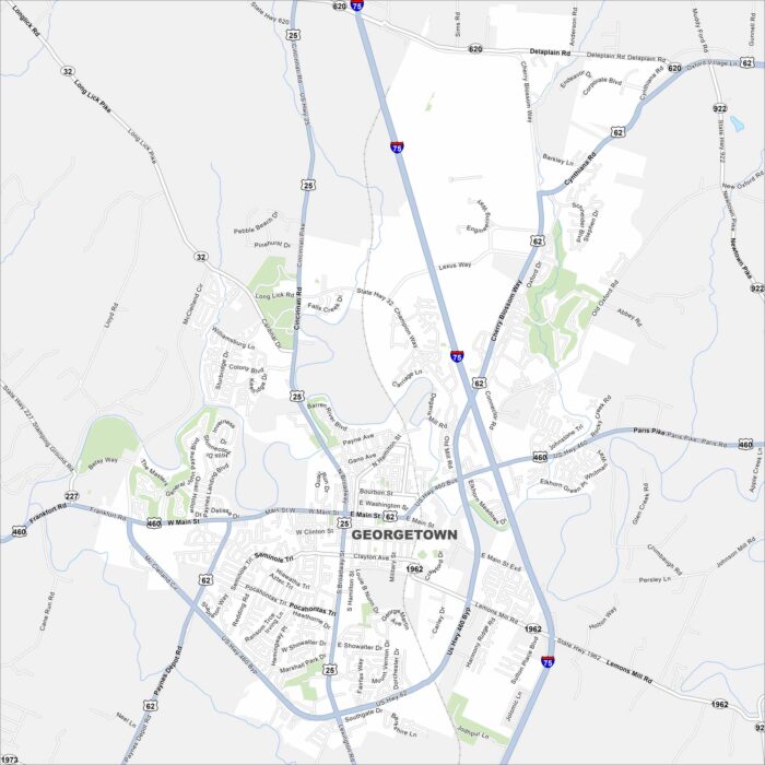
We’ve mapped out Georgetown with its main streets, highways, and nearby waterways. Our map shows how roads flow around parks and open land.
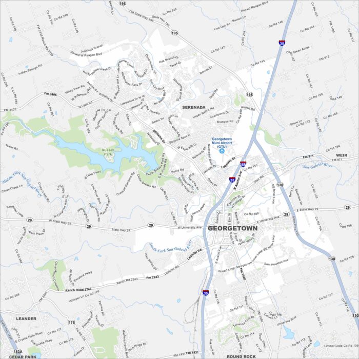
See the streets, highways, and rivers that cut through Georgetown, Texas. Our map displays its layout with plenty of green spaces.
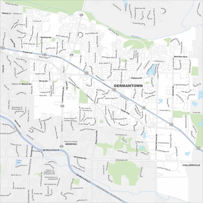
Our map of Germantown highlights the streets, parks, and highway routes. The city is part of Greater Memphis region.
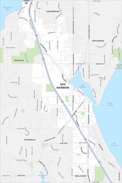
Gig Harbor is tucked on Puget Sound, with marinas and waterfronts. It’s nicknamed the “Maritime City” because of its boating history.
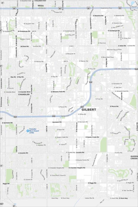
Our map of Gilbert, Arizona, shows a fast-growing suburb southeast of Phoenix. You’ll find highways, roads, parks and more.
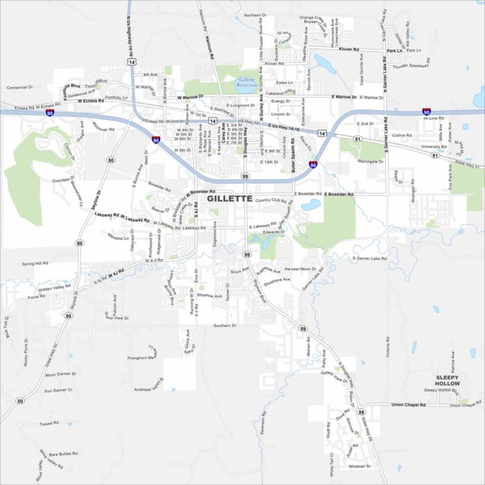
Gillette lies in northeast Wyoming surrounded by wide plains. It’s a hub for coal and energy because of nearby mining operations.
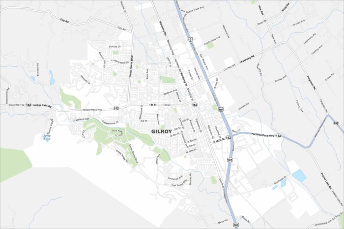
Explore our map of Gilroy, California. The city is called the “Garlic Capital of the World” because of its famous crop.
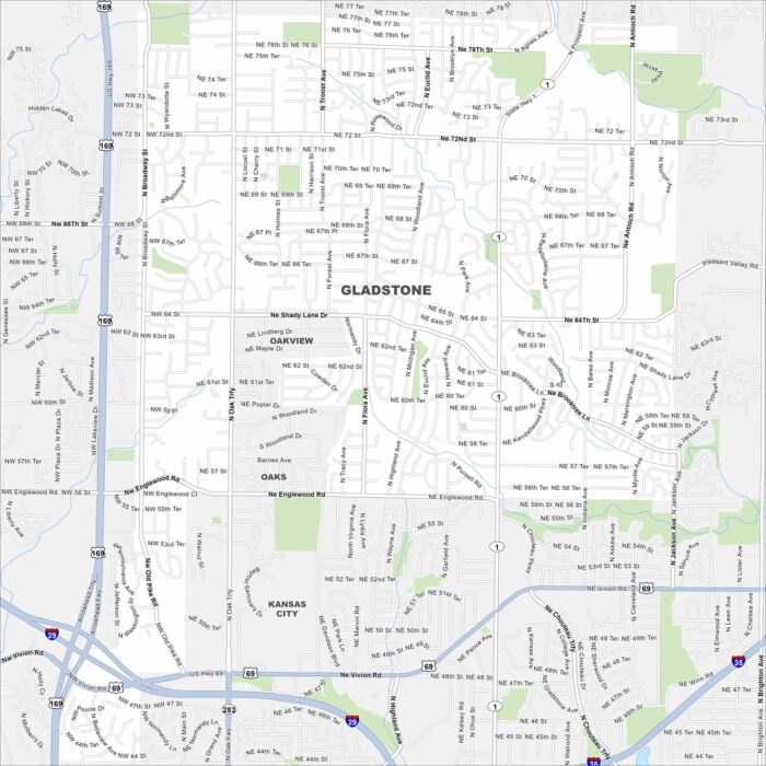
Gladstone, Missouri is a small city in the Kansas City metro. Our map shows its highways, roads, streams and local parks.
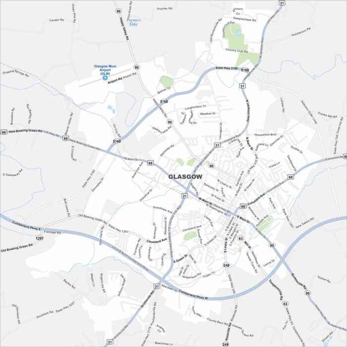
Glasgow, Kentucky, sits among hills and farmland. It’s located in the southern part of the state and is close to Mammoth Cave National Park.