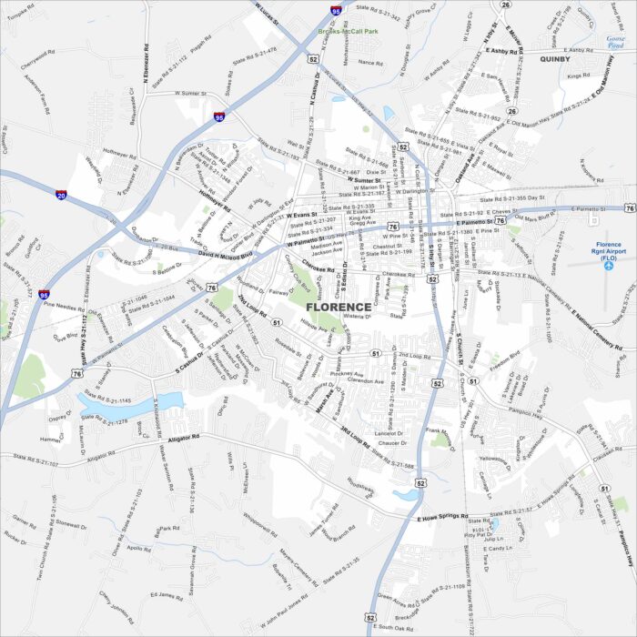
Map of Florence, South Carolina
Florence, South Carolina is in the Pee Dee region of the state. Rail lines and highways cross here, giving it a hub-like feel.
Florence, South Carolina is in the Pee Dee region of the state. Rail lines and highways cross here, giving it a hub-like feel.
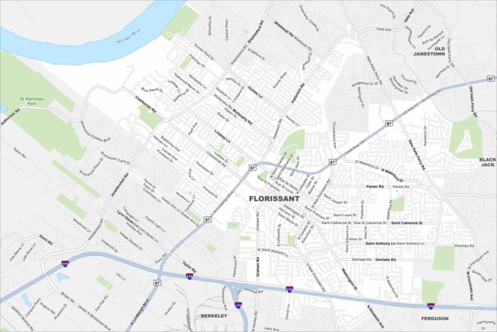
Florissant sits in north St. Louis County near the Missouri River. Residential neighborhoods spread widely across the map.
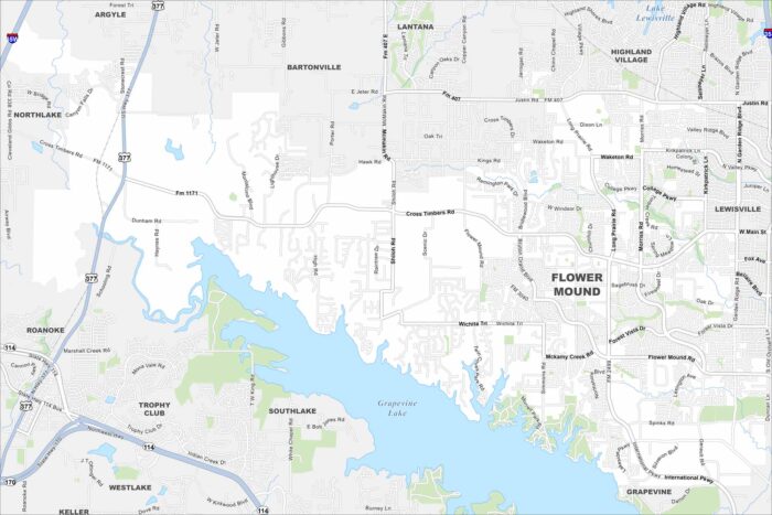
Check out our map of Flower Mound north of the Dallas–Fort Worth area. Grapevine Lake stretches along its eastern edge.
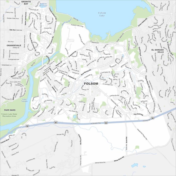
Folsom lies east of Sacramento along the American River. Folsom Lake and its dam dominate the northern edge.
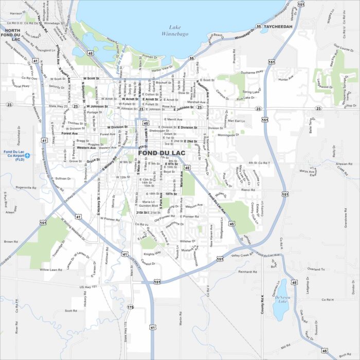
Fond du Lac is at the southern tip of Lake Winnebago. Streets spread out from the shoreline into farmland. The lakefront location is key.
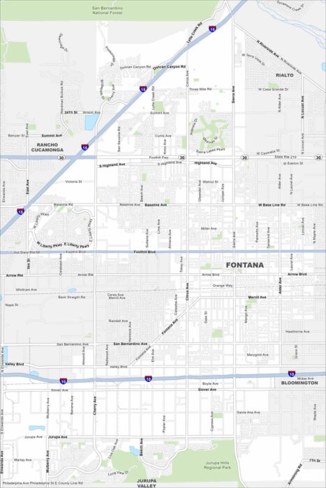
Our map of Fontana shows it in the Inland Empire at the foot of the San Bernardino Mountains. Wide neighborhoods stretch out.
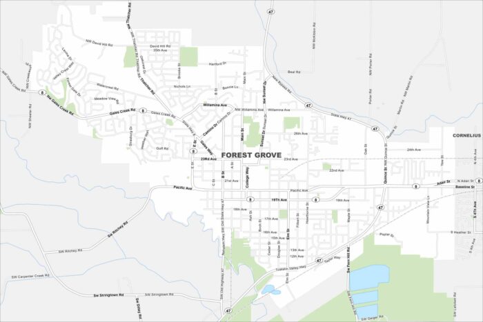
Explore our map of Forest Grove west of Portland. Vineyards and farmland surround the city on all sides. The backdrop is the Coast Range.
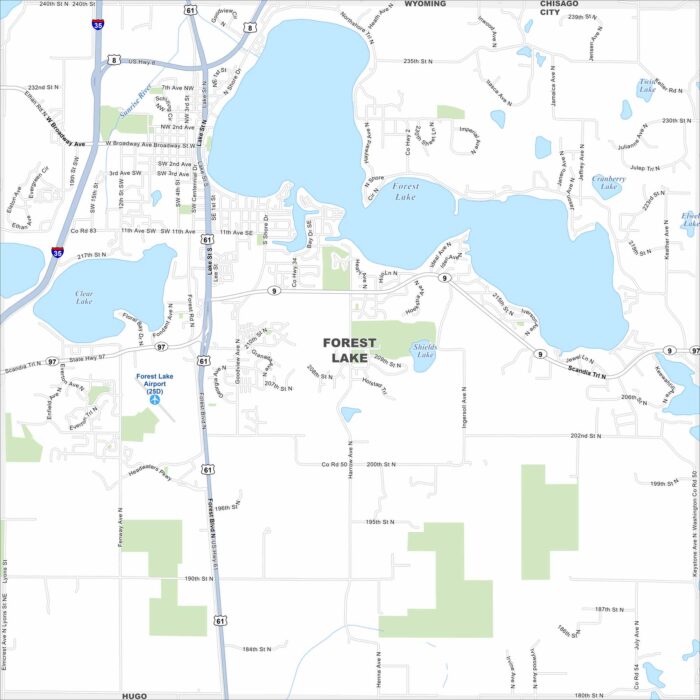
Forest Lake is shaped like a square and sits north of St. Paul. Its namesake lake is front and center but other smaller lakes are here too.
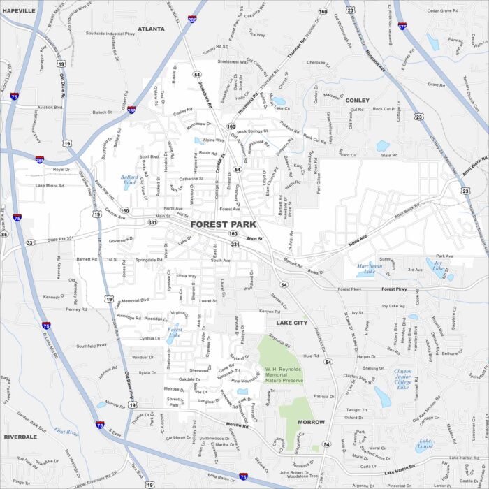
Our map of Forest Park shows it just south of Atlanta. Residential blocks mix with industrial space nearby.
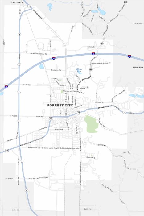
Check out our map of Forrest City in eastern Arkansas. The city lies along Crowley’s Ridge, which rises above the Delta flatlands.
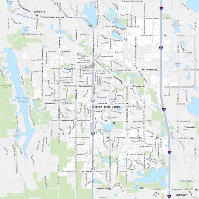
Fort Collins is at the base of the Rocky Mountain foothills. Our map shows green spaces, lakes, highways and rivers.
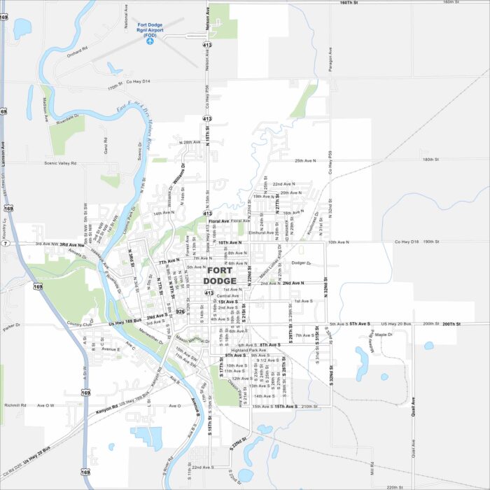
Our map of Fort Dodge highlights its spot along the Des Moines River. Our map includes rivers, lakes, highways and parks.
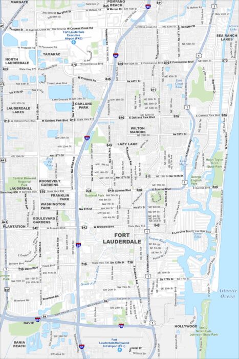
Fort Lauderdale sits on the Atlantic coast with lots of canals. Our map shows the New River and streets winding right through the city.
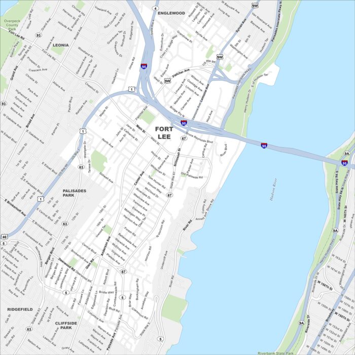
Fort Lee rises just across the Hudson River from Manhattan. The George Washington Bridge makes it a true landmark spot.
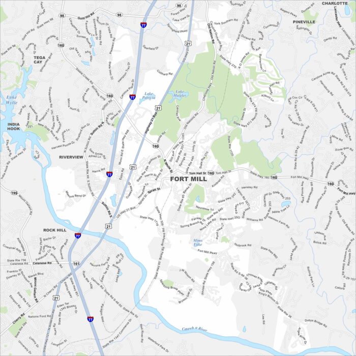
Explore our map of Fort Mill just south of Charlotte. The Catawba River flows nearby, giving the area a natural border.