Map of Farmington, New Mexico
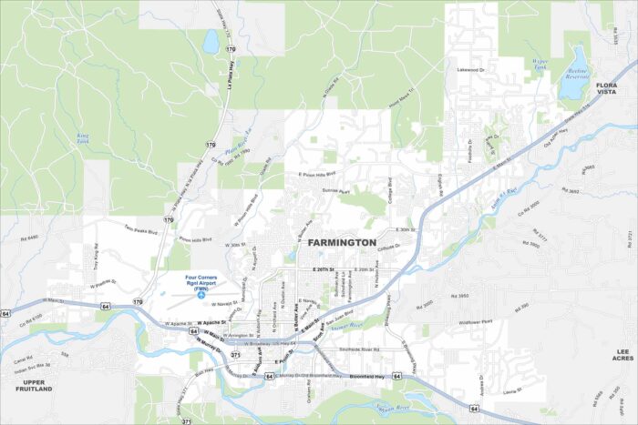
Farmington sits where the San Juan, Animas, and La Plata rivers meet. High desert terrain surrounds the city with mesas and open land.
Farmington sits where the San Juan, Animas, and La Plata rivers meet. High desert terrain surrounds the city with mesas and open land.
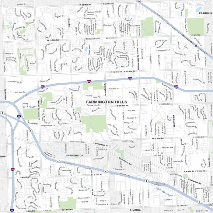
Our map of Farmington Hills shows it northwest of Detroit. Suburban neighborhoods fill in between I-696 and State Highway 5.
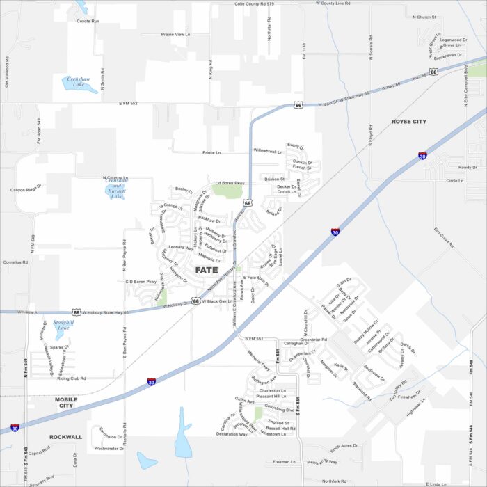
Explore our map of Fate just east of Rockwall. It’s located between I-30 and open stretches of farmland. It has a small-town feel.
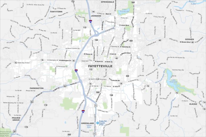
Fayetteville is in the Ozark Mountains of northwest Arkansas. Roads wind through hills and ridges across the city.
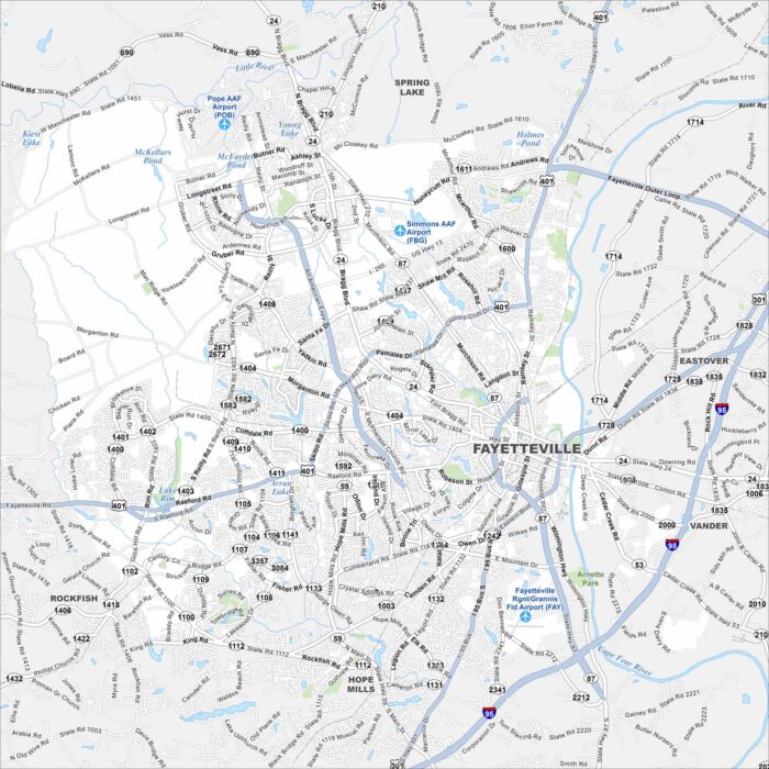
Our map of Fayetteville shows it along the Cape Fear River. Major highways like I-95 run just east of the city. It has a hub-like feel.
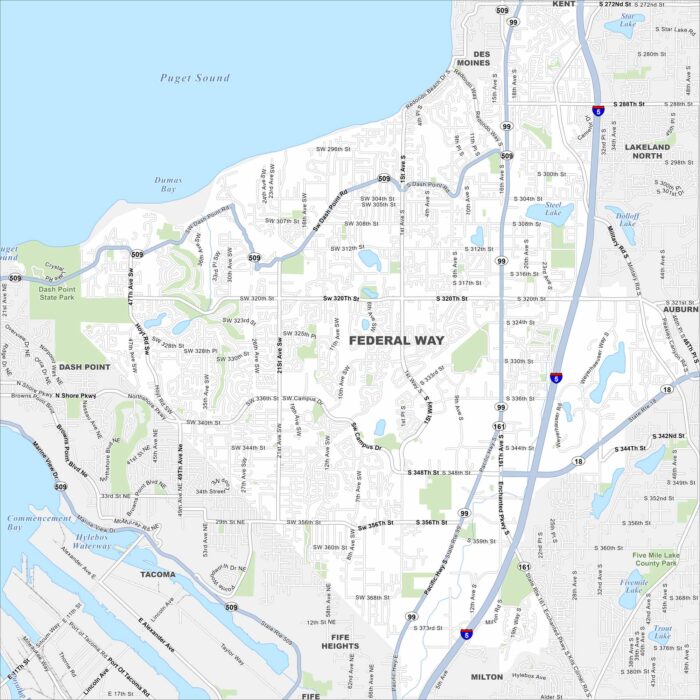
Federal Way lies between Seattle and Tacoma, with Puget Sound to the west. Evergreen forests surround much of the city.
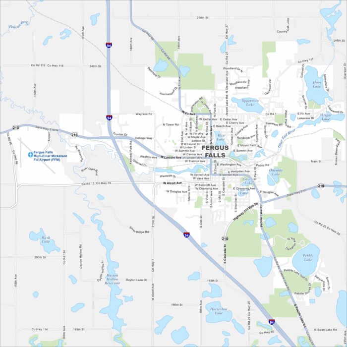
Fergus Falls sits in the heart of Minnesota lake country. The Otter Tail River cuts through town, connecting several small lakes.
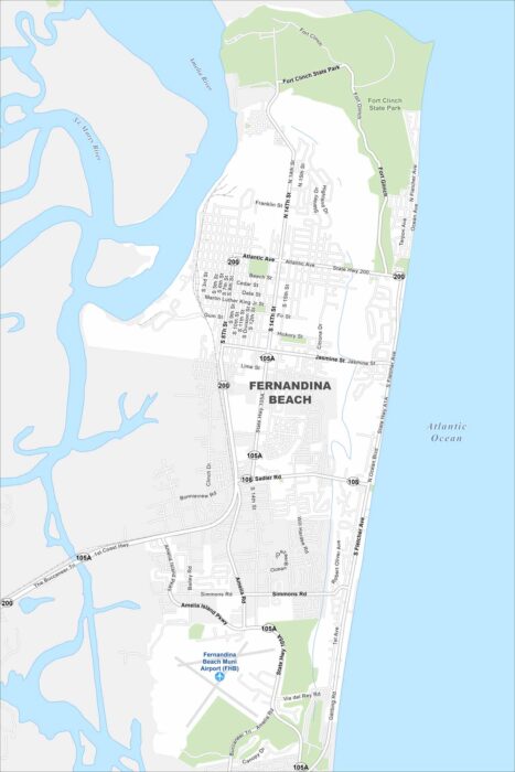
Check out our map of Fernandina Beach on Amelia Island. It hugs the Atlantic shoreline with wide beaches to the east.
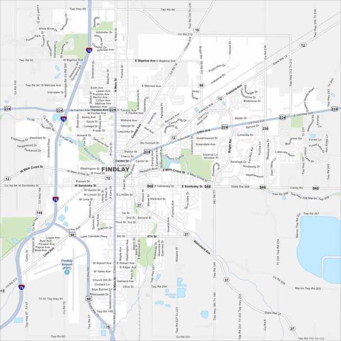
Findlay is on the banks of the Blanchard River in northwest Ohio. The river curves through the downtown area.
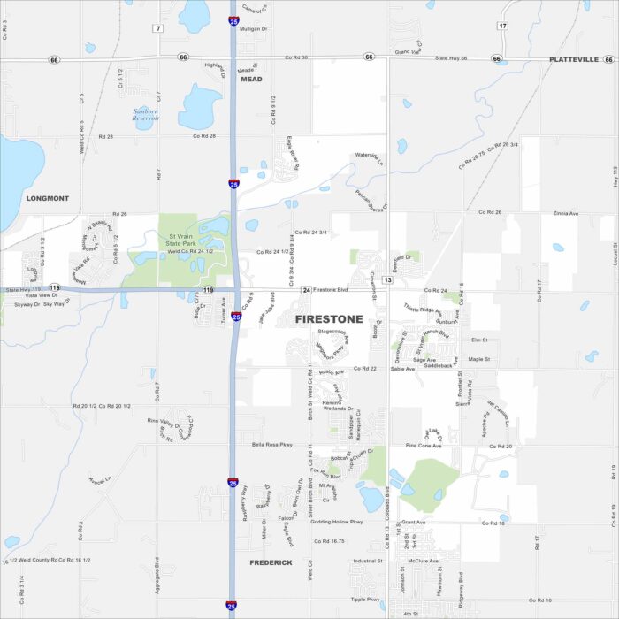
Our map of Firestone shows it north of Denver in the Front Range. Wide-open plains spread east, while the Rockies rise in the distance.
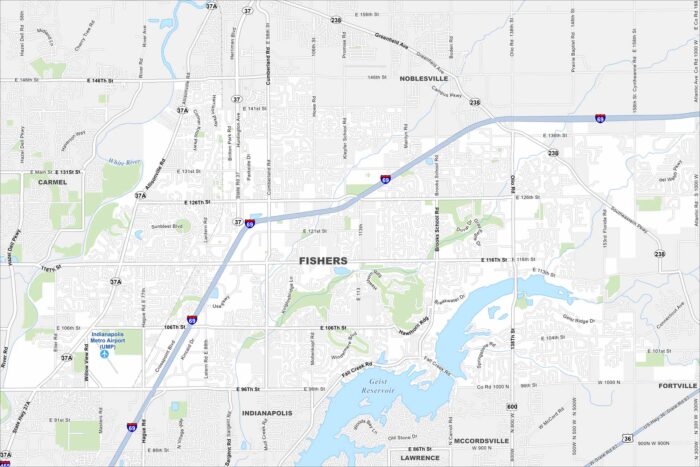
Our map of Fishers shows it northeast of Indianapolis. While the White River winds nearby, the Geist Reservoir stands out too.
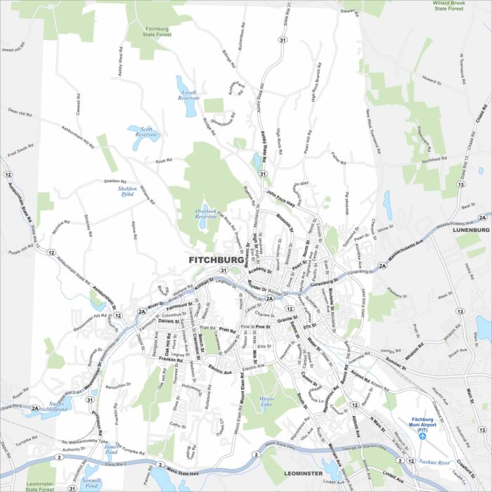
Fitchburg lies in north-central Massachusetts among rolling hills. The Nashua River runs right through the city.
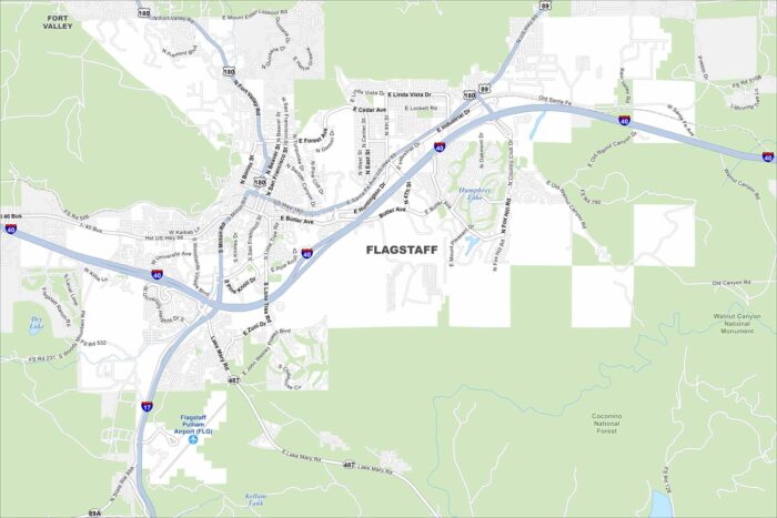
Explore our map of Flagstaff, Arizona high on the Colorado Plateau. Ponderosa pine forests surround the city in every direction.
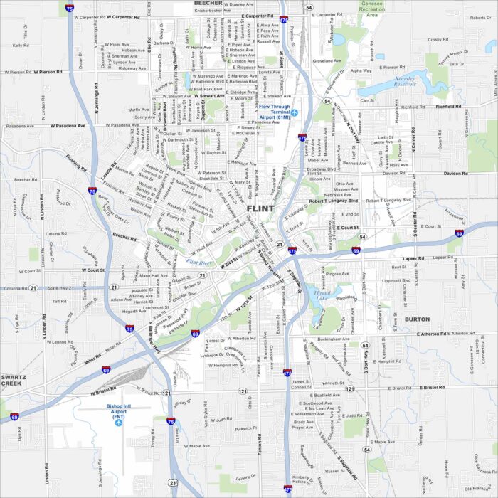
Flint sits along the Flint River in eastern Michigan. Its streets stretch out from the downtown core into wide neighborhoods.
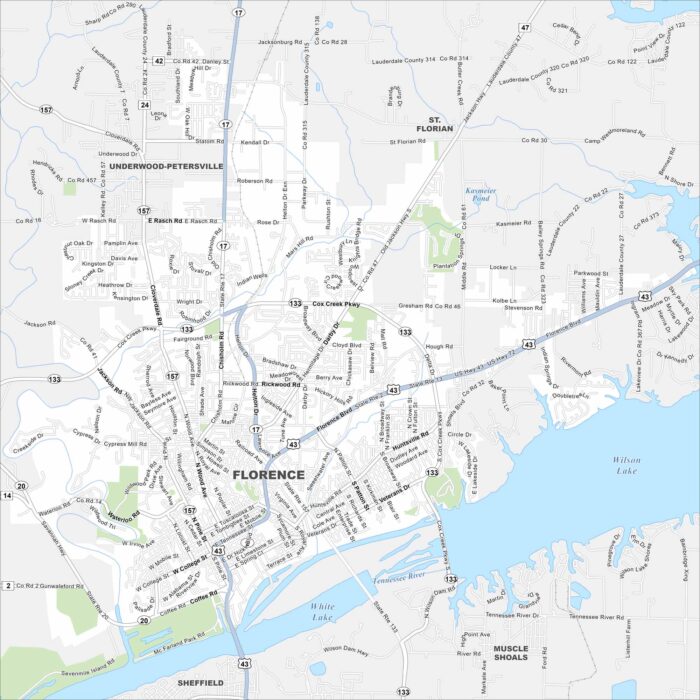
Our map of Florence shows it on the banks of the Tennessee River. Bridges connect the city across the wide waterway.