Map of Aberdeen, Washington
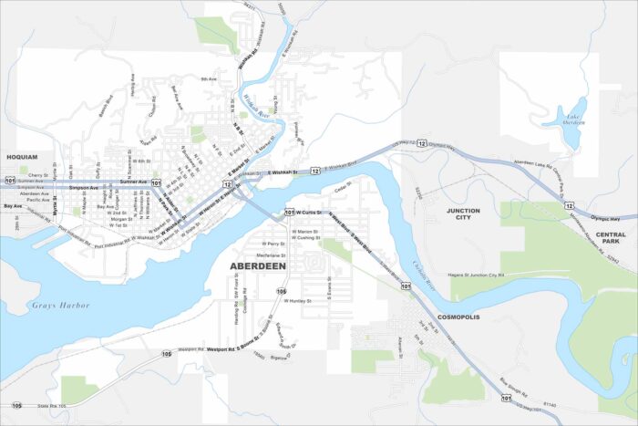
Our map of Aberdeen shows its waterfront location. It’s at the intersection of the Chehalis River and the Pacific Ocean.
Our map of Aberdeen shows its waterfront location. It’s at the intersection of the Chehalis River and the Pacific Ocean.
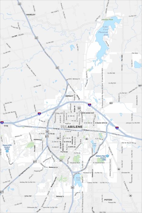
Highways spread wide in Abilene, linking neighborhoods across the open plains. Our map shows its spot in West Texas.
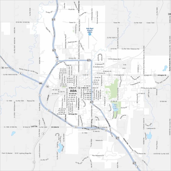
Ada is a compact city with roads crossing near the Canadian River basin. Our map shows its small-town core and Ada City Lake.
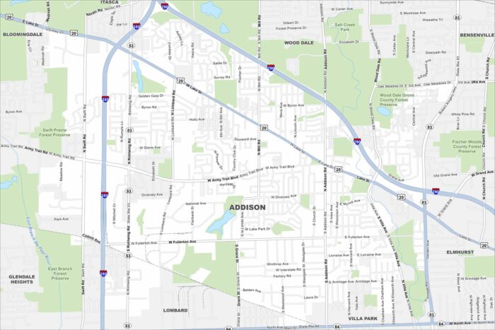
Our map of Addison shows a dense suburban community just west of Chicago. It has busy roads, industrial parks, and is near the metro area.
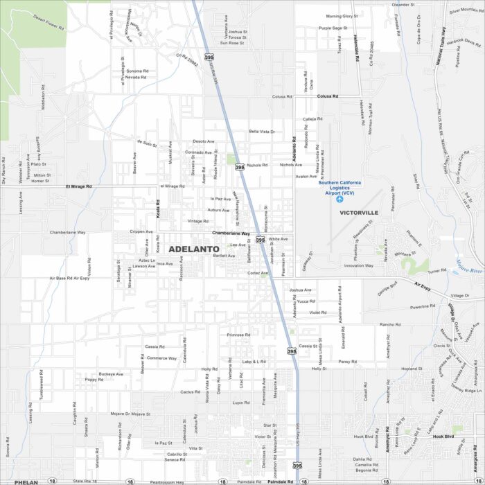
Adelanto spreads across the Mojave Desert. Its wide roads and highways cut through open land. Our map highlights its desert setting.
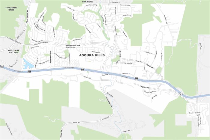
Winding canyon roads and freeway routes are main features Agoura Hills. Our map shows these types of road as well as natural features.
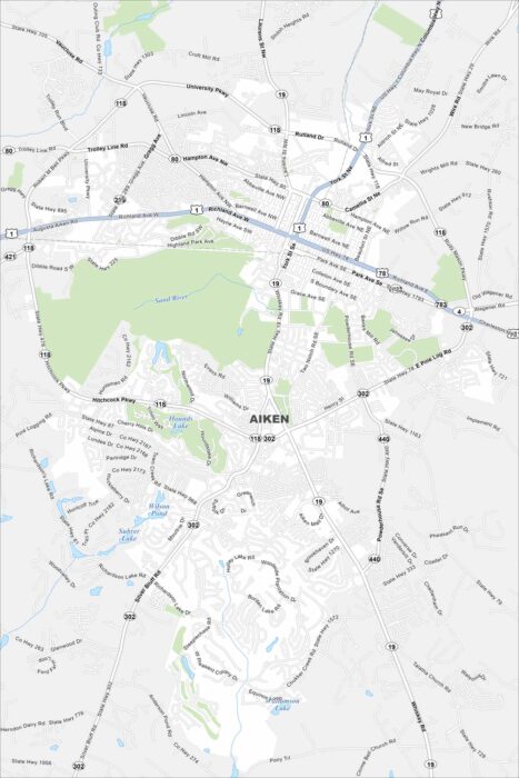
Our map of Aiken highlights its streets lined with parks and greenways. The city is known for horses and history.
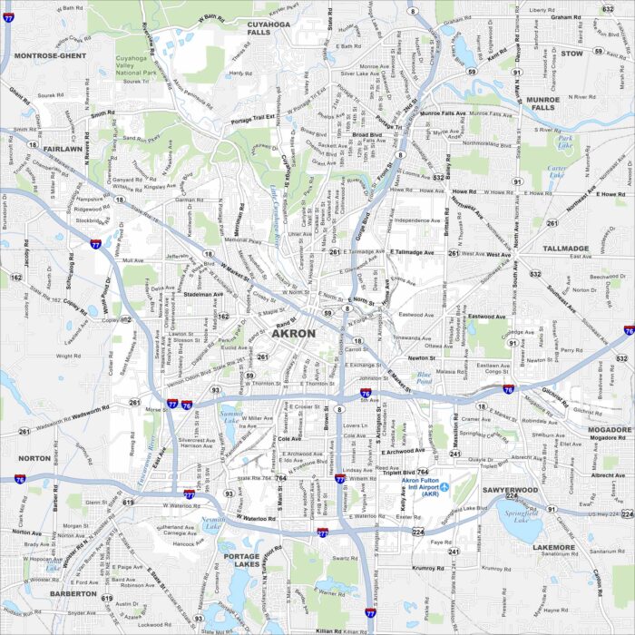
Akron is laid out with its roads traveling from its downtown. Our map shows its highways, lakes, parks and railways.
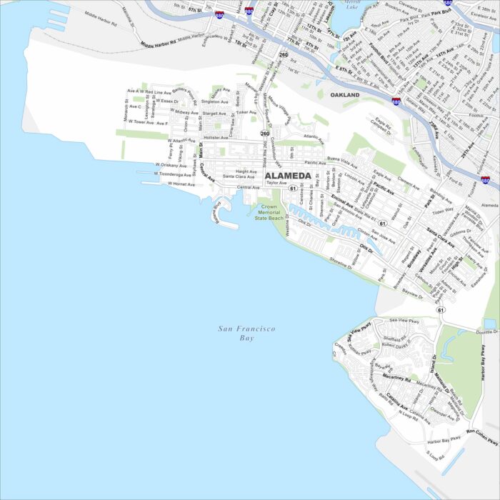
Alameda sits on an island across the bay from Oakland, with bridges and tunnels connecting it. Our map highlights its shoreline and highways.
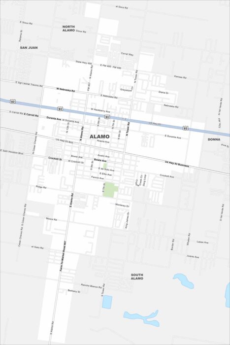
Our map of Alamo lays out a small city in the Rio Grande Valley. It’s known as the gateway to Santa Ana National Wildlife Refuge.
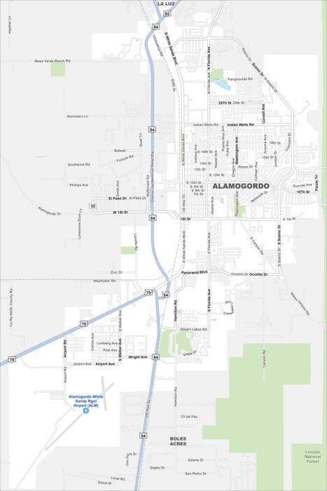
Alamogordo is a desert city next to the Sacramento Mountains. Our map shows its streets traveling out under wide skies.
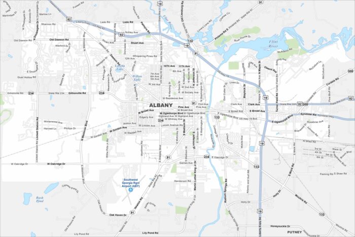
Roadways cross through Albany along the Flint River. Green spaces are also scattered around. Our map shows this South Georgia city.
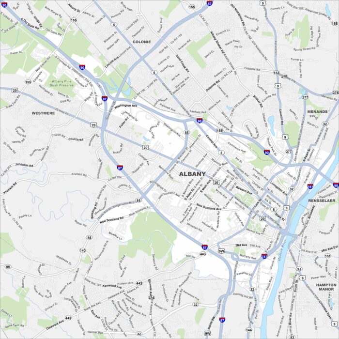
Our map of Albany lays out this historic city on the Hudson River. As New York’s capital, it’s known for its government buildings.
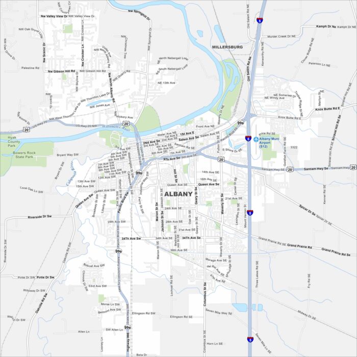
Our map of Albany shows how the city spreads across the Willamette River. Bridges link neighborhoods on both sides of the bank.
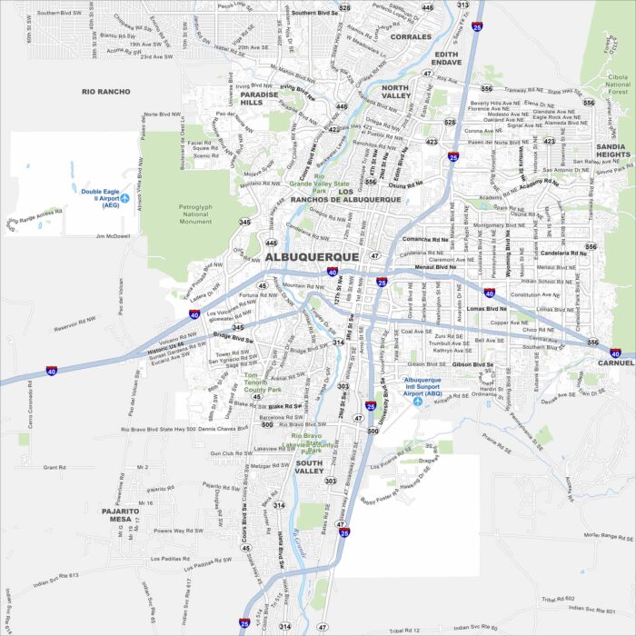
Albuquerque is a desert city in New Mexico. Highways stretch across mesas and the Rio Grande cuts right through the middle.